Stonebeck Down
Stonebeck Down is a civil parish in Harrogate district, North Yorkshire, England. The main settlements in the parish are the village of Ramsgill and the hamlets of Stean and Heathfield. The population of the parish in the 2011 census was 192.[1]

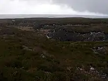
The parish occupies the west side of upper Nidderdale. It is bounded on the north by Stean Beck, from which the parish takes its name (stean being a dialect form of "stone"), and which separates it from the parish of Stonebeck Up.[2] To the west it is bounded by the ridge separating Nidderdale from Wharfedale, to the south by Ashfold Gill, separating the parish from Bewerley, and to the east by the River Nidd and Gouthwaite Reservoir, which separate the parish from Fountains Earth. The parish includes large areas of grouse moor, rising to the remote peak of Meugher.
Historically Stonebeck Down was a township in the ancient parish of Kirkby Malzeard in the West Riding of Yorkshire.[3] In the Middle Ages, it formed part of the lands of Byland Abbey, which established granges in the dale.[4] Stonebeck Down became a separate civil parish in 1866, and was transferred from the West Riding to North Yorkshire in 1974. The parish now shares the Upper Nidderdale grouped parish council with the parishes of Stonebeck Up and Fountains Earth.[5]
References
- ONS Census 2011: Neighbourhood statistics
- Stean Beck, also known as How Stean Beck, should not be confused with Stone Beck, another tributary of the Nidd near its source.
- Vision of Britain: Down Stonebeck
- Jennings, Bernard (1992). A History of Nidderdale. p. 88. ISBN 1-85072-114-9.
- Upper Nidderdale Parish Council website
