Straight River (central Minnesota)
The Straight River is a tributary of the Fish Hook River, 23 miles (37 km) long, in north-central Minnesota in the United States. Via the Fish Hook, Shell, and Crow Wing Rivers, it is part of the watershed of the Mississippi River, draining an area of approximately 60 square miles (160 km2) in a rural region. The river is known as one of Minnesota's best trout fishing streams.[5]
| Straight River | |
|---|---|
 The Straight River in Straight River Township in 2007 | |
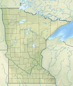 Location of the mouth of the Straight River | |
| Location | |
| Country | United States |
| State | Minnesota |
| Physical characteristics | |
| Source | |
| • location | Pine Point Township, Becker County |
| • coordinates | 47°00′08″N 95°18′34″W[1] |
| • elevation | 1,506 ft (459 m)[2] |
| Mouth | Fish Hook River |
• location | Hubbard Township, Hubbard County |
• coordinates | 46°52′08″N 95°01′55″W[1] |
• elevation | 1,384 ft (422 m)[2] |
| Length | 22.7 mi (36.5 km)[3] |
| Basin size | 60 sq mi (160 km2)approx.[4] |
| Discharge | |
| • location | near Park Rapids[4] |
| • average | 60.8 cu ft/s (1.72 m3/s)[4] |
| • minimum | 21 cu ft/s (0.59 m3/s) |
| • maximum | 149 cu ft/s (4.2 m3/s) |
The river's name is a translation of the Ojibwe name for Straight Lake,[6] through which the river flows near its source.[7]
Geography
The Straight River rises in the White Earth Indian Reservation and Two Inlets State Forest, approximately 6 miles (9.7 km) northeast of Pine Point in Pine Point Township in northeastern Becker County. It flows initially southeastwardly, passing through Straight Lake, then east-southeastwardly into southwestern Hubbard County. It flows into the Fish Hook River in Hubbard Township, approximately 4 miles (6.4 km) south of Park Rapids.[7] The river flows in the Northern Lakes and Forests ecoregion, which is characterized by conifer and hardwood forests on flat and rolling till plains and outwash plains.[8]
The Straight River is fed by springs which provide water cold enough to support an abundant trout population, and is known in sport fishing for catches of brown trout exceeding 20 inches (51 cm) in length. The river formerly supported a population of brook trout which declined due to rising water temperatures. In the early 1990s a group of organizations including Trout Unlimited sued the Minnesota Department of Natural Resources, seeking heightened protection of the Straight River; the department has since begun scrutinizing the irrigation activities of agricultural operations in the river's watershed, which may threaten the springs feeding cold water to the river.[5][9]
Flow rate
At the United States Geological Survey's stream gauge in Straight River Township near Park Rapids, the annual mean flow of the river between 1987 and 2005 was 60.8 cubic feet (1.72 m3) per second. The highest recorded flow during the period was 149 cubic feet (4.2 m3) per second on April 6, 1997. The lowest recorded flow was 21 cubic feet (0.59 m3) per second on November 23, 2003.[4]
See also
- List of rivers in Minnesota
References
- "Geographic Names Information System entry for Straight River (Feature ID #652709)". Geographic Names Information System. United States Geological Survey. Retrieved 2007-06-24.
- Google Earth elevation for GNIS coordinates. Retrieved on 2007-06-24.
- "National Assessment Database: Assessment Data for the State of Minnesota Year 2004". United States Environmental Protection Agency. pp. Crow Wing Watershed. Archived from the original on 2007-07-07. Retrieved 2007-06-24.
- Mitton, G. B.; K. G. Guttormson; G. W. Stratton; E. S. Wakeman. "Water Resources Data in Minnesota, Water Year 2005 Annual Report". United States Geological Survey. pp. Straight River near Park Rapids, MN. Retrieved 2007-06-24.
- Waters, Thomas F. (2006). "The Crow Wing: Oxcart to Canoe". The Streams and Rivers of Minnesota. Minneapolis: University of Minnesota Press. pp. 184–194. ISBN 0-8166-0960-8.
- Upham, Warren. "Minnesota Place Names: A Geographical Encyclopedia". Minnesota Historical Society. pp. Hubbard County: Straight River Township. Archived from the original on 2007-06-20. Retrieved 2007-06-24.
- Minnesota Atlas & Gazetteer. Yarmouth, Me.: DeLorme. 1994. p. 61. ISBN 0-89933-222-6.
- "Upper Mississippi River Basin". Minnesota Pollution Control Agency. 2000. pp. Upper Mississippi River Basin Water Quality Plan, Headwaters to the Rum River - Anoka, Section III: Upper Mississippi River Basin. Archived from the original on 2007-06-18. Retrieved 2007-06-24.
- Gunderson, Dan (2002-05-06). "The Straight River: In the shadow of a corporate farm". Minnesota Public Radio. Retrieved 2007-06-24.