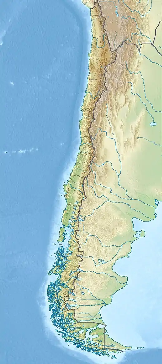
Strait of Magellan
The Strait of Magellan (Spanish: Estrecho de Magallanes), also called the Straits of Magellan, is a navigable sea route in southern Chile separating mainland South America to the north and Tierra del Fuego to the south. The strait is considered the most important natural passage between the Atlantic and Pacific oceans. It was discovered and first traversed by the Spanish expedition of Ferdinand Magellan in 1520, after whom it is named.
| Strait of Magellan | |
|---|---|
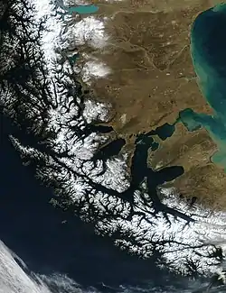 The Strait of Magellan at the southern tip of South America | |
 Strait of Magellan | |
| Location | Magallanes Region, Chile |
| Coordinates | 53°28′S 70°47′W |
| Type | Strait |
| Basin countries | Chile, Argentina |
| Max. length | 570 km (350 mi) |
| Min. width | 2 km (1.2 mi) |
Magellan's original name for the strait was Estrecho de Todos los Santos ("Strait of All Saints"). Spanish King Charles V, the sponsor of the Magellan-Elcano expedition, changed the name to Strait of Magellan to honor him.[1]
The route is difficult to navigate due to frequent narrows and unpredictable winds and currents. Maritime piloting is now compulsory. The strait is shorter and more sheltered than the Drake Passage, the often stormy open sea route around Cape Horn, which is beset by frequent gale-force winds and icebergs.[2] Along with the Beagle Channel, the strait was one of the few sea routes between the Atlantic and Pacific before the construction of the Panama Canal.
History
Pre-history
The Strait of Magellan has been inhabited by indigenous Americans for thousands of years.[3] The Kawésqar lived on the western part of the strait's northern coast. To the east of the Kawésqar were the Tehuelche, whose territory extended to the north in Patagonia. To the south of the Tehuelche across the strait lived the Selk'nam, who inhabited the majority of the eastern portion of Tierra del Fuego. To the west of the Selk'nam were the Yaghan people, who inhabited the southernmost part of Tierra del Fuego.[4][5]
All tribes in the area were nomadic hunter-gatherers. The Tehuelche were the only non-maritime culture in the area; they fished and gathered shellfish along the coast during the winter and moved into the southern Andes in the summer to hunt.[6] The tribes of the region saw little European contact until the late 19th century. Later, European-introduced diseases decimated portions of the indigenous population.[7]
Selk'nam traditions recorded by the Salesian missionary Giuseppe María Beauvoir relate that the Selk'nam arrived in Tierra del Fuego by land, and that the Selk'nam were later unable to return north as the sea had flooded their crossing.[8] Selknam migration to Tierra del Fuego is generally thought to have displaced a related non-seafaring people, the Haush that once occupied most of the main island.[9] The Selk'nam, Haush, and Tehuelche are generally thought to be culturally and linguistically related peoples physically distinct from the sea-faring peoples.[9]
Magellan
Expeditionaries led by Ferdinand Magellan, an explorer and navigator in the service of Spanish King Charles V, became the first Europeans to navigate the strait in 1520 in what later became the first voyage of global circumnavigation.[10][11] On March 22, 1518, the expedition was organized in Valladolid, naming Magellan captain general of the fleet and governor of all the lands discovered. The fleet would become known as the Armada de Molucas or "Fleet of the Moluccas". The expeditionary fleet of five ships set sail from Sanlúcar de Barrameda in southern Spain on September 20, 1519.[12]
The five ships included La Trinidad (110 tons, 55 crew members), under the command of Magellan; La San Antonio (120 tons, 60 crew members) under the command of Juan de Cartagena; La Concepción (90 tons, 45 crew members) under the command of Gaspar de Quezada (Juan Sebastián Elcano served as boatswain); La Victoria (85 tons, 42 crew members) under the command of Luis de Mendoza; and La Santiago (75 tons, 32 crew members), under command of Juan Rodríguez Serrano (João Rodrigues Serrão). Before the passage of the strait (and after the mutiny in Puerto San Julián), Álvaro de Mesquita became captain of the San Antonio, and Duarte Barbosa of the Victoria. Later, Serrão became captain of the Concepcion (the Santiago, sent on a mission to find the passage, was caught in a storm and wrecked). San Antonio, charged to explore Magdalen Sound, failed to return to the fleet, instead sailing back to Spain under Estêvão Gomes, who imprisoned the captain Mesquita.
Magellan's ships entered the strait on November 1, 1520, All Saints' Day. It was initially called Estrecho de Todos los Santos ("Strait of All Saints"). Magellan's chronicler, Antonio Pigafetta, called it the Patagonian Strait, and others Victoria Strait, commemorating the first ship that entered.[13][12][14] Within seven years, it was being called Estrecho de Magallanes in honor of Magellan.[12][14] The Spanish Empire and the Captaincy General of Chile used it as the southern boundary of their territory.
On All Saints' Day, Magellan planted a flag and claimed the land on behalf of the King of Spain.[15]
Accounts before Magellan
There is no historical evidence of the knowledge of the strait prior to the Spanish expedition of Ferdinand Magellan.[16] In 1563, António Galvão reported that the position of the strait was previously mentioned in old charts as Dragon's Tail (Draco Cola):[lower-alpha 1]
[Peter, Duke of Coimbra] brought a map which had all the circuit of the world described. The Strait of Magellan was called the Dragon's Tail; and there were also the Cape of Good Hope and the coast of Africa. ... Francisco de Sousa Tavares told me that in the year 1528, the Infant D. Fernando showed him a map which had been found in the Cartorio of Alcobaça, which had been made more than 120 years before, which contained all the navigation of India with the Cape of Good Hope.[18]
As this would suggest that the strait was mentioned in maps before the Americas were discovered by Europeans, the claim is considered dubious.[16][lower-alpha 2]
16th century explorations after Magellan
.svg.png.webp)
In the 1530s Charles V divided South America and whatever was to be south of it into a series of grants to different conquistadors. The strait of Magellan and the area south of it went to Pedro Sánchez de la Hoz.[19][lower-alpha 3]
While in a temporary visit to Europe conquistador of Chile Pedro de Valdivia managed to have Charles V extend his governorship all the way to the northern shores of the strait. Meanwhile, Sánchez de la Hoz was executed in Chile by Francisco de Villagra, one of Valdivia's men.
García Jofré de Loaiza was the second captain to navigate the strait and the first to discover that Tierra del Fuego was an island. Thereafter, Governor of Chile Pedro de Valdivia dispatched Francisco de Ulloa to survey and explore the strait, thereby facilitating navigation from Spain to Chile. In October 1553, Ulloa sailed from the city of Valdivia in the first expedition to enter the strait from the west. After reaching Woods Bay, Ulloa recognized the steep coastline and lack of provisions. Fearing entrapment in the strait during the winter, Ulloa turned around, returning to Chilean ports in February 1554.[15]
In October 1557, Governor of Chile García Hurtado de Mendoza sent out another exploratory squad of 70 men under the command of Juan Ladrillero. They were charged with mapping the coastline and surveying the region's flora, fauna, and ethnography. On August 16, 1558, Ladrillero arrived in the Atlantic Ocean, becoming the first navigator to cross the Strait of Magellan in both directions.[15]
Twenty years later, English navigator Francis Drake crossed the strait, creating fear among Pacific coast inhabitants that an attack was imminent. In order to seal the passage, Viceroy of Peru Francisco de Toledo sent a squadron with two ships under Pedro Sarmiento de Gamboa. They scrupulously explored the strait, trying to ferret out English invaders, while surveying where to build fortifications.[15] This data was concealed, but new explorations to the area were still organized.[15] In 1599 it took five ships under Simon de Cordes - his pilot was William Adams - four months to pass it; Sebalt de Weert returned before the end.
The first map of the Pacific Ocean, Maris Pacifici from 1589, depicts the strait as the only route between the Atlantic and Pacific oceans.
Spanish colonisation attempt
Gradual southward colonization by the Spanish in Chile halted after the conquest of Chiloé Archipelago in 1567. The Spanish are thought to have lacked incentives for further conquests south.[20] The indigenous populations were scarce and had ways of life that differed from the sedentary agricultural life the Spanish were accostumed to.[20] The harsh climate in the fjords and channels of Patagonia may also have deterred further expansion.[20] Indeed, even in Chiloé did the Spanish encounter difficulties to adapt as their attempts to base the economy on gold extraction and a "hispanic-mediterranean" agricultural model failed.[21]
In 1584, Pedro Sarmiento de Gamboa founded two colonies in the strait: Nombre de Jesús and Ciudad del Rey Don Felipe. The latter was established north of the strait with 300 settlers.[22][23] That winter, it became known as Puerto del Hambre, or "Port Famine"—most of the settlers were killed by cold or starvation.[24] When Sir Thomas Cavendish landed at the site of Rey Don Felipe in 1587, he found only ruins of the settlement. He renamed it Port Famine.
The Spanish failure at colonizing the Strait of Magellan made Chiloé Archipelago assume the role of protecting western Patagonia from foreign intrusions.[25] Valdivia, reestablished in 1645, and Chiloé acted as sentries, being hubs where the Spanish collected information and rumors from all over Patagonia.[26]
17th century explorations
In 1616, Dutch travelers, including Willem Schouten and Jacob Le Maire, discovered Cape Horn and recognized the southern end of Tierra del Fuego. Years later, a Spanish expedition commanded by brothers Bartolomé and Gonzalo Nodal verified this discovery[15] making in the way also the first circumnavigation of Tierra del Fuego.[27] After this there would be 150 years before the next ship from Spain would traverse the strait.[27] In 1620, one hundred years after European discovery, at least 55 ships had traversed the strait including 23 Spanish, 17 English and 15 Dutch.[27]
John Narborough's 1670 explorations in Patagonia caused the Spanish to launch various maritime expeditions to western Patagonia from 1674 to 1676.[28][29] In the last and largest one, Pascual de Iriate led a party to Evangelistas Islets at the western entrance to the strait. At Evangelistas sixteen men of the party disappeared on February 17 including the son of Pascual de Iriarte.[30][31] The ill-fated men had attempted to reach one of the islets to install a metal plaque indicating the King of Spain's ownership of the territory.[31] Viceroy of Peru Baltasar de la Cueva issued orders to the governments of Chile, Chiloé and Río de la Plata to inquire about the men who disappeared at Evangelistas Islets.[32] However no information about their fate came forth and it is presumed that the boat wrecked in the same storm that forced the remaining party to leave the area.[32][33] Overall a total of 16–17 men perished in it.[20][33][31] While by 1676 rumours about English bases in Western Patagonia had been dispelled, that year new rumours appeared claiming that England was preparing an expedition to settle the Straits of Magellan.[34] The focus of Spanish attention to repel tentative English settlements shifted from the Pacific coast of Patagonia to the Straits of Magellan and Tierra del Fuego.[34] Such a change, from the western archipelagoes to the strait, meant that any English settlement could be approached by Spain by land from the north, which was not the case for the islands in western Patagonia.[34]
In February 1696, the first French expedition under the command of M. de Gennes reached the Strait of Magellan. The expedition is described by the French explorer, engineer, and hydrographer François Froger in his A Relation of a Voyage (1699).
18th century explorations
In the 18th century further explorations were done by English explorers John Byron and James Cook. The French sent Louis Antoine de Bougainville and JSC Dumont D'Urville.[15] By 1770 the focus of a potential conflict between Spain and Britain had shifted from the strait to Falkland Islands.
Explorations
From 1826 to 1830, the strait was explored and thoroughly charted by Phillip Parker King, who commanded the British survey vessel HMS Adventure. In consort with HMS Beagle, King surveyed the complex coasts around the strait. A report on the survey was presented at two meetings of the Geographical Society of London in 1831.[13][35]
Richard Charles Mayne commanded HMS Nassau on a survey expedition to the strait from 1866 to 1869.[36] The naturalist on the voyage was Robert Oliver Cunningham.[37] Charles Darwin requested the Lords of the Admiralty to ask Mayne to collect several boatloads of fossils of extinct quadruped species. Admiral Sulivan had previously discovered an astonishingly rich accumulation of fossil bones not far from the strait. These remains apparently belonged to a more ancient period than collections made by Darwin on HMS Beagle and other naturalists, and therefore were of great scientific interest. Many of these fossils were collected with the aid of hydrographer Richards R. N. and deposited in the British Museum.[38] The Admiralty compiled advice to mariners of the strait in 1871.[39]
Incorporation into Chile
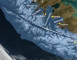
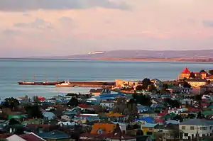
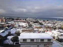
Chile took possession of the Strait of Magellan on May 23, 1843. President Manuel Bulnes ordered this expedition after consulting the Chilean libertador Bernardo O'Higgins, who feared an occupation by Great Britain or France. The first Chilean settlement, Fuerte Bulnes, was situated in a forested zone on the north side of the strait, and was later abandoned. In 1848, Punta Arenas was founded farther north, where the Magellanic forests meet the Patagonian plains. In Tierra del Fuego, across the strait from Punta Arenas, the village of Porvenir emerged during the Tierra del Fuego gold rush in the late 19th century. Until the opening of the Panama Canal, the town was an important supply stop for mariners.[2] It has been claimed that Chile's annexation of the area originated from a fear of occupation by Great Britain or France.[13][40]
In the Boundary treaty of 1881 between Chile and Argentina, Argentina effectively recognized Chilean sovereignty over the Strait of Magellan. Argentina had previously claimed all of the strait, or at least the eastern third of it.
In the Treaty of Peace and Friendship of 1984 between Chile and Argentina the conflicts between two countries were settled and Argentina ratified the strait as Chilean.[41]
Steamship navigation
In 1840, the Pacific Steam Navigation Company became the first to use steamships for commercial traffic in the strait.[13] Until the Panama Canal opened in 1914, the Strait of Magellan was the main route for steamships traveling from the Atlantic Ocean to the Pacific. It was often considered the only safe way to move between the Atlantic and Pacific Oceans, as the Drake Passage separating Cape Horn from Antarctica is notorious for turbulent and unpredictable weather, and is frequented by icebergs and sea ice. Ships in the strait, protected by Tierra del Fuego to the south and the coast of continental South America to the north, crossed with relative ease, and Punta Arenas became a primary refueling port that provided coal for steamships in transit. Sailing ships, partly because of variable winds and currents in the strait, generally preferred the Drake Passage, where they had more room to maneuver.
Features
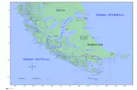
The strait is approximately 570 kilometres (310 nmi; 350 mi) long and 2 kilometres (1.1 nmi; 1.2 mi) wide at its narrowest point (Carlos III Island, west of Cape Froward).[42] The northwestern portion of the strait is connected with other sheltered waterways via the Smyth Channel. This area is similar to the Inside Passage of Alaska. South of Cape Froward, the principal shipping route follows the Magdalena Channel. The climate is generally foggy and cold, and the course is convoluted with several narrow passages. It is several hundred miles shorter than the Drake Passage, but sailing ships, particularly clipper ships, prefer the latter. Its major port is Punta Arenas, a transshipment point for Chilean mutton situated on the Brunswick Peninsula.[43] Exemplifying the difficulty of the passage, it took Magellan 38 days to complete the crossing.[13]
The eastern opening is a wide bay on the border of Chile and Argentina between Punta Dúngeness on the mainland and Cabo del Espíritu Santo ("Cape of the Holy Spirit") on Tierra del Fuego, the border as defined in the Treaty of Peace and Friendship of 1984 between Chile and Argentina. Immediately west are Primera Angostura and Segunda Angostura, narrows formed by two terminal moraines of different ages.[44] The Primera Angostura is the closest approach of Isla Grande de Tierra del Fuego to mainland South America. Farther west lies Magdalena Island, part of Los Pingüinos Natural Monument. The strait's southern boundary in the east follows first the shoreline of the Isla Grande de Tierra del Fuego, then the northern end of the Canal Whiteside and the shoreline of Dawson Island.
The western part of the strait leads northwest from the northern end of the Magdalena Channel to the strait's Pacific entrance. This is flanked on the south by Capitán Aracena Island, Clarence Island, Santa Inés Island, Desolación Island (Cabo Pilar), and other smaller islands, and on the north by Brunswick Peninsula, Riesco Island, Muñoz Gamero Peninsula, Manuel Rodriguez Island, and other minor islands of the Queen Adelaide Archipelago. Two narrow channels connect the strait with Seno Otway and Seno Skyring. A broader channel, Smyth Channel, leads north from the strait between Muñoz Gamero Peninsula and Manuel Rodriguez Island. Francisco Coloane Coastal and Marine Protected Area, a sanctuary for humpback whales, is located in this area. This part of the strait lies on the elongated Magallanes-Fagnano Fault, which marks a plate boundary between the South American Plate and the Scotia Plate. This fault continues southward under Almirantazgo Fjord and then below Fagnano Lake.[45] Possibly, new tourism industries could be established in the eastern part of the strait for watching southern right whales,[46] as the number of observations in the area has increased in recent years.[47][48]
On the Atlantic side, the strait is characterized by semidiurnal macrotides with mean and spring tide ranges of 7.1 and 9.0 m, respectively. On the Pacific side, tides are mixed and mainly semidiurnal, with mean and spring tide ranges of 1.1 and 1.2 m, respectively.[49] There is enormous tidal energy potential in the strait.[50] The strait is prone to Williwaws, "a sudden violent, cold, katabatic gust of wind descending from a mountainous coast of high latitudes to the sea".[51][lower-alpha 4]
Place names
The place names of the area around the strait come from a variety of languages. Many are from Spanish and English, and several are from the Ona language, adapted to Spanish phonology and spelling.[52] Examples include Timaukel (a hamlet at the east side of Tierra del Fuego), Carukinka (the end of the Almirantazgo Fjord), Anika (a channel located at 54° 7' S and 70° 30' W), and Arska (the north side of the Dawson Island).
Magellan named the strait Todos los Santos,[15] as he began his voyage through the strait on November 1, 1520, the day of "All Saints" (Todos los Santos in Spanish). Charles V renamed it Estrecho de Magallanes. Magellan named the island on the south side of the strait Tierra del Fuego, which the Yaghan people called Onaisín in the Yaghan language. Magellan also gave the name Patagones to the mainland Indians, and their land was subsequently known as Patagonia.
Bahía Cordes is named for the Dutch pirate Baltazar de Cordes.[53]
The Strait of Magellan Park, 52 kilometres (32 mi) south of Punta Arenas, is a 250-hectare (620-acre) protected area.[54]
Lighthouses in the strait
The National Geospatial-Intelligence Agency lists 41 lighthouses in the waterway. Some of them are more than a century old, and some are declared Monumento Nacional ("national monument"). Among the most notable lighthouses are: County of Peebles hulk, the world's first four-masted, iron-hulled "full-rig ship",[55] used now as a breakwater for the harbour at Punta Arenas; the San Isidro lighthouse, restored in 2004 and is now a museum and lodge;[56] and the Evangelistas Lighthouse, located at the western mouth of the strait and built by George Slight, who wrote on his arrival in 1934:
I never imagined seeing something so wild and desolate as those emerging dark rocks in the middle of the raging waves. To see these stormy craggy rocks was frightening. With a dim light on the horizon we could see large waves crashing heavily in the western part of the islands: a vision that hardly anyone can imagine ...[57]
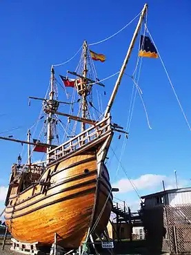
This strait is one of the region's most popular tourist destinations. Several cruise companies ply its waters, and the lighthouses, including Magdalena Island Light, are popular attractions.[13]
Environment
Numerous protected systems are located around the strait (S.P.: Sistema Protegido; B.N.P: Bienes Nacionales Protegidos):[58]
- B.N.P. Isla Carlos III
- B.N.P. Islote Rupert
- S.P. Cabo Espíritu Santo
- S.P. Cabo Froward
- S.P. Cabo Posesión
- S.P. Estepa Húmeda Kampenaiken Tres Chorrillos
- S.P. Isla Dawson
- S.P. Península Muñoz Gamero
- S.P. Reservas Biológicas de Río Cóndor
- S.P. San Gregorio
- S.P. San Juan
- S.P. Timaukel
Traffic
The strait provides a well-protected inland waterway sheltered from rough weather and high seas, allowing for safe navigation. Ships sail through the strait from the Pacific to the Atlantic and back, from the oceans to the Beagle Channel through the Magdalena Channel, Cockburn Channel, Paso Brecknock or Canal Ocasión, Ballenero Channel, O'Brien Channel, Paso Timbales, northwest arm of the Beagle Channel and the Beagle Channel and back, and also to cross the strait from north to south and back. This is the case for all traffic between the Chile and Argentina and the cities in Tierra del Fuego, Porvenir, Cerro Sombrero, Timaukel, Ushuaia, and Río Grande.
In 2008, 571 Chilean ships and 1,681 non-Chilean ships sailed through the strait.[59] Piloting is compulsory for sailing the strait. As one authority notes, "The Pilotage Regulations of the Chilean Hydrographic and Oceanographic Service ('the Regulations") provide that pilotage through the Magellan Strait is compulsory", with limited exceptions for local traffic. Who pays the fees for the pilot is subject to interpretation, however.[60][61]
Navigation status
Article 35 of the United Nations Convention on the Law of the Sea states that "Nothing in this Part affects: ... the legal regime in straits in which passage is regulated in whole or in part by long-standing international conventions in force specifically relating to such straits". Article V of the Boundary treaty of 1881 between Chile and Argentina established a legal regime for the Strait of Magellan, and in a diplomatic letter to major shipping nations in 1873, Chile promised freedom of navigation through and neutrality within the strait.[62][63]
Notable events
Joshua Slocum was the first documented person to have single-handedly sailed the strait. He experienced a 40-day hiatus in the strait due to storms and adverse weather,[lower-alpha 5] while piloting the gaff-rigged sloop oyster boat Spray in the first solo global circumnavigation. He wrote about the experience in Sailing Alone Around the World.[65][66]
In 1976, American open water swimmer Lynn Cox became the first person to swim across the strait. Almost 40 years later, on January 17, 2014, Hunter Wright became the youngest person to swim across the strait at age 17.[13]
USS Ronald Reagan was the first nuclear-powered aircraft carrier to navigate the strait.[13]
Gallery
- Strait of Magellan
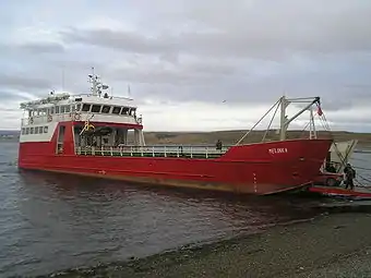 Barcaza Melinka at Porvenir port, providing a ferry service across the strait between Punta Arenas and Porvenir
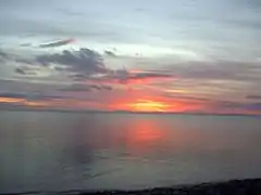 The Strait of Magellan at dawn
- A true-color MODIS satellite image of the strait
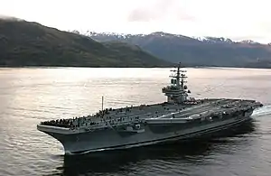 U.S. Navy carrier USS Ronald Reagan in the strait
See also
- Agostini Fjord
- Archipelagoes of Patagonia
- Bahía Posesión
- Beaver eradication in Tierra del Fuego
- Cape Route
- Continental Divide of the Americas
- Exploration of the Pacific
- Fjords and channels of Chile
- Geography of Chile
- Islands of Chile
- List of Antarctic and subantarctic islands
- List of countries bordering on two or more oceans
- List of fjords, channels, sounds and straits of Chile
- List of islands of Chile
- List of things named after Ferdinand Magellan
- Magallanes Region
- Monte Sarmiento
- Punta Arenas
- Timeline of the Magellan–Elcano circumnavigation
- Transit passage
Footnotes
- "For some decades a group of scholars in Latin America has been claiming that this so‐called 'Dragon's Tail' peninsula is really a pre‐Columbian map of South America. In this paper, the cartographical and place‐name evidence is examined, showing that the identification has not been proved, and that perceived similarities between the river and coastal outlines on this 'Dragon's Tail' peninsula and those of South America are fortuitous."[16][17]
- See also: Pre-Columbian trans-oceanic contact theories, Exploration of North America, Waldseemüller map, Madoc, and Norse colonization of North America
- Later this has served Chilean and Argentine governments to claim Terra Australis, and Tierra del Fuego and by extension the continent of Antarctica was in effect claimed by Spain and that an animus occupandi existed on the part of Spain in the lands south of the strait.[19] Spain's sovereignty claim over this territory was internationally recognized with the Inter caetera bull of 1493 and the Treaty of Tordesillas of 1494.[19]
- The Aleutian Islands exhibit the same phenomenon.[51]
- In Port Angosto, Strait of Magellan, the Spray was re-rigged as a yawl by adding a jigger.[64]
References
- Crum, Haley. "The Man Who Sailed the World". Smithsonianmag.com. Smithsonian Institution. Retrieved October 23, 2019.
- "Straight Of Magellan – Map & Description". worldatlas.com. Archived from the original on October 19, 2019. Retrieved October 19, 2019.
- "Fell's Cave (9000–8000 B.C.)". metmuseum. The Metropolitan Museum of Art. Retrieved October 23, 2019.
- "Strait of Magellan, a voyage throughout History XVI-XXI centuries". magellanstraittravel. Magellan Straight Travel. Retrieved October 23, 2019.
- de la Fuente, C.; Ávila-Arcos, M. C.; Galimany, J.; Carpenter, M. L.; Homburger, J. R.; Blanco, A.; Contreras, P.; Cruz Dávalos, D.; Reyes, O.; San Roman, M.; Moreno-Estrada, A.; Campos, P. F.; Eng, C.; Huntsman, S.; Burchard, E. G.; Malaspinas, A. S.; Bustamante, C. D.; Willerslev, E.; Llop, E.; Verdugo, R. A.; Moraga, M. (2018). "Genomic insights into the origin and diversification of late maritime hunter-gatherers from the Chilean Patagonia". Proceedings of the National Academy of Sciences of the United States of America. 115 (17): E4006–E4012. doi:10.1073/pnas.1715688115. PMC 5924884. PMID 29632188.
- Espinoza, María Cecilia. "RIGHTS-CHILE: A 'New Deal' for Indigenous Groups". ipsnews. Inter Press Service. Retrieved October 23, 2019.
- Benson, Andrew; Aeberhard, Danny (November 15, 2010). The Rough Guide to Argentina (4th ed.). Rough Guides. p. 501. ISBN 978-1848365216.
- "Selk'nam". La enciclopedia de ciencias y tecnologías en Argentina (in Spanish). December 1, 2013. Retrieved December 23, 2020.
- Chapman, Anne; Hester, Thomas R. (1973). "New data on the archaeology of the Haush: Tierra del Fuego". Journal de la Société des Américaniste. 62: 185–208.
- "Ferdinand Magellan, Discovery of the Strait of Magellan". Encyclopædia Britannica. Retrieved October 18, 2019.
- Ponce et al. 2016.
- Murphy & Coye 2013.
- "Little-known Facts About the Hazardous Strait of Magellan". Vacayholics. Archived from the original on October 18, 2019. Retrieved October 18, 2019.
- Bergreen 2003, p. 194.
- "Navegantes europeos en el estrecho de Magallanes [Discovery and recognition of the territory: European navigators in the Strait of Magellan]". Memoria Chilena (in Spanish). Retrieved October 20, 2019.
- Richardson, William A.R. (2003). "South America on Maps before Columbus? Martellus's 'Dragon's Tail' Peninsula". Imago Mundi. 55: 25–37. doi:10.1080/0308569032000097477.
- de Zurara, Prestage & Beazley 2010, p. cxiv.
- Galvaão & Hakluyt 2004.
- Prieto Larrain, M. Cristina (2004). "El Tratado Antártico, vehículo de paz en un campo minado". Revista Universum (in Spanish). University of Talca. 19 (1): 138–147. Retrieved December 31, 2015.
- Urbina Carrasco, Ximena (2016). "Interacciones entre españoles de Chiloé y Chonos en los siglos XVII y XVIII: Pedro y Francisco Delco, Ignacio y Cristóbal Talcapillán y Martín Olleta" [Interactions between Spaniards of Chiloé and Chonos in the XVII and XVII centuries: Pedro and Francisco Delco, Ignacio and Cristóbal Talcapillán and Martín Olleta] (PDF). Chungara (in Spanish). 48 (1): 103–114. Retrieved December 21, 2019.
- Torrejón, Fernando; Cisternas, Marco; Alvial, Ingrid and Torres, Laura. 2011. Consecuencias de la tala maderera colonial en los bosques de alece de Chiloé, sur de Chile (Siglos XVI-XIX)*. Magallania. Vol. 39(2):75–95.
- Relación y derrotero del viaje y descubrimiento del Estrecho de la Madre de Dios - antes llamado de Magallanes (in Spanish). Archived from the original on March 9, 2008.
Pedro Sarmiento de Gamboa, según Amancio Landín, uno de sus más reputados biógrafos, nació en Pontevedra, hacia 1532. Julio Guillén --el marino-académico--, por su parte, dice que es posible fuera Colegial Mayor en la Universidad de Alcalá de Henares, ciudad que fue --asegura-- cuna del gran marino español. Este, no ha dejado aclarada la duda sobre su origen geográfico, pues afirmó ser natural de ambos lugares.
- Markham 2016.
- "History of the Strait of Magellan". April 7, 2017. Retrieved October 25, 2019.
- Urbina C., M. Ximena (2013). "Expediciones a las costas de la Patagonia Occidental en el periodo colonial". Magallania (in Spanish). 41 (2). Retrieved January 27, 2016.
- Urbina C., María Ximena (2017). "La expedición de John Narborough a Chile, 1670: Defensa de Valdivia, rumeros de indios, informaciones de los prisioneros y la creencia en la Ciudad de los Césares" [John Narborough expedition to Chile, 1670: Defense of Valdivia, indian rumors, information on prisoners, and the belief in the City of the Césares]. Magallania. 45 (2). doi:10.4067/S0718-22442017000200011. Retrieved December 27, 2019.
- Martinic 1977, p. 76.
- Martinic B., Mateo; Moore, David M. (1982). "Las exploraciones inglesas en el estrecho de Magallanes. El mapa manuscrito de John Narborough" (PDF). Anales del Instituto de la Patagonia (in Spanish). 13: 7–20. Retrieved December 21, 2019.
- Gallardo, Bartolomé (1886). "Expedición de Bartolomé Gallardo" (PDF). Anuario Hidrográfico de la Marina de Chile (in Spanish). Valparaíso. pp. 525–537.
- de Vea 1886, p. 587
- de Vea 1886, p. 590
- Barros Arana 1884, p. 120
- Barros Arana 1884, p. 119
- Urbina C., María Ximena (2016). "La sospecha de ingleses en el extremo sur de Chile, 1669-1683: Actitudes imperiales y locales como consecuencia de la expedición de John Narborough" [Suspicion of English at the southern end of Chile, 1669-1683: Imperial and local attitudes as a result of John Narborough´s expedition]. Magallania (in Spanish). 44 (1). doi:10.4067/S0718-22442016000100002. Retrieved December 22, 2019.
- King, P. P. (1839), FitzRoy, Robert (ed.), Narrative of the surveying voyages of His Majesty's Ships Adventure and Beagle between the years 1826 and 1836, describing their examination of the southern shores of South America, and the Beagle's circumnavigation of the globe. Proceedings of the first expedition, 1826–30, under the command of Captain P. Parker King, R.N., F.R.S., I, London: Henry Colburn, archived from the original on May 5, 2011, retrieved August 15, 2016. – p. 563 Archived September 15, 2016, at the Wayback Machine: Some Observations relating to the Southern Extremity of South America, Tierra del Fuego, and the Strait of Magalhaens; made during the Survey of those Coasts in his Majesty's ships Adventure and Beagle, between the years 1826 and 1830. By Captain Phillip Parker King, F.R.S., Commander of the Expedition; "read before the Geographical Society of London on the 25th of April and 9th of May 1831; and ... printed in the Journal of that Society for the same year."
- Dictionary of national biography. Edited by Leslie Stephen and Sidney Lee. 63 vols. and 2 supplements (6 vols.). London: Smith, Elder & Co. 1885--1912
- Cunningham 2012.
- Letter from B.J. Sulivan, 27 June 1866 and nn. 6 and 7 in the Darwin Letters. See:,
- Mayne 1871, pp. 37-84.
- Talbott, Robert D. (November 1967). "The Chilean Boundary in the Strait of Magellan". The Hispanic American Historical Review. Duke University Press. 47 (4): 519–531. doi:10.2307/2510673. JSTOR 2510673.
- John Ranson García (December 2011). "CONDICIÓN JURÍDICA DEL ESTRECHO DE MAGALLANES". Revista Chilena de Derecho, vol. 38 N° 3 (in Spanish): 457–485.
Chile succeeded in making Argentina's claim to the existence of an "Argentine Strait of Magellan" disappear, which that country postulated in a small triangle to the east of the Dungeness - Espiritu Santo line, enclosing Espiritu Santo with Cape Virgins, when Argentina recognized that the eastern end of the Strait of Magellan is that straight line, but at a high price, since it generated Argentina's jurisdiction over all waters, soils and subsoils to the east of the Dungeness - Espiritu Santo line, in Atlantic waters
- "The Straits of Magellan and Oceanographical Setting Chile". Archived from the original on March 6, 2008.
- Wallenfeldt, Jeff. "Strait of Magellan". Encyclopædia Britannica. Archived from the original on July 11, 2019. Retrieved October 18, 2019.
- USGS. "P 1386-I Chile and Argentina – Wet Andes: Past Glaciation". Archived from the original on May 11, 2008. Retrieved January 25, 2008.
- Lodolo, Emanuele; Menichetti, Marco; Bartole, Roberto; Ben‐Avraham, Zvi; Tassone, Alejandro; Lippai, Horacio (2003). "Magallanes-Fagnano continental transform fault (Tierra del Fuego, southernmost South America)". Tectonics. 22 (6): 1076. Bibcode:2003Tecto..22.1076L. doi:10.1029/2003TC001500.
- El Mercurio (July 13, 2009). "Ballena franca retorna a Estrecho de Magallanes y abre nueva opción de avistamientos turísticos" (in Spanish). WordPress. Archived from the original on December 9, 2015. Retrieved December 3, 2015.
- The Patagon Journal. 2009. Southern Right Whale Spotted in Chilean Waters Archived May 2, 2015, at the Wayback Machine. Retrieved on October 16, 2014
- Belgrano, Jimena; Iñíguez, Miguel; Gibbons, Jorge; García, Cristian; Olavarría, Carlos (2008). "South-West Atlantic Right Whales Eubalaena Australis (Desmoulins, 1822) Distribution Nearby the Magellan Strait". Anales del Instituto de la Patagonia. 36 (2): 69–74. doi:10.4067/S0718-686X2008000200007.
- Medeiros, Carmen; Kjerfve, Bjorn (1988). "Tidal characteristics of the Strait of Magellan" (PDF). Continental Shelf Research. Great Britain: Pergamon Press plc. pp. 947–960. Archived from the original (PDF) on November 4, 2013. Retrieved July 23, 2013.
- Wynne-Hughes, Antonia (August 17, 2009). "Chile ponders tidal energy potential in Magellan Strait — MercoPress". En.mercopress.com. Archived from the original on September 21, 2013. Retrieved September 18, 2013.
- "Williwaw". Weather on line. Archived from the original on May 14, 2019. Retrieved October 18, 2019.
- Latorre, Guillermo (1998). "Sustrato y superestrato multilingües en la toponimia del extremo sur de Chile [Multilingual substratum and superstratum in the toponymy of the south of Chile]". Philological Studies (in Spanish) (33): 55–67. doi:10.4067/S0071-17131998003300004. Archived from the original on April 21, 2014. Retrieved September 4, 2013.
- Martinic 1977.
- "Strait of Magellan Park". Archived from the original on April 22, 2019. Retrieved October 18, 2019.
- Cumming 2009.
- "Hostería Faro san Isidro". hosteriafarosanisidro.cl. Archived from the original on September 16, 2013.
- Quoted at "Bell Rock Bicentennial : Biographies". 200.bellrock.org.uk. June 26, 1934. Archived from the original on October 21, 2013. Retrieved September 18, 2013.
- Mapas ambientales de Ministerio de Obras Públicas Archived May 19, 2013, at the Wayback Machine, retrieved on 26 August 2013
- "Estrecho De Magallanes". Web.directemar.cl. Archived from the original on October 2, 2013. Retrieved September 18, 2013.
- "Web alert: Magellan Strait Pilotage - is it compulsory and who should pay the fees?". The Standard Club. Charles Taylor, P.L.C. February 23, 2015. Archived from the original on October 18, 2019. Retrieved October 18, 2019.
- Chilean Navy, "General piloting regulations and information", Strait of Magellan, Chilean Channels and Fiords; Regulations and information for Piloting. Routes (in Spanish), Chilean Navy, archived from the original on October 8, 2012, retrieved April 16, 2013,
Pilotage is compulsory for navigating inner waters, between Canal de Chacao and Cabo de Hornos.
- Morris 1989, pp. 68, 104.
- See also Chilean note to the "UN Law of Sea, Declaración formulada al momento de la ratificación" (PDF) (in Spanish). p. 9. Archived (PDF) from the original on March 3, 2016. Retrieved June 29, 2017.
- Slocum, Joshua (1919) [1900]. "Chapter X". Sailing Alone Around the World. New York: The Century Company. p. 127. "I also mended the sloop's sails and rigging, and fitted a jigger, which changed the rig to a yawl [...]"
- Slocum 1900, pp. 89-90.
- Slocum & Scher 2009.
Bibliography
- Barros Arana, Diego (2000) [1884]. "Capítulo VI". Historia General de Chile (in Spanish). V (2 ed.). Santiago, Chile: Editorial Universitaria. ISBN 956-11-1535-2.
- Bergreen, Laurence (October 14, 2003). Over the Edge of the World. Harper Perennial. p. 194. ISBN 978-0-06-621173-2.
- de Zurara, Gomes Eanes; Prestage, Edgar; Beazley, C.R. (2010). The Chronicle of the Discovery and Conquest of Guinea. 2. New York, NY: Hayklut Society; Cambridge University Press. p. cxiv. ISBN 978-1-108-01390-1.
- Cumming, Bill (2009). Gone: A chronicle of the seafarers & fabulous clipper ships of R. & J. Craig of Glasgow: Craig's "Counties". Glasgow: Brown, Son, and Ferguson. ISBN 978-1-84927-013-7.
- Cunningham, Robert Oliver (January 26, 2012) [1871]. Notes on the Natural History of the Strait of Magellan and West Coast of Patagonia Made During the Voyage of H.M.S. Nassau in the Years 1866, 67, 68, & 69. London, Edinburgh, Cambridge, Dublin, Glasgow, Cambridge: Printed by R. Clark for Edmonson & Douglas, Hamilton, Adams & Co., MacMillan & Co., M'Glashan & Gill, James Macalhose, Cambridge University Press. ISBN 978-1-108-04185-0.
- Galvaão, António; Hakluyt, Richard (2004) [1862]. The Discoveries of the World from their First Original unto the Year of Our Lord 1555. Works issued by the Hakluyt Society. Issue 30. Kessinger Publishing. ISBN 0-7661-9022-6. Based on the 1601 English translation, sub ann. 1428.
- Markham, Clements R., ed. (May 15, 2017) [1911]. Early Spanish Voyages to the Strait of Magellan. Hakluyt Society second series. XXVII. London, U.K.: Routledge, Ashgate Publishing. ISBN 9781317146704.
- Markham, Clements R., ed. (2016) [1895]. Narratives of the voyages of Pedro Sarmiento de Gamboa to the Straits of Magellan. Translated by Markham, Clements R. Hakluyt Society.
- Martinic, Mateo (1977). Historia del Estrecho de Magallines (PDF) (in Spanish). Santiago: Andres Bello. ISBN 9561604027. Retrieved October 16, 2019.
- Mayne, Richard C. (1871). Sailing Directions for Magellan Strait, and Channels Leading to the Gulf of Peñas. Hydrogaphic Office, Admiralty. pp. 37–84.
- Morris, Michael (July 27, 1989). The Strait of Magellan. International Straits of the World. Dordrecht, Boston, Norwell, MA: M. Nijhoff (sold and distributed in the U.S.A. and Canada by Kluwer Academic Publishers). pp. 68–104. ISBN 9780792301813.
- Murphy, Patrick J.; Coye, Ray W. (2013). Mutiny and Its Bounty: Leadership Lessons from the Age of Discovery. New Haven, CT; London, UK: Yale University Press. ISBN 9780300170283.
- Ponce, Jose Vargas; de Córdoba, Antonio; Alcalá-Galiano, Dionisio; Belmonte, Alejandro (1820) [1760–1821]. A Voyage of Discovery to the Strait of Magellan: With an account of the manners and customs of the inhabitants; and of the natural productions of Patagonia; undertaken, by order of the King of Spain (illustrated, reprint ed.). Neele & Son, Biblio Bazaar. ISBN 9781371286323.
- Slocum, Joshua (January 1, 2009) [1900]. Sailing Alone Around the World. The Floating Press. pp. 80–90.
- Slocum, Joshua (March 1, 2009) [1900]. Scher, Rod (ed.). The Annotated Sailing Alone Around the World. Dobbs Ferry, NY: Sheridan House. ISBN 9781574092752.
- de Vea, Antonio (1886). "Expedición de Antonio de Vea". Anuario Hidrográfico de la Marina de Chile (in Spanish). Valparaíso. pp. 539–596.
Further reading
- Kent, Rockwell (March 10, 2000). Voyaging: Southward from the Strait of Magellan (Hardcover). Hanover, New Hampshire: University Press of New England. ISBN 9780819564092.
- Parr, Charles McKew (1953) So Noble a Captain: The Life and Times of Ferdinand Magellan New York: Thomas Y. Crowell.
- Robertson, James Alexander; Pigafetta, Antonio (August 8, 2015). Magellan's Voyage Around the World (Hardcover). Andesite Press. ISBN 978-1298538710.
External links
 Media related to Strait of Magellan at Wikimedia Commons
- Media related to Ship Lord Londsdale, a wreckship at Wikimedia Commons
- The First Map of the Strait of Magellan, 1520 from 1800 (in English and Latin)
- Map of the Strait of Magellan and Part of the Land of Fire, Prepared in 1786 (in English and Spanish) via World Digital Archive
- Ministerio de Obras Públicas de Chile (2012), "Maps of all regions of Chile", Cartas camineras 2010 in 200 dpi and 70 dpi resolution available (Maps) (in Spanish), Government of Chile, archived from the original on September 4, 2012, retrieved April 20, 2013
- Nov 1 1520 to Nov 28 1520 Ferdinand Magellan discovers and explores Strait of Magellan World History Project
- Satellite image, Strait of Magellan via Google maps
- United States Hydrographic Office, South America Pilot (1916)
| Authority control |
|
|---|