Suryapura, India
Suryapura, also spelled Surajpura, is a village and corresponding community development block in Rohtas district of Bihar, India. As of 2011, the village of Suryapura had a population of 6,347, in 900 households, while Suryapura block had a population of 57,529, in 8,728 households. It is the least populous of Rohtas's 19 blocks.[2]
Suryapura
Surajpura | |
|---|---|
Village | |
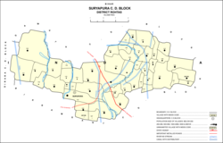 | |
 Suryapura Location in Bihar, India | |
| Coordinates: 25.25864°N 84.22546°E[1] | |
| Country | |
| State | Bihar |
| District | Rohtas |
| Area | |
| • Total | 1.96 km2 (0.76 sq mi) |
| Elevation | 89 m (292 ft) |
| Population (2011) | |
| • Total | 6,347[2] |
| Languages | |
| • Official | Hindi |
| Time zone | UTC+5:30 (IST) |
| PIN | 802221[2] |
Demographics
| Year | Pop. | ±% |
|---|---|---|
| 2001 | 48,222 | — |
| 2011 | 57,529 | +19.3% |
| Source: 2011 Census of India[2] | ||
Suryapura is a rural block, with no large urban centres. The sex ratio of Suryapura block was 918 as of 2011, which was equal to the Rohtas district average (although slightly below the rural average of 921 for the district). The ratio was slightly higher among the 0-6 age group, with 928 females for every 1000 males. The gender distribution in Suryapura itself was 3,331 male and 3,016 female. Members of scheduled castes constituted 15.46% of the population (somewhat lower than the district average), while members of scheduled tribes made up 0.2% (also lower than the district average). The literacy rate of Suryapura block was 72.06%, which was slightly below the district average of 73.37% (72.50% in rural areas). Literacy was higher in men than in women, with 82.98% of men but only 60.13% of women able to read and write, resulting in a 22.85% gender literacy gap (higher than the overall district average of 19.91% as well as the rural average of 21.04%).[2]
Employment
Most people in Suryapura block were engaged in agriculture in 2011, with 35.72% of the workforce being cultivators who owned or leased their own land, and a further 39.62% being agricultural labourers who worked someone else's land for wages. 4.86% of the workforce was engaged in household industries, and the remaining 19.80% were classified as "other workers".[2]
Amenities
All 40 inhabited villages in Suryapura block have access to drinking water, although only 3 of them have tap water, Suryapura itself among them. 28 villages have schools, serving 90.3% of the block's population, and 12 have medical facilities, serving 46.58%. 24 villages have telephone service, serving 74.2% of the block's residents, and 32 have electrical power, serving 92.26%. Five villages have banks and agricultural credit societies, 13 have transport communications (rail, bus, or navigable waterways), and 20 have permanent pucca roads.[2]
Land use
Suryapura block covers an area of 5,723.24 hectares; of this total area, 85.45% is cultivable. Of the cultivable area, 75.42% was irrigated. In the village of Suryapura itself, there are 150.6 hectares of farmland.[2]
Villages
In total, there are 48 villages in Suryapura block, including Suryapura itself. 40 of these are inhabited and the remaining 8 are uninhabited.[2]
| Village name | Total land area (hectares) | Population (in 2011) |
|---|---|---|
| Kharauj Khurd | 49 | 0 |
| Dubali | 54 | 0 |
| Balihar | 178 | 4,369 |
| Kharauj Kalan | 80 | 1,628 |
| Surajpura (headquarters) | 196 | 6,347 |
| Sirikantpur | 26 | 724 |
| Harpur | 36 | 0 |
| Barun | 248 | 3,834 |
| Bhur Kunriya Kalan | 85 | 434 |
| Bhur Kunriya Khurd | 86 | 425 |
| Jora | 42 | 0 |
| Surhuriya | 161 | 875 |
| Dobariya | 206 | 1,352 |
| Rampur | 83 | 237 |
| Lakhanpura | 105 | 975 |
| Angrer Khurd | 293 | 3,519 |
| Agrer Kalan | 524 | 3,250 |
| Ragho Dehra | 29 | 903 |
| Shiwa Bahar | 64 | 2,305 |
| Kailani | 227 | 1,568 |
| Gothani | 174 | 1,734 |
| Narayanpur | 66 | 1,682 |
| Dhawai | 229 | 798 |
| Parariya | 98 | 447 |
| Randehra | 106 | 0 |
| Bijechaunri | 45 | 13 |
| Kosanda | 63 | 1,382 |
| Kosanda Buzurg | 87 | 363 |
| Gosal Dih | 60 | 1,862 |
| Dhango | 97 | 654 |
| Chaurasi | 188 | 565 |
| Ratanpatti | 70 | 1,255 |
| Jamuara | 189 | 1,376 |
| Madaina | 78 | 536 |
| Hunka Dih | 62 | 600 |
| Nima | 51 | 617 |
| Digar Majhauli | 30.64 | 82 |
| Kawai | 136.3 | 1,794 |
| Chauriya | 78.9 | 683 |
| Imirta | 77.3 | 797 |
| Aliganj | 260.31 | 1,784 |
| Bahrar | 65.2 | 0 |
| Atrauliya | 35.9 | 0 |
| Anhar | 78.1 | 982 |
| Karma | 276 | 2,538 |
| Gaha Dih | 42.1 | 0 |
| Kalyanpur | 57.35 | 713 |
| Suara | 130.34 | 1,527 |
References
- "Geonames.org. Surajpura". Retrieved 22 June 2020.
- "Census of India 2011: Bihar District Census Handbook - Rohtas, Part A (Village and Town Directory)". Census 2011 India. pp. 33, 41–70, 436–459, 1191–1192. Retrieved 1 April 2020.
