Susitna, Alaska
Susitna is a census-designated place (CDP) in Matanuska-Susitna Borough, Alaska, United States. It is part of the Anchorage, Alaska Metropolitan Statistical Area. As of the 2010 census, the population of the CDP is 18, down from 37 in 2000.
Susitna, Alaska | |
|---|---|
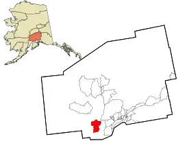 Location in Matanuska-Susitna Borough and the state of Alaska. | |
 Susitna, Alaska Location within the state of Alaska | |
| Coordinates: 61°33′27″N 150°34′36″W | |
| Country | United States |
| State | Alaska |
| Borough | Matanuska-Susitna |
| Government | |
| • Borough mayor | Vern Halter |
| • State senators | Mike Dunleavy (R) David Wilson (R) |
| • State reps. | David Eastman (R) Mark Neuman (R) |
| Area | |
| • Total | 158.8 sq mi (411.4 km2) |
| • Land | 158.2 sq mi (409.8 km2) |
| • Water | 0.6 sq mi (1.6 km2) |
| Elevation | 33 ft (10 m) |
| Population (2010) | |
| • Total | 18 |
| • Density | 0.11/sq mi (0.044/km2) |
| Time zone | UTC-9 (Alaska (AKST)) |
| • Summer (DST) | UTC-8 (AKDT) |
| Area code(s) | 907 |
| FIPS code | 02-74340 |
| GNIS feature ID | 1410439 |
Susitna was once home to the legendary Athabaskan elder, historian and ethnologist Shem Pete (c1896-1989), who documented countless locations travelling thousands of miles within the Matanuska-Susitna region.[1] His works were published in Shem Pete's Alaska: The Territory of the Upper Cook Inlet Dena'ina.[2]
Geography
Susitna is located at 61°33′27″N 150°34′36″W (61.557631, -150.576743).[3]
According to the United States Census Bureau, the CDP has a total area of 158.9 square miles (412 km2), of which, 158.2 square miles (410 km2) of it is land and 0.6 square miles (1.6 km2) of it (0.38%) is water.
Demographics and History
| Historical population | |||
|---|---|---|---|
| Census | Pop. | %± | |
| 1880 | 90 | — | |
| 1890 | 142 | 57.8% | |
| 1910 | 233 | — | |
| 1920 | 48 | −79.4% | |
| 1930 | 91 | 89.6% | |
| 1940 | 12 | −86.8% | |
| 1960 | 42 | — | |
| 2000 | 37 | — | |
| 2010 | 18 | −51.4% | |
| U.S. Decennial Census[4] | |||
Susitna first appeared on the 1880 U.S. Census as the unincorporated Tinneh villages of Sushetno (combined total of 90 residents, all Tinneh, although they were listed separately as "Sushetno (1st) and (2nd) Villages" (with a population of 44 and 46, respectively).[5] It was not specified which was the present village of Susitna.[6] In 1890, it returned as "Sushitna" (including 2 other villages on Susitna River). All of the residents were Native.[7] It did not return on the 1900 census. In 1910, it returned as Susitna, with a peak population of 233. It returned in 1920 as "Susitna Station."
In 1930, census enumerators returned it as two separate places: "Susitna" and "Susitna Station." It was divided on race, with Susitna Station (population 52), having 51 White residents and 1 Native and Susitna being the "native village", with 39 residents (all native).[8] Depending upon the boundaries of the recording districts (whose maps have not confirmed which side of the 3rd Judicial District they were located within), each was listed in two different districts: Susitna was located in Talkeetna and Susitna Station in Wasilla. This may be erroneous, but further research is needed on the matter.
In 1940, it returned as "Susitna Station" again, with just 12 residents. It did not report again until 1960, when it returned as Susitna. It would not appear again after that until 2000, when Susitna was made a census-designated place (CDP). It was greatly enlarged from its original location on the east bank of the Susitna River to take in both sides of the river, and now the bulk of its area is on the west bank today.[9]
As of the census[10] of 2000, there were 37 people, 19 households, and 6 families residing in the CDP. The population density was 0.2 people per square mile (0.1/km2). There were 102 housing units at an average density of 0.6/sq mi (0.2/km2). The racial makeup of the CDP was 89.19% white, and 10.81% from two or more races.
There were 19 households, out of which 15.8% had children under the age of 18 living with them, 26.3% were married couples living together, 10.5% had a female householder with no husband present, and 63.2% were non-families. 47.4% of all households were made up of individuals, and 26.3% had someone living alone who was 65 years of age or older. The average household size was 1.95 and the average family size was 3.14.
In the CDP, the population was spread out, with 21.6% under the age of 18, 5.4% from 18 to 24, 24.3% from 25 to 44, 27.0% from 45 to 64, and 21.6% who were 65 years of age or older. The median age was 44 years. For every 100 females, there were 105.6 males. For every 100 females age 18 and over, there were 107.1 males.
The median income for a household in the CDP was $22,500, and the median income for a family was $51,250. Males had a median income of $51,250 versus $0 for females. The per capita income for the CDP was $17,355. There were no families and 16.1% of the population living below the poverty line, none of whom were aged under 18 or over 64.
References
- "Pete, Shem (K'etech'ayuilen) | Alaska History".
- Kari, James; Fall, James A. (August 2003). Shem Pete's Alaska: The Territory of the Upper Cook Inlet Dena'ina. ISBN 9781602232433.
- "US Gazetteer files: 2010, 2000, and 1990". United States Census Bureau. 2011-02-12. Retrieved 2011-04-23.
- "U.S. Decennial Census". Census.gov. Retrieved June 6, 2013.
- http://www2.census.gov/prod2/decennial/documents/1880a_v1-17.pdf
- "Geological Survey Professional Paper". 1949.
- http://www2.census.gov/prod2/decennial/documents/1890a_v8-01.pdf
- http://akgenweb.com/census/censuspdfs/1930AK3rdDistrictPartC.pdf
- http://live.laborstats.alaska.gov/cen/maps/place/2010/74340.pdf
- "U.S. Census website". United States Census Bureau. Retrieved 2008-01-31.
Municipalities and communities of Matanuska-Susitna Borough, Alaska, United States | ||
|---|---|---|
| Cities | 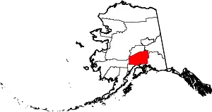 Matanuska-Susitna Borough map | |
| CDPs | ||
| Unincorporated communities |
| |
| ||