Suwannakhuha District
Suwannakhuha District (Thai: สุวรรณคูหา, pronounced [sù.wān.nā.kʰūː.hǎː]) is the northernmost district (amphoe) of Nong Bua Lamphu Province, northeastern Thailand.
Suwannakhuha
สุวรรณคูหา | |
|---|---|
 Wat Tham Suwannakuha | |
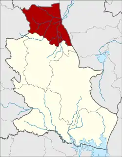 District location in Nongbua Lamphu Province | |
| Coordinates: 17°33′48″N 102°16′47″E | |
| Country | Thailand |
| Province | Nong Bua Lamphu |
| Seat | Suwannakhuha |
| Area | |
| • Total | 646.1 km2 (249.5 sq mi) |
| Population (2005) | |
| • Total | 66,277 |
| • Density | 102.6/km2 (266/sq mi) |
| Time zone | UTC+7 (ICT) |
| Postal code | 39270 |
| Geocode | 3905 |
History
The minor district (king amphoe) was created on 17 July 1973, when the three tambons Na Si, Ban Khok, and Na Di were split off from Na Klang District.[1] It was upgraded to a full district on 25 March 1979.[2] In 1993 it was one of five districts of Udon Thani Province which formed the new province, Nong Bua Lamphu.
Geography
Neighboring districts are (from the south clockwise): Na Klang of Nong Bua Lamphu Province; Na Duang of Loei Province; Nam Som, Ban Phue, and Kut Chap of Udon Thani Province.
Administration
The district is divided into eight sub-districts (tambons), which are further subdivided into 92 villages (mubans). There are two townships (thesaban tambons): Suwannakhuha covers parts of tambons Suwannakhuha, Na Si, and Kut Phueng. Ban Khok covers parts of tambon Ban Khok. There are a further seven tambon administrative organizations (TAO).
| No. | Name | Thai name | Villages | Population | |
|---|---|---|---|---|---|
| 1 | Na Si | นาสี | 14 | 8,269 | |
| 2 | Ban Khok | บ้านโคก | 13 | 12,395 | |
| 3 | Na Di | นาดี | 12 | 10,609 | |
| 4 | Na Dan | นาด่าน | 11 | 8,736 | |
| 5 | Dong Mafai | ดงมะไฟ | 12 | 10,272 | |
| 6 | Suwannakhuha | สุวรรณคูหา | 13 | 4,462 | |
| 7 | Bun Than | บุญทัน | 9 | 5,841 | |
| 8 | Kut Phueng | กุดผึ้ง | 8 | 5,693 |
References
- ประกาศกระทรวงมหาดไทย เรื่อง แบ่งท้องที่อำเภอนากลาง จังหวัดอุดรธานี ตั้งเป็นกิ่งอำเภอสุวรรณคูหา (PDF). Royal Gazette (in Thai). 90 (81 ง): 2104. July 10, 1973.
- พระราชกฤษฎีกาตั้งอำเภอหนองกุงศรี อำเภอไทรงาม อำเภอบ้านฝาง อำเภออุบลรัตน์ อำเภอเวียงชัย อำเภอดอยเต่า อำเภอนิคมคำสร้อย อำเภอนาหว้า อำเภอเสิงสาง อำเภอศรีสาคร อำเภอบึงสามพัน อำเภอนาดูน อำเภอค้อวัง อำเภอโพธิ์ชัย อำเภอเมืองสรวง อำเภอปลวกแดง อำเภอยางชุมน้อย อำเภอกาบเชิง อำเภอสุวรรณคูหา และอำเภอกุดข้าวปุ้น พ.ศ. ๒๕๒๒ (PDF). Royal Gazette (in Thai). 96 (42 ก Special): 19–24. March 25, 1979.