Tázlár
Tázlár is a village and municipality in Bács-Kiskun county, in the Southern Great Plain region of southern Hungary. It is about 10 km away from its closest neighbor, Soltvadkert.
Tázlár | |
|---|---|
| Country | |
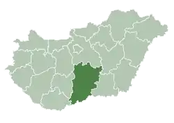
| County | Bács-Kiskun |
| Area | |
| • Total | 7,338 km2 (2,833 sq mi) |
| Population (2001) | |
| • Total | 2,014 |
| • Density | 27/km2 (70/sq mi) |
| Time zone | UTC+1 (CET) |
| • Summer (DST) | UTC+2 (CEST) |
| Postal code | 6236 |
| Area code(s) | 78 |

Location of Bács-Kiskun
county in Hungary
History
Tázlár's name was changed to Prónayfalva in 1907, but since 1947 it's called Tázlár again. The village was studied in the 1970s by anthropologist Chris Hann, resulting in a book "Tázlár: A village in Hungary".[1] He has returned there in 2000s studying the further developments The New Property System in Tázlár
Demographics
Ethnicity
As of the census of 2001 there were 2,014 people living in Tázlár. The ethnical background of the town was 95.1% Hungarian, 0.7% Gypsy, 0.2% Slovak, 4.5% other.
Religion
The religious affiliations of the people of Tázlár are:
- Roman Catholic - 65.9%
- Presbyterian - 16.1%
- Lutheran - 6.5%
- Other Christian - 0.9%
- Non-Religious - 10.5%
- Hann, Chris 1980. Tázlár: a village in Hungary, Cambridge: Cambridge University Press
| Authority control |
|
|---|
This article is issued from Wikipedia. The text is licensed under Creative Commons - Attribution - Sharealike. Additional terms may apply for the media files.