Talladega Springs, Alabama
Talladega Springs is a town in Talladega County, Alabama, United States. At the 2010 census the population was 166.[3]
Talladega Springs, Alabama | |
|---|---|
 | |
 Location of Talladega Springs in Talladega County, Alabama. | |
| Coordinates: 33°7′15″N 86°26′43″W | |
| Country | United States |
| State | Alabama |
| County | Talladega |
| Area | |
| • Total | 1.24 sq mi (3.22 km2) |
| • Land | 1.23 sq mi (3.19 km2) |
| • Water | 0.01 sq mi (0.03 km2) |
| Elevation | 430 ft (131 m) |
| Population (2010) | |
| • Total | 166 |
| • Estimate (2019)[2] | 159 |
| • Density | 129.16/sq mi (49.89/km2) |
| Time zone | UTC-6 (Central (CST)) |
| • Summer (DST) | UTC-5 (CDT) |
| FIPS code | 01-74616 |
| GNIS feature ID | 0153640 |
History
Before being submerged beneath Lay Lake, Fort Williams was located near Talladega Springs. It was used as an Indian Agency and supply depot during the Creek War.[4]
Geography
Talladega Springs is located at 33°7′15″N 86°26′43″W (33.120713, -86.445266).[5]
According to the U.S. Census Bureau, the town has a total area of 1.2 square miles (3.2 km2), of which 0.012 square miles (0.03 km2), or 0.90%, is water.[3]
Demographics
| Historical population | |||
|---|---|---|---|
| Census | Pop. | %± | |
| 1920 | 257 | — | |
| 1930 | 118 | −54.1% | |
| 1940 | 150 | 27.1% | |
| 1950 | 222 | 48.0% | |
| 1960 | 177 | −20.3% | |
| 1970 | 143 | −19.2% | |
| 1980 | 196 | 37.1% | |
| 1990 | 148 | −24.5% | |
| 2000 | 124 | −16.2% | |
| 2010 | 166 | 33.9% | |
| 2019 (est.) | 159 | [2] | −4.2% |
| U.S. Decennial Census[6] 2013 Estimate[7] | |||
As of the census[8] of 2000, there were 124 people, 57 households, and 38 families residing in the town. The population density was 99.7 people per square mile (38.6/km2). There were 65 housing units at an average density of 52.3 per square mile (20.2/km2). The racial makeup of the town was 91.13% White, 6.45% Black or African American, 0.81% Native American, and 1.61% from two or more races. 1.61% of the population were Hispanic or Latino of any race.
There were 57 households, out of which 26.3% had children under the age of 18 living with them, 61.4% were married couples living together, 3.5% had a female householder with no husband present, and 33.3% were non-families. 33.3% of all households were made up of individuals, and 14.0% had someone living alone who was 65 years of age or older. The average household size was 2.18 and the average family size was 2.76.
In the town, the population was spread out, with 21.0% under the age of 18, 7.3% from 18 to 24, 30.6% from 25 to 44, 21.0% from 45 to 64, and 20.2% who were 65 years of age or older. The median age was 39 years. For every 100 females, there were 85.1 males. For every 100 females age 18 and over, there were 88.5 males.
The median income for a household in the town was $35,833, and the median income for a family was $41,250. Males had a median income of $36,042 versus $14,167 for females. The per capita income for the town was $29,556. There were 11.1% of families and 17.2% of the population living below the poverty line, including 38.5% of under eighteens and 29.6% of those over 64.
References
- "2019 U.S. Gazetteer Files". United States Census Bureau. Retrieved June 29, 2020.
- "Population and Housing Unit Estimates". United States Census Bureau. May 24, 2020. Retrieved May 27, 2020.
- "Geographic Identifiers: 2010 Demographic Profile Data (G001): Talladega Springs town, Alabama". U.S. Census Bureau, American Factfinder. Archived from the original on February 12, 2020. Retrieved January 23, 2013.
- http://alabamatrailswar1812.com/forts.htm
- "US Gazetteer files: 2010, 2000, and 1990". United States Census Bureau. 2011-02-12. Retrieved 2011-04-23.
- "U.S. Decennial Census". Census.gov. Retrieved June 6, 2013.
- "Annual Estimates of the Resident Population: April 1, 2010 to July 1, 2013". Retrieved June 3, 2014.
- "U.S. Census website". United States Census Bureau. Retrieved 2008-01-31.
External links
- Talladega Springs email address: talladegasprings@alabamagreencities.com
Municipalities and communities of Talladega County, Alabama, United States | ||
|---|---|---|
| Cities | 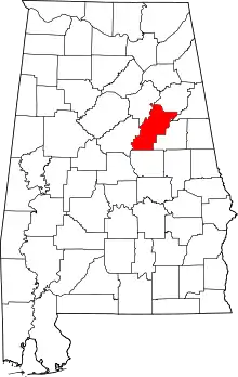 Map of Alabama highlighting Talladega County | |
| Towns | ||
| CDPs | ||
| Unincorporated communities | ||
| Ghost town | ||
| Footnotes | ‡This populated place also has portions in an adjacent county or counties | |
| ||