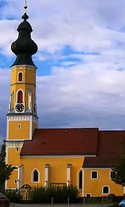
Tarsdorf
Tarsdorf is a municipality in the district of Braunau am Inn in the Austrian state Upper Austria.
Tarsdorf | |
|---|---|
 | |
 Coat of arms | |
 Tarsdorf Location within Austria | |
| Coordinates: 48°04′48″N 12°49′33″E | |
| Country | Austria |
| State | Upper Austria |
| District | Braunau am Inn |
| Government | |
| • Mayor | Andrea Holzner (ÖVP) |
| Area | |
| • Total | 32.34 km2 (12.49 sq mi) |
| Elevation | 429 m (1,407 ft) |
| Population (2018-01-01)[2] | |
| • Total | 2,068 |
| • Density | 64/km2 (170/sq mi) |
| Time zone | UTC+1 (CET) |
| • Summer (DST) | UTC+2 (CEST) |
| Postal code | 5121 |
| Area code | 06278 |
| Vehicle registration | BR |
| Website | www.tarsdorf.at |
Geography
Tarsdorf is located in the Innviertel. About 38 percent of its area consist of forest and 55 percent is made up of farmland.
Villages
The villages in the municipity are (with population in brackets as at 1 Jan 2020):
- Am Anger (69)
- Döstling (50)
- Eckldorf 57
- Ehersdorf (203)
- Eichbichl (83)
- Fugging (106)
- Haid (48)
- Hofstadt (89)
- Hofweiden (124)
- Hörndl (243)
- Hucking (59)
- Leithen (76)
- Neues Dorf (82)
- Ölling (18)
- Schmidham (38)
- Sensberg (53)
- Sinzing (4)
- Staig (28)
- Tarsdorf (481)
- Wimm (1)
- Winham (52)
- Wolfing (45)
- Wupping (51)
References
- "Dauersiedlungsraum der Gemeinden Politischen Bezirke und Bundesländer - Gebietsstand 1.1.2018". Statistics Austria. Retrieved 10 March 2019.
- "Einwohnerzahl 1.1.2018 nach Gemeinden mit Status, Gebietsstand 1.1.2018". Statistics Austria. Retrieved 9 March 2019.
External links
 Media related to Tarsdorf at Wikimedia Commons
| Authority control |
|
|---|
This article is issued from Wikipedia. The text is licensed under Creative Commons - Attribution - Sharealike. Additional terms may apply for the media files.