Tasmantid hotspot
The Tasmantid hotspot is a volcanic hotspot located in the South Pacific Ocean. Due to plate tectonics the hotspot was under different parts of the seabed in the past. It was initially centered under what is now the southern Coral Sea 60 million years ago where the first Tasmantid volcano was created. As the Indo-Australian Plate continued to drift northwards the hotspot was positioned in the northern Tasman Sea 20 million years ago, eventually reaching its current location east of Tasmania in response to ongoing northward plate motion.[1]
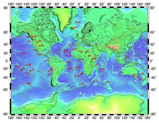
 The Tasmantid hotspot is marked 39 on map | |
| Region | South Pacific Ocean |
|---|---|
| Coordinates | 40.24°S 155.30°E |
The northward movement of the Indo-Australian Plate over the last 60 million years coupled with volcanism of the Tasmantid hotspot has resulted in a north-south line of submarine volcanoes called the Tasmantid Seamount Chain.[1] This includes over 10 seamounts, the youngest of which is the seven million year old Gascoyne Seamount.[1][2] The Tasmantid hotspot is now 400 km (250 mi) south of Gascoyne Seamount and is defined by a prominent zone of seismic activity.[1]
The Tasmantid hotspot may have created the Louisiade Plateau, a supposed large igneous province at the northern end of the Tasmantid Seamount Chain.[3]
References
- Johnson, R. W.; Knutson, J.; Taylor, S. R. (1989). Intraplate Volcanism: In Eastern Australia and New Zealand. Australian Academy of Science. p. 52. ISBN 0-521-38083-9.
- W. J. Morgan and J. P. Morgan. "Plate velocities in hotspot reference frame: electronic supplement" (PDF). Retrieved 2017-02-24.
- Kalnins, L. M.; Cohen, B. E.; Fitton, J. G.; Mark, D. F.; Richards, F. D.; Barfod, D. N. (2015). "The East Australian, Tasmantid, and Lord Howe Volcanic Chains: Possible mechanisms behind a trio of hotspot trails". AGU Fall Meeting Abstracts. American Geophysical Union. 2015: DI41A–2591. Bibcode:2015AGUFMDI41A2591K.
