Tatsuno, Nagano
Tatsuno (辰野町, Tatsuno-machi) is a town located in Nagano Prefecture, Japan. As of 1 June 2019, the town had an estimated population of 18,951 in 7917 households,[1] and a population density of 112 persons per km². The total area of the town is 169.20 square kilometres (65.33 sq mi).
Tatsuno
辰野町 | |
|---|---|
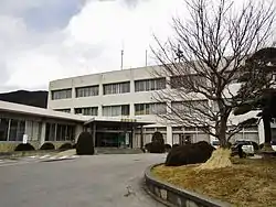 Tatsuno Town Hall | |
 Flag  Seal | |
 Location of Tatsuno in Nagano Prefecture | |
 Tatsuno | |
| Coordinates: 35°58′56.7″N 137°59′15.2″E | |
| Country | Japan |
| Region | Chūbu (Kōshin'etsu) |
| Prefecture | Nagano |
| District | Kamiina |
| Area | |
| • Total | 169.20 km2 (65.33 sq mi) |
| Population (June 1, 2019) | |
| • Total | 18,951 |
| • Density | 110/km2 (290/sq mi) |
| Time zone | UTC+9 (Japan Standard Time) |
| Symbols | |
| • Flower | Adonis amurensis |
| Phone number | 0266-41-1111 |
| Address | 1-banchi, Chuo Nakaminowa, Tatsuno-machi, Kitaina-gun, Nagano-ken 399-0493 |
| Website | Official website |

Geography
Tatsuno is located in the Ina Valley of south-central Nagano Prefecture, bordered by the Kiso Mountains. The Tenryū River flows through the town, which is surrounded by mountains and is rich in a natural environment. It is takes about 3 hours from Tokyo, 2 hours from Nagoya, 5 hours from Kyoto by train and equally by car. Part of the town is within the borders of the Enrei Ōjō Prefectural Natural Park. The Yokokawa Dam is located in Tatsuno.
Surrounding municipalities
- Nagano Prefecture
Demographics
Per Japanese census data,[2] the population of Tatsuno has remained relatively steady over the past 60 years.
| Year | Pop. | ±% |
|---|---|---|
| 1940 | 20,842 | — |
| 1950 | 24,146 | +15.9% |
| 1960 | 22,419 | −7.2% |
| 1970 | 22,351 | −0.3% |
| 1980 | 23,894 | +6.9% |
| 1990 | 23,901 | +0.0% |
| 2000 | 22,407 | −6.3% |
| 2010 | 20,913 | −6.7% |
Climate
The village has a climate characterized by characterized by warm and humid summers, and cold winters (Köppen climate classification Dfa). The average annual temperature in Tatsuno is 6.7 °C. The average annual rainfall is 1549 mm with September as the wettest month. The temperatures are highest on average in August, at around 22.2 °C, and lowest in January, at around -3.1 °C.[3]
History
The area of present-day Tatsuno was part of ancient Shinano Province. The village of Inatomi established on April 1, 1889 by the establishment of the municipalities system, and was elevated to town status on January 1, 1947, changing its name to Tatsuno at that time. The neighboring village of Asahi was annexed on April 1, 1955, followed by Kawashima on September 30, 1956 and Ono on March 31, 1961.
Education
Tatsuno has five public elementary schools and five public middle school operated by the town government, and one high school operated the Nagano Prefectural Board of Education. The Shinshu Honan Junior College is also located in Tatsuno.
Transportation
Railway
.svg.png.webp) East Japan Railway Company - Chūō Main Line (old line)
East Japan Railway Company - Chūō Main Line (old line)
.svg.png.webp) Central Japan Railway Company - Iida Line
Central Japan Railway Company - Iida Line
- Haba - Ina-Shimmachi - Miyaki - Tatsuno
Highway
International relations
 - Waitomo, New Zealand.
Local attractions
- Matsuo-kyo (松尾峡): one of the most famous places in Japan for fireflies (called Genji fireflies (ゲンジボタル) in Japan) every summer. However, the intentional introduction of non-native fireflies and its negative influence on the native fireflies of Tatsuno were highlighted in an academic journal.[4] and several major newspapers.[5][6][7]
- Enrei Ōjō Prefectural Natural Park
References
- Tatsuno town official statistics(in Japanese)
- Tatsuno population statistics
- Tatsuno climate data
- Y. Iguchi (2009) The ecological impact of an introduced population on a native population in the firefly Luciola cruciata (Coleoptera: Lampyridae).Biodiversity and Conservation, 18: 82119-2126. https://doi.org/10.1007%2Fs10531-009-9576-8.
- Asahi Shimbun (Jun 17, 2008; Nagano Chunan edition, p27).
- Mainichi Shimbun (Jun 22, 2008; Nagano Nanshin edition, p25).
- Yomiuri Shimbun (July 28, 2008; evening edition, p13).
External links
 Media related to Tatsuno, Nagano at Wikimedia Commons
- Official Website (in Japanese)
| Authority control |
|---|