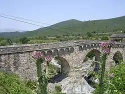
Tavignano
The Tavignano is a river on the island of Corsica, France. It is 88.9 km (55.2 mi) long.[1] Its source is in the mountainous middle of the island, south of Monte Cinto. It flows generally east, through Corte. It ends in the Tyrrhenian Sea near Aléria. Its entire course is in the Haute-Corse département.[1][2] In antiquity the river was known as the Rhotanus or Ῥότανος.[3]
| Tavignano | |
|---|---|
 | |
| Location | |
| Country | France |
| Physical characteristics | |
| Source | |
| • location | central Corsica |
| Mouth | |
• location | Tyrrhenian Sea |
• coordinates | 42°6′13″N 9°32′56″E |
| Length | 89 km (55 mi) |
References
- Sandre. "Fiche cours d'eau - Le Tavignano (Y9--0200)".
- United States. Hydrographic Office (1917). Mediterranean Pilot: The coast of France and Italy from Cape Cabère to Cape Spartivento, together with the Tuscan archipelago, Islands of Corsica, Sardinia, Sicily, and the Maltese Islands. Hydrographic Office under the authority of the secretary of the navy. pp. 327–.
- Dyson, S., R. Talbert, S. Gillies, T. Elliott, J. Becker. "Places: 472122 (Rhotanos (river))". Pleiades. Retrieved March 12, 2015.CS1 maint: multiple names: authors list (link)
This article is issued from Wikipedia. The text is licensed under Creative Commons - Attribution - Sharealike. Additional terms may apply for the media files.
