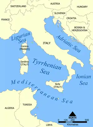
Tyrrhenian Sea
The Tyrrhenian Sea (/tɪˈriːniən/; Italian: Mar Tirreno [mar tirˈrɛːno], French: Mer Tyrrhénienne [mɛʁ tiʁenjɛn], Sardinian: Mare Tirrenu, Corsican: Mari Tirrenu, Sicilian: Mari Tirrenu, Neapolitan: Mare Tirreno) is part of the Mediterranean Sea off the western coast of Italy. It is named for the Tyrrhenian people identified with the Etruscans of Italy.
| Tyrrhenian Sea | |
|---|---|
 Tyrrhenian Sea. | |
| Location | Mediterranean Sea |
| Coordinates | 40°N 12°E |
| Type | Sea |
| Basin countries | Italy, Corsica |
| Surface area | 275,000 km2 (106,200 sq mi) |
| Average depth | 2,000 m (6,562 ft) |
| Max. depth | 3,785 m (12,418 ft) |
Geography
The sea is bounded by the islands of Corsica and Sardinia (to the west), the Italian peninsula (regions of Tuscany, Lazio, Campania, Basilicata, and Calabria) to the east, and the island of Sicily (to the south).[1] The Tyrrhenian Sea also includes a number of smaller islands like Capri, Elba, Ischia and Ustica.[2]
The maximum depth of the sea is 3,785 metres (12,418 ft).
The Tyrrhenian Sea is situated near where the African and Eurasian Plates meet; therefore mountain chains and active volcanoes such as Mount Marsili are found in its depths. The eight Aeolian Islands and Ustica are located in the southern part of the sea, north of Sicily.
Extent
The International Hydrographic Organization defines the limits of the Tyrrhenian Sea as follows:[3]
- In the Strait of Messina: A line joining the North extreme of Cape Paci (15°42′E) with the East extreme of the Island of Sicily, Cape Peloro (38°16′N).
- On the Southwest: A line running from Cape Lilibeo (West extreme of Sicily) to the South extreme of Cape Teulada (8°38′E) in Sardinia.
- In the Strait of Bonifacio: A line joining the West extreme of Cape Testa (41°14′N) in Sardinia with the Southwest extreme of Cape Feno (41°23′N) in Corsica.
- On the North: A line joining Cape Corse (Cape Grosso, 9°23′E) in Corsica, with Tinetto Island (44°01′N 9°51′E) and thence through Tino and Palmaria islands to San Pietro Point (44°03′N 9°50′E) on the coast of Italy.
Exits
There are four exits from the Tyrrhenian Sea (north to south):
| Exit | Location | Width | Connected Sea |
|---|---|---|---|
| Corsica Channel | between Tuscany and Corsica 42°50′N 9°45′E | about 80 kilometres (50 mi) | Ligurian Sea |
| Strait of Bonifacio | between Corsica and Sardinia | 11 kilometres (6.8 mi) | Mediterranean Sea (proper) |
| no name | between Sardinia and Sicily | about 290 kilometres (180 mi) | Mediterranean Sea (proper) |
| Strait of Messina | between Sicily and Calabria on the toe of Italy | 3 kilometres (1.9 mi) | Ionian Sea |
Basins
The Tyrrhenian Basin is divided into two basins (or plains), the Vavilov plain and the Marsili plain. They are separated by the undersea ridge known as the Issel Bridge, after Arturo Issel.[4]
Geology
The Tyrrhenian Sea is a back-arc basin that formed due to the rollback of the Calabrian slab towards South-East during the Neogene.[4] Episodes of fast and slow trench retreat formed first the Vavilov basin and, then, the Marsili basin.[5] Submarine volcanoes formed because trench retreat produces extension in the overriding plate allowing the mantle to rise below the surface and partially melt. The magmatism here is also affected by the fluids released from the slab.
Name
Its name derives from the Greek name for the Etruscans, who were said to be emigrants from Lydia and led by the prince Tyrrhenus.[6] The Etruscans settled along the coast of modern Tuscany and referred to the water as the "Sea of the Etruscans".
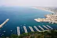
Ports
The main ports of the Tyrrhenian Sea in Italy are: Naples, Palermo, Civitavecchia (Rome), Salerno, Trapani and Gioia Tauro. In Corsica the most important port is Bastia.
Note that even though the phrase "port of Rome" is frequently used, there is in fact no port in Rome. Instead, the "port of Rome" refers to the maritime facilities at Civitavecchia, some 68 km (42 miles) to the northwest of Rome, not too far from its airport.
Giglio Porto is a small island port in this area. It rose to prominence, when the Costa Concordia ran aground near the coast of Giglio and sank. The ship was later refloated and towed to Genoa for scrapping.
Winds
In Greek mythology, it is believed that the cliffs above the Tyrrhenian Sea housed the four winds kept by Aeolus. The winds are the Mistral from the Rhône valley, the Libeccio from the southwest, and the Sirocco and Ostro from the south.
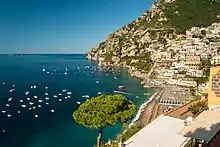
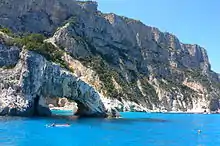
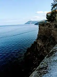
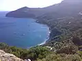
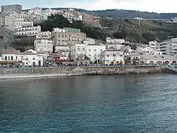
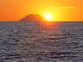
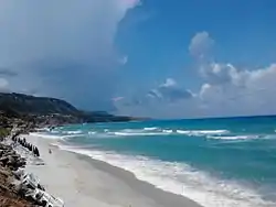
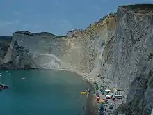
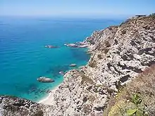
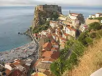
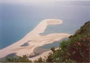
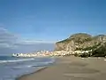
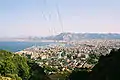
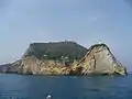
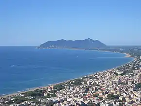
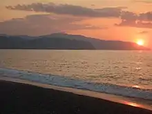
Image gallery
References
- The Editors of Encyclopaedia Britannica. "Tyrrhenian Sea". In Chisholm, Hugh (ed.). Encyclopedia Britannica. Cambridge University Press. Retrieved July 18, 2017.
- "Tyrrhenian Sea - Map & Details". World Atlas. Retrieved July 18, 2017.
- Limits of Oceans and Seas (PDF). International Hydrographic Organization. 172 (3rd ed.). 1953. p. 17. Bibcode:1953Natur.172R.484.. doi:10.1038/172484b0. S2CID 36029611. Retrieved May 2, 2020.
- Sartori, Renzo (2003). "The Tyrrhenian back-arc basin and subduction of the Ionian lithosphere" (PDF). Episodes. University of Bologna. 26 (3): 217–221. doi:10.18814/epiiugs/2003/v26i3/011. Archived from the original (PDF) on December 19, 2008.
- Faccenna, Claudio; Funiciello, Francesca; Giardini, Domenico; Lucente, Pio (2001). "Episodic back-arc extension during restricted mantle convection in the Central Mediterranean". Earth and Planetary Science Letters. 187 (1–2): 105–116. Bibcode:2001E&PSL.187..105F. doi:10.1016/s0012-821x(01)00280-1. ISSN 0012-821X.
- "The Origins of the Etruscans". San José State University. Retrieved October 28, 2016.
- "Map of Tyrrhenian Sea - Tyrrhenian Sea Map, History Facts, Tyrrhenian Sea Location - World Atlas". www.worldatlas.com. Retrieved 20 March 2018.
| Authority control |
|
|---|