Texhoma, Texas
Texhoma is a city in Sherman County, Texas, United States. The population was 364 at the 2010 census, declining from 371 in 2000. Texhoma is a divided city with the Texas-Oklahoma state border separating the city from Texhoma, Oklahoma. It is also the northernmost settlement in the entire state of Texas.
Texhoma, Texas | |
|---|---|
 Location of Texhoma, Texas | |
 | |
| Coordinates: 36°29′48″N 101°47′7″W | |
| Country | United States |
| State | Texas |
| County | Sherman |
| Area | |
| • Total | 1.90 sq mi (4.92 km2) |
| • Land | 1.90 sq mi (4.92 km2) |
| • Water | 0.00 sq mi (0.00 km2) |
| Elevation | 3,501 ft (1,067 m) |
| Population (2010) | |
| • Total | 346 |
| • Estimate (2019)[2] | 323 |
| • Density | 170.18/sq mi (65.71/km2) |
| Time zone | UTC-6 (Central (CST)) |
| • Summer (DST) | UTC-5 (CDT) |
| ZIP code | 73960[3] |
| FIPS code | 48-72464[4] |
| GNIS feature ID | 1369760[5] |
Geography
Texhoma is located at 36°29′48″N 101°47′7″W (36.496553, -101.785272).[6] According to the United States Census Bureau, the city has a total area of 1.9 square miles (4.9 km2), all of it land.
Texhoma-Texhoma relationship
Texhoma is most known for the fact that it is paired with another Texhoma across the border in Oklahoma. Tourists come for the border sign that separates Oklahoma and Texas, and the sign is very iconic.
Demographics
| Historical population | |||
|---|---|---|---|
| Census | Pop. | %± | |
| 1920 | 313 | — | |
| 1930 | 300 | −4.2% | |
| 1940 | 191 | −36.3% | |
| 1950 | 299 | 56.5% | |
| 1960 | 350 | 17.1% | |
| 1970 | 356 | 1.7% | |
| 1980 | 358 | 0.6% | |
| 1990 | 291 | −18.7% | |
| 2000 | 371 | 27.5% | |
| 2010 | 346 | −6.7% | |
| 2019 (est.) | 323 | [2] | −6.6% |
| U.S. Decennial Census[7] | |||
As of the census[4] of 2000, there were 371 people, 138 households, and 104 families residing in the city. The population density was 196.3 people per square mile (75.8/km2). There were 155 housing units at an average density of 82.0 per square mile (31.7/km2). The racial makeup of the city was 88.95% White, 0.27% African American, 1.08% Native American, 6.20% froom other races, and 3.50% from two or more races. Hispanic or Latino of any race were 15.63% of the population. In terms of ancestry, 32.8% were of German, 10.2% were of American, 7.5% were of English, 7.5% were of Irish, 3.0% were of French.
There were 138 households, out of which 39.9% had children under the age of 18 living with them, 66.7% were married couples living together, 7.2% had a female householder with no husband present, and 24.6% were non-families. 23.9% of all households were made up of individuals, and 13.0% had someone living alone who was 65 years of age or older. The average household size was 2.69 and the average family size was 3.20.
In the city, the population was spread out, with 32.1% under the age of 18, 5.9% from 18 to 24, 28.6% from 25 to 44, 20.2% from 45 to 64, and 13.2% who were 65 years of age or older. The median age was 34 years. For every 100 females, there were 99.5 males. For every 100 females age 18 and over, there were 88.1 males.
The median income for a household in the city was $35,938, and the median income for a family was $47,344. Males had a median income of $31,172 versus $22,292 for females. The per capita income for the city was $16,183. About 10.3% of families and 12.4% of the population were below the poverty line, including 21.5% of those under age 18 and 4.2% of those age 65 or over.
Education
Texhoma students are served jointly by two districts: kindergarten through fourth grade students by Texhoma Independent School District in Texas and fifth through twelfth grade students by Texhoma Public Schools in Oklahoma. For much of the 20th century, the divided town was served by a single school district. It is the only city in Texas where graduating students can attend either Texas or Oklahoma Universities and pay in-state tuition for either.[8]
References
- "2019 U.S. Gazetteer Files". United States Census Bureau. Retrieved August 7, 2020.
- "Population and Housing Unit Estimates". United States Census Bureau. May 24, 2020. Retrieved May 27, 2020.
- "Texhoma Zipcode". Retrieved 2019-01-26.
- "U.S. Census website". United States Census Bureau. Retrieved 2008-01-31.
- "US Board on Geographic Names". United States Geological Survey. 2007-10-25. Retrieved 2008-01-31.
- "US Gazetteer files: 2010, 2000, and 1990". United States Census Bureau. 2011-02-12. Retrieved 2011-04-23.
- "Census of Population and Housing". Census.gov. Retrieved June 4, 2015.
- Wallace, Linda (1991-11-17). "In Texhoma, A Bridge Over Interstate Rivalry". Philadelphia Inquirer: A02.
Municipalities and communities of Sherman County, Texas, United States | ||
|---|---|---|
| Cities | 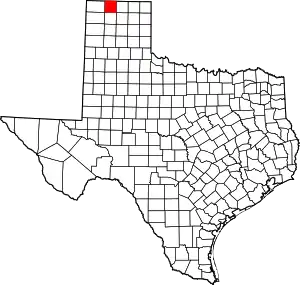 Sherman County map | |
| Ghost towns | ||
| ||