Tha Tum District
Tha Tum District (Thai: ท่าตูม, pronounced [tʰâː tūːm]) is a district (amphoe) in the northern part of Surin Province, northeastern Thailand.
Tha Tum
ท่าตูม | |
|---|---|
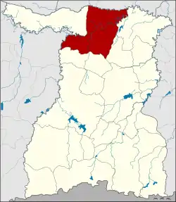 District location in Surin Province | |
| Coordinates: 15°19′6″N 103°40′30″E | |
| Country | Thailand |
| Province | Surin |
| Area | |
| • Total | 643.3 km2 (248.4 sq mi) |
| Population (2005) | |
| • Total | 97,390 |
| • Density | 151.4/km2 (392/sq mi) |
| Time zone | UTC+7 (ICT) |
| Postal code | 32120 |
| Geocode | 3203 |
Geography
Neighboring districts are (from the east clockwise): Rattanaburi, Sanom and Chom Phra of Surin Province; Satuek of Buriram Province; Chumphon Buri of Surin; Kaset Wisai and Suwannaphum of Roi Et Province.
Administration
The district is divided into 10 sub-districts (tambons), which are further subdivided into 165 villages (mubans). Tha Tum is a township (thesaban tambon) which covers parts of tambon Tha Tum. There are a further 10 tambon administrative organizations (TAO).
| No. | Name | Thai name | Villages | Pop. | |
|---|---|---|---|---|---|
| 1. | Tha Tum | ท่าตูม | 22 | 19,198 | |
| 2. | Krapho | กระโพ | 20 | 15,789 | |
| 3. | Phrom Thep | พรมเทพ | 22 | 7,969 | |
| 4. | Phon Khrok | โพนครก | 16 | 9,344 | |
| 5. | Mueang Kae | เมืองแก | 19 | 10,173 | |
| 6. | Ba | บะ | 15 | 6,555 | |
| 7. | Nong Bua | หนองบัว | 11 | 7,417 | |
| 8. | Bua Khok | บัวโคก | 19 | 9,700 | |
| 9. | Nong Methi | หนองเมธี | 11 | 5,976 | |
| 10. | Thung Kula | ทุ่งกุลา | 10 | 5,269 |
This article is issued from Wikipedia. The text is licensed under Creative Commons - Attribution - Sharealike. Additional terms may apply for the media files.
