Timblin, Pennsylvania
Timblin is a borough in Jefferson County, Pennsylvania, United States. The population was 157 at the 2010 census.[3]
Timblin, Pennsylvania | |
|---|---|
 Location of Timblin in Jefferson County, Pennsylvania. | |
 Timblin Location of Timblin in Jefferson County, Pennsylvania.  Timblin Timblin (the United States) | |
| Coordinates: 40°57′58″N 79°12′02″W | |
| Country | United States |
| State | Pennsylvania |
| County | Jefferson |
| Government | |
| • Type | Borough Council |
| Area | |
| • Total | 0.95 sq mi (2.47 km2) |
| • Land | 0.95 sq mi (2.47 km2) |
| • Water | 0.00 sq mi (0.01 km2) |
| Elevation | 1,224 ft (373 m) |
| Population (2010) | |
| • Total | 157 |
| • Estimate (2019)[2] | 146 |
| • Density | 153.36/sq mi (59.20/km2) |
| Time zone | UTC-5 (Eastern (EST)) |
| • Summer (DST) | UTC-4 (EDT) |
| ZIP code | 15778 |
| Area code(s) | 814 |
| FIPS code | 42-76744 |
History
Timblin had its start around 1883 when John A. Timblin opened a store at the site.[4] A post office called Timblin was established in 1889.[5]
Geography
Timblin is located in southwestern Jefferson County at 40°57′58″N 79°12′2″W (40.965989, -79.200538).[6] The Armstrong County line forms the western border of the borough.
According to the United States Census Bureau, the borough has a total area of 0.95 square miles (2.47 km2), of which 1.7 acres (7,036 m2), or 0.28%, are water. Timblin is in the valley of Pine Run,[7] a west-flowing tributary of Mahoning Creek, part of the Allegheny River watershed. Two streams join Pine Run from the north in Timblin: Eagle Run,[8] and Painter Run.[9]
Demographics
| Historical population | |||
|---|---|---|---|
| Census | Pop. | %± | |
| 1930 | 431 | — | |
| 1940 | 454 | 5.3% | |
| 1950 | 327 | −28.0% | |
| 1960 | 240 | −26.6% | |
| 1970 | 218 | −9.2% | |
| 1980 | 197 | −9.6% | |
| 1990 | 165 | −16.2% | |
| 2000 | 151 | −8.5% | |
| 2010 | 157 | 4.0% | |
| 2019 (est.) | 146 | [2] | −7.0% |
| Sources:[10][11][12] | |||
As of the census[11] of 2000, there were 151 people, 58 households, and 45 families residing in the borough. The population density was 166.4 people per square mile (64.1/km2). There were 72 housing units at an average density of 79.4 per square mile (30.5/km2). The racial makeup of the borough was 98.68% White, 0.66% from other races, and 0.66% from two or more races. Hispanic or Latino of any race were 1.99% of the population.
There were 58 households, out of which 34.5% had children under the age of 18 living with them, 65.5% were married couples living together, 6.9% had a female householder with no husband present, and 20.7% were non-families. 19.0% of all households were made up of individuals, and 8.6% had someone living alone who was 65 years of age or older. The average household size was 2.60 and the average family size was 2.96.
In the borough the population was spread out, with 27.2% under the age of 18, 6.0% from 18 to 24, 32.5% from 25 to 44, 17.2% from 45 to 64, and 17.2% who were 65 years of age or older. The median age was 37 years. For every 100 females there were 98.7 males. For every 100 females age 18 and over, there were 103.7 males.
The median income for a household in the borough was $30,625, and the median income for a family was $35,139. Males had a median income of $29,219 versus $38,125 for females. The per capita income for the borough was $14,831. None of the families and 4.6% of the population were living below the poverty line, including no under eighteens and 9.8% of those over 64.
References
- "2019 U.S. Gazetteer Files". United States Census Bureau. Retrieved July 28, 2020.
- "Population and Housing Unit Estimates". United States Census Bureau. May 24, 2020. Retrieved May 27, 2020.
- "Geographic Identifiers: 2010 Census Summary File 1 (G001): Timblin borough, Pennsylvania". American Factfinder. U.S. Census Bureau. Archived from the original on February 13, 2020. Retrieved November 8, 2018.
- McKnight, William James (1917). Historical. J.H. Beers. p. 493.
- "Jefferson County". Jim Forte Postal History. Retrieved 2 December 2015.
- "US Gazetteer files: 2010, 2000, and 1990". United States Census Bureau. 2011-02-12. Retrieved 2011-04-23.
- "Pine Run, Armstrong County, Pennsylvania". Geographic Names Information System. United States Geological Survey.
- "Eagle Run, Jefferson County, Pennsylvania". Geographic Names Information System. United States Geological Survey.
- "Painter Run, Jefferson County, Pennsylvania". Geographic Names Information System. United States Geological Survey.
- "Census of Population and Housing". U.S. Census Bureau. Retrieved 11 December 2013.
- "U.S. Census website". United States Census Bureau. Retrieved 2008-01-31.
- "Incorporated Places and Minor Civil Divisions Datasets: Subcounty Resident Population Estimates: April 1, 2010 to July 1, 2012". Population Estimates. U.S. Census Bureau. Archived from the original on June 11, 2013. Retrieved 11 December 2013.
Municipalities and communities of Jefferson County, Pennsylvania, United States | ||
|---|---|---|
| Boroughs | 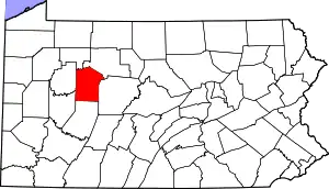 | |
| Townships | ||
| CDP | ||
| Other unincorporated communities |
| |
| Footnotes | ‡This populated place also has portions in an adjacent county or counties | |
| ||
