Toubkal National Park
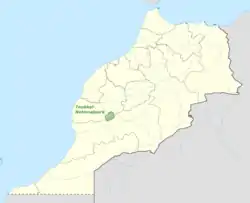
Toubkal National Park is a national park in the High Atlas mountain range, 70 kilometres from Marrakesh in central-western Morocco. Established in 1942, it covers an area of 380 km2. Jbel Toubkal is the highest peak of the park at 4,167 metres.
| Toubkal National Park | |
|---|---|
IUCN category II (national park) | |
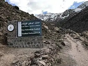 Sign of the park | |
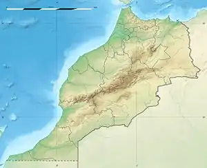 | |
| Location | Morocco |
| Coordinates | 31°5′N 7°50′W |
| Area | 380 km2 (150 sq mi) |
| Established | 1942 |
Main Attractions
The Toubkal National Park offers many attractions to visitors. Climbing to the mount peak takes 2-days and offers flowery landscapes during spring and colorful forests of cedar oaks and junipers during the fall. The rural village of Imlil, surrounded by mountains, is a stop point to immerse in dwellers simple life. The ecomuseum of the Toubkal National Park showcases the history of the park and the ongoing projects about sustainability and protection of endangered species. [1][2]

Archeological sites
In October 2012 Salafists were blamed for destroying an 8,000-year-old petroglyph within the park that depicted the Sun as a divinity.[3][4]
Mountains
The park contains the following mountains:
- Toubkal (4167 m)
- Ouanoukrim (4089 m )
- Plateau de Tazarhart (3995 m)
- L'Aksoual ( 3910 m)
- Ineghmar (3892 m)
- Bou Iguenouane (3882m)
- Le Tichki (3753 m)
- Azrou Tamadout (3664 m)
References
- "The Toubkal National Park Guide (2021)". Moroccanzest. 2021-01-20. Retrieved 2021-01-20.
- "Accueil". Parc national de Toubkal (in French). Retrieved 2021-01-20.
- Karam, Souhail (18 October 2012). "Salafists blamed for destroying pagan rock carving in Morocco". Reuters.
- "Region | Morocco Pagan rock carving in Morocco destroyed". Gulf News. 18 October 2012. Retrieved 18 October 2012.
| Wikimedia Commons has media related to Toubkal National Park. |