Towamensing Trails, Pennsylvania
Towamensing Trails is a census-designated place (CDP)[1] in Penn Forest Township, Carbon County, Pennsylvania, United States. The community is located directly south of the village of Albrightsville. As of the 2010 census, the population was 2,292.[2]
Towamensing Trails, Pennsylvania | |
|---|---|
 Towamensing Trails Location in Pennsylvania | |
| Coordinates: 40°59′42″N 75°35′0″W | |
| Country | United States |
| State | Pennsylvania |
| County | Carbon |
| Township | Penn Forest |
| Area | |
| • Total | 6.2 sq mi (16.1 km2) |
| • Land | 5.9 sq mi (15.4 km2) |
| • Water | 0.3 sq mi (0.7 km2) |
| Elevation | 1,810 ft (550 m) |
| Population (2010) | |
| • Total | 2,292 |
| • Density | 386/sq mi (148.9/km2) |
| Time zone | UTC-5 (Eastern (EST)) |
| • Summer (DST) | UTC-4 (EDT) |
| FIPS code | 42-77163 |
| GNIS feature ID | 1212327 |
The CDP is located in the southern part of the Poconos and is bordered by Pennsylvania Route 903 on the northwest, separating it from Albrightsville, and by Pennsylvania Route 534 on the northeast. PA 903 leads southwest 12 miles (19 km) to Jim Thorpe, the Carbon County seat, and north 7 miles (11 km) to Interstate 80 near Blakeslee, while PA 534 leads south 9 miles (14 km) to U.S. Route 209 and west through Hickory Run State Park 14 miles (23 km) to White Haven.
References
- https://www.census.gov/2010census/
- "Geographic Identifiers: 2010 Census Summary File 1 (G001): Towamensing Trails CDP, Pennsylvania". U.S. Census Bureau, American Factfinder. Archived from the original on April 8, 2015. Retrieved April 8, 2015.
External links
Places adjacent to Towamensing Trails, Pennsylvania | ||||||||||
|---|---|---|---|---|---|---|---|---|---|---|
| ||||||||||
Municipalities and communities of Carbon County, Pennsylvania, United States | ||
|---|---|---|
| Boroughs | 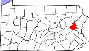 | |
| Townships | ||
| CDPs | ||
| Unincorporated communities | ||
| Footnotes | ‡This populated place also has portions in an adjacent county or counties | |
| ||
This article is issued from Wikipedia. The text is licensed under Creative Commons - Attribution - Sharealike. Additional terms may apply for the media files.