Towner, Colorado
Towner is an unincorporated community and a census-designated place (CDP) located in and governed by Kiowa County, Colorado, United States. The population of the Towner CDP was 22 at the United States Census 2010.[4] The Sheridan Lake post office (Zip Code 81071) serves Towner postal addresses.[3]
Towner, Colorado | |
|---|---|
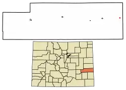 Location of the Towner CDP in Kiowa County, Colorado. | |
 Towner Location of the Towner CDP in the United States. | |
| Coordinates: 38°28′13″N 102°04′50″W[1] | |
| Country | |
| State | |
| County | Kiowa County |
| Government | |
| • Type | unincorporated community |
| Area | |
| • Total | 0.037 sq mi (0.097 km2) |
| • Land | 0.037 sq mi (0.097 km2) |
| • Water | 0.000 sq mi (0.000 km2) |
| Elevation | 3,927 ft (1,197 m) |
| Population (2010) | |
| • Total | 22 |
| • Density | 595/sq mi (227/km2) |
| Time zone | UTC-7 (MST) |
| • Summer (DST) | UTC-6 (MDT) |
| ZIP Code[3] | 81071 |
| Area code(s) | 719 |
| GNIS feature[2] | Towner CDP |
History
Towner was originally known as "Memphis". It was a frequent attraction for Kansans when their state was "dry". Towner is the easternmost town in Colorado, located less than 2 miles (3 km) from the Kansas border.
The town currently supports two grain elevators. Its population swells during harvest due to the influx of agricultural crews who often camp in the town. Towner students attend Plainview School, close to Sheridan Lake. It is responsible for the education of students in grades prekindergarten through grade 12.
Hunting opportunities are abundant in the area, with deer, antelope, and pheasant commonplace, as well as an occasional elk sighting.[5]
In 1931, five students and their bus driver died in the Pleasant Hill bus tragedy near Towner.
Geography
Towner is located in eastern Kiowa County. Colorado State Highway 96 passes through the community. The closest gas station is about 11 miles (18 km) to the west on Highway 96 in the town of Sheridan Lake. The Kansas state line is 2 miles (3 km) to the east, and Tribune, Kansas, is 18 miles (29 km) to the east of Towner via Kansas State Highway 96.
The Towner CDP has an area of 24 acres (0.097 km2), all land.[1]
Demographics
The United States Census Bureau initially defined the Towner CDP for the United States Census 2010.
| Year | Pop. | ±% |
|---|---|---|
| 2010 | 22 | — |
| 2020 | — | |
| Source: United States Census Bureau | ||
See also
- Outline of Colorado
- State of Colorado
- Colorado cities and towns
- Colorado counties
References
- "State of Colorado Census Designated Places - BAS20 - Data as of January 1, 2020". United States Census Bureau. Retrieved December 22, 2020.
- "U.S. Board on Geographic Names: Domestic Names". United States Geological Survey. Retrieved December 22, 2020.
- "Look Up a ZIP Code". United States Postal Service. Retrieved December 22, 2020.
- "2010: DEC Summary File 1". United States Census Bureau. Retrieved December 22, 2020.
- http://webarchive.org/web/20061023130311/http://www.kcedf.org/Kiowa+Cnty+Fact+Book.doc
External links
Municipalities and communities of Kiowa County, Colorado, United States | ||
|---|---|---|
| Towns | 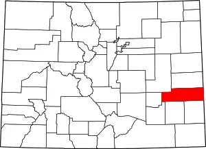 Map of Colorado highlighting Kiowa County | |
| CDPs | ||
| Unincorporated communities | ||
| ||
| Authority control |
|
|---|
