Trebišnjica wellsprings group
Trebišnjica wellspring-group is a system of two geographically and hydrologically distinct principal groupings of strong karstic springs, Trebišnjica and Čeplica, which together constitute source of the Trebišnjica river. Wellsprings are located just below town of Bileća in Bosnia and Herzegovina. The entire area where founts are situated is submerged under Bilećko Lake since 1967, formed after the construction of Trebinje-1 Hydroelectric Power Station and its large arch dam at Grnčarevo village.[3]
| Trebišnjica wellsprings group | |
|---|---|
| Karst spring | |
_River_the_source_Herzegowina_Austro-Hungary.jpg.webp) Dejanova Pećina, primary outlet in the Trebišnjica wellspring system - photochrome cca 1890 | |
| Location | Bileća, Bosnia and Herzegovina |
| Coordinates | 42.8644525°N 18.4212613°E |
| Spring source | Trebišnjica river |
| Elevation | 325 m 1,066 ft a.s.l.[1] |
| Type | Karst spring |
| Discharge | 125 m3/s 4,400 cu ft/s to 220 m3/s 7,800 cu ft/s[2] |
 Location in Bosnia and Herzegovina Dejanova pećina wellspring | |
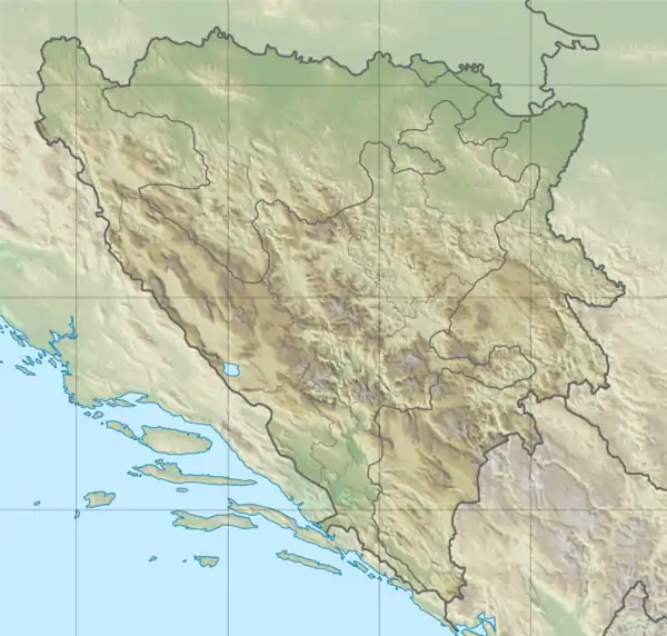
Springs
The Trebišnjica river emerges under the karstic plateau on which town of Bileća sits. There are two main spring-groups, first in immediate proximity of town itself, and second little more than 3 kilometers downstream at Ćeplica village.
Trebišnjica spring-group
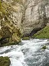
The Trebišnjica spring-group at Bileća, at 325 m (1,066 ft) a.s.l.,[1] is composed of three major wellspring outlets, "Dejanova Pećina", "Vrelo Oko", and "Nikšičko Vrelo".
Čepelica spring-group
Another submerged springs are Čepelica river spring-group ("Čeplica spring-group"), located at Ćeplica village, 3.25 kilometres (2.02 mi) further down the stream from first group, at 324 m (1,063 ft) a.s.l.[1] The Čepelica river itself was less than 2 kilometres (1.2 mi) long seasonal river, and flowed through valley of "Luke" (literally transl. Bay, Haven, Harbour; figuratively transl. glade(s), meadow(s)) before it meet Trebišnjica at "Mistialj" confluence. The Čepelica spring-group consists of two main karst hydrological features, Wellspring Čepo (Vrelo "Čepo") with three main outlets, and group of smaller estavelles (sinkholes) and springs on the left-bank side of the Čeplica river streambed.
Bileća Lake ecological impact
Both groups were part of the characteristic Dinaric karst landscape with significant aesthetic value, however entire region surrounding the Trebišnjica headwaters, together with its sources, many villages and productive land is flooded in 1967 by the Bilećko Lake, formed after construction of the Grnčarevo dam, with the primary purpose of serving as an artificial water reservoir for the Trebinje-1 Hydroelectric Power Station turbines.[3]
See also
References
- "KARST HYDROLOGY & HYDROGEOLOGY - The Trebišnjica River Spring-group below Bileća (Vrela Rijeke Trebišnjice) - 2.3.2. Overview of the Fatničko Polje Karst Outlet Springs". www.devonkarst.org.uk. The Devon Karst Research Society. Retrieved 21 January 2019.
- "KARST HYDROLOGY & HYDROGEOLOGY - The Trebišnjica River Spring-group below Bileća (Vrela Rijeke Trebišnjice) - Monitored Effects during and after the Submersion of the Trebišnjica". www.devonkarst.org.uk. The Devon Karst Research Society. Retrieved 21 January 2019.
- "KARST HYDROLOGY & HYDROGEOLOGY - The Trebišnjica River Spring-group below Bileća (Vrela Rijeke Trebišnjice)". www.devonkarst.org.uk. The Devon Karst Research Society. Retrieved 29 October 2018.
| Flooded |
|  |
|---|---|---|
| Karst spring |
| |
| Spring |
| |
| Thermal spring | ||
| Mineral & thermo-mineral spring |
| |
| Vrulja | ||
Most Bosnia and Herzegovina springs are karst spring; sea also Dinaric Alps | ||
| Unexplored, flooded |  | |
|---|---|---|
| Caves with paintings, pictograms & cave prehistoric sites |
| |
| Subterranean river |
| |
| Caves with underground lakes |
| |
| Caves with wellsprings |
| |
| Estavelle caves (Ponor) | ||
| Show caves & explored |
| |
Most Bosnia and Herzegovina caves belong to Dinaric Alps and are kast caves | ||
| Countries | 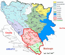 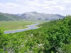 | ||||||||||||||||
|---|---|---|---|---|---|---|---|---|---|---|---|---|---|---|---|---|---|
| Places | |||||||||||||||||
| Wellsprings |
| ||||||||||||||||
| Tributaries |
| ||||||||||||||||
| Lakes |
| ||||||||||||||||
| Hydroelectric Power Plants | |||||||||||||||||
| Related articles | |||||||||||||||||
| Trebišnjica drainage: sub-basin of the Neretva |
| ||||||||||||||||