U.S. Route 136 in Illinois
U.S. Route 136 (US 136) runs east–west across central Illinois for 225.5 miles (362.9 km). US 136 enters the state from Iowa across the Keokuk–Hamilton Bridge over the Mississippi River between Keokuk, Iowa, and Hamilton, Illinois, and exits into Indiana east of Danville. The largest population centers along the route are Macomb, Rantoul, and Danville.
| ||||
|---|---|---|---|---|
_map.svg.png.webp) | ||||
| Route information | ||||
| Maintained by IDOT | ||||
| Length | 225.5 mi[1][2][3] (362.9 km) | |||
| Existed | 1950[4][5]–present | |||
| Major junctions | ||||
| West end | ||||
| East end | ||||
| Location | ||||
| Counties | Hancock, McDonough, Fulton, Mason, Logan, McLean, Champaign, Vermilion | |||
| Highway system | ||||
| ||||

For nearly its entire route, US 136 is two-lane and rural, with the exception of portions in and around major towns and cities and its overlap with the Chicago–Kansas City Expressway. Despite the highway's rural routing, it has junctions into four Interstates: Interstate 155 (I-155), I-55, I-74, and I-57. Additionally, US 136 contains what is perhaps one of the longest straight stretches of a U.S. Highway east of the Mississippi River, running nearly 86 miles (138 km) without any deviations from north of Easton to just west of Rantoul.[6]
Route description
Hamilton to Havana
From the Keokuk–Hamilton Bridge, US 136 exits Keokuk and enters Hamilton. US 136 then runs concurrently with Illinois Route 96 (IL 96) in Hamilton. It then bends slightly northwestward east of Elvaston as it is near Carthage. In Carthage, US 136 then runs concurrently with IL 94 until it reaches a diamond interchange east of the city. At that point, IL 94 leaves US 136 while it joins with IL 110 (CKC)/IL 336. US 136 then leaves the concurrency southwest of Tennessee. North of the McDonough County Courthouse in downtown Macomb, US 67 joins in from the north. US 67 then branches south from US 136 east of Macomb. It then turns southward as it intersects IL 41. Then, it turns southeast north of Adair and then south and then east at Table Grove. At Duncan Mills, US 136 then runs concurrently with US 24 and IL 100. US 24 then leaves as the other two routes bending eastward. IL 100 soon leaves US 136. Just west of the Scott W. Lucas Bridge, IL 78 and IL 97 join with US 136. After the crossing, IL 78 turns southward, leaving the concurrency.[1]
Havana to Indiana state line
US 136 then turns northward and then eastward from IL 97. It then meets IL 29 from the south where it travels concurrently until it leaves northward near San Jose.[1] Further east, US 136 reaches four diamond interchanges with I-155, I-55, US 51, and I-74 respectively. Furthermore, it also intersects US 150, IL 54, and IL 47. West of Rantoul, US 136 meets I-57 at a parclo interchange. In downtown Rantoul, it intersects US 45. At Armstrong, it turns south and then back east which overlaps IL 49.[2] In the middle of Henning and Alvin, US 136 turns south which overlaps IL 1. The concurrency runs from the junction of US 136/IL 1/IL 119 to the junction of US 136/US 150/IL 1 in Danville. At that point, US 136 turns eastward all the way to Indiana.[3]
History
Initially, before the formation of US 136, parts of IL 9, IL 31, IL 43, IL 24, IL 1, and IL 10 followed what is now part of US 136. The rest of it wasn't built yet.[7] Over time, new roads were being built. By 1929, IL 98, IL 122, and IL 119 were established.[8] In 1935, IL 31 was superseded by US 24 while IL 43 was superseded by parts of IL 122 and IL 120. In 1939, a part of Illinois Route 10 (IL 10) moved its western terminus from Decatur to Keokuk, Iowa. This caused the relocation of IL 98 from Adair–Duncan Mills route to its present-day routing. This also caused IL 9 to relocate northward. Also, IL 119 finished extending to IL 10 east of Havana.[9][10] Since 1950, most of IL 119, as well as some sections of IL 10, were removed in favor of US 136.[4]
Major intersections
| County | Location | mi[1][2][3] | km | Destinations | Notes |
|---|---|---|---|---|---|
| Mississippi River | 0.0 | 0.0 | Continuation into Iowa | ||
| 0.0– 0.4 | 0.0– 0.64 | Keokuk–Hamilton Bridge | |||
| Hancock | Hamilton | 1.6– 1.7 | 2.6– 2.7 | Eastern end of GRR overlap; western end of IL 96 overlap | |
| 2.2 | 3.5 | Eastern end of IL 96 overlap | |||
| Carthage | 13.3 | 21.4 | Western end of IL 94 overlap | ||
| 14.6– 15.0 | 23.5– 24.1 | Western end of IL 110 / 336 overlap; hospital signed eastbound only; interchange on IL 110 / 336 | |||
| McDonough | Tennessee Township | 26.9 | 43.3 | Northern terminus of IL 61 | |
| 28.7 | 46.2 | Eastern end of IL 110 / 336 overlap | |||
| Chalmers Township | 35.3– 35.8 | 56.8– 57.6 | Interchange on IL 336 | ||
| Macomb | 39.4 | 63.4 | Western end of US 67 overlap | ||
| Scotland–Macomb township line | 42.5 | 68.4 | Eastern end of US 67 overlap | ||
| Mound–New Salem township line | 48.4 | 77.9 | Southern terminus of IL 41 | ||
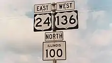
| Fulton | Duncan Mills | 69.8 | 112.3 | Western end of US 24 / IL 100 overlap | |
| Isabel Township | 72.1 | 116.0 | Eastern end of US 24 overlap | ||
| 74.7– 74.8 | 120.2– 120.4 | Eastern end of IL 100 overlap | |||
| 77.7– 77.9 | 125.0– 125.4 | Western end of IL 78 / 97 overlap | |||
| Illinois River | 78.4– 78.8 | 126.2– 126.8 | Scott Wike Lucas Bridge | ||
| Mason | Havana | 78.8 | 126.8 | Eastern end of IL 78 overlap | |
| 79.4 | 127.8 | Eastern end of IL 97 overlap | |||
| Sherman Township | 90.5 | 145.6 | Western terminus of IL 10; Mason City signed eastbound only | ||
| Allens Grove Township | 98.7 | 158.8 | Western end of IL 29 overlap | ||
| 101.7 | 163.7 | Eastern end of IL 29 overlap | |||
| Logan | Orvil Township | 111.5– 111.7 | 179.4– 179.8 | I-155 exit 10 | |
| McLean | McLean | 126.7– 127.0 | 203.9– 204.4 | I-55 exit 145 | |
| Heyworth | 135.9– 136.1 | 218.7– 219.0 | Interchange on US 51 | ||
| Empire Township | 149.7– 150.0 | 240.9– 241.4 | I-74 exit 152 | ||
| 151.2 | 243.3 | ||||
| Bellflower Township | 158.4 | 254.9 | Farmer City signed eastbound, Clinton westbound | ||
| Champaign | Newcomb Township | 167.9 | 270.2 | ||
| Rantoul | 178.2– 178.7 | 286.8– 287.6 | I-57 exit 250 | ||
| 180.0 | 289.7 | ||||
| Vermilion | Middlefork Township | 194.0 | 312.2 | Western end of IL 49 overlap | |
| 194.8 | 313.5 | Eastern end of IL 49 overlap | |||
| South Ross Township | 207.3 | 333.6 | Western end of IL 1 overlap; western terminus of IL 119 | ||
| Danville | 219.8 | 353.7 | Eastern end of IL 1 overlap | ||
| Danville Township | 225.5 | 362.9 | Continuation into Indiana | ||
1.000 mi = 1.609 km; 1.000 km = 0.621 mi
| |||||
See also
 U.S. roads portal
 Illinois portal
References
- Google (November 5, 2020). "North America to 36241-36773 US Hwy 136, San Jose, IL 62682" (Map). Google Maps. Google. Retrieved November 5, 2020.
- Google (November 5, 2020). "36241-36773 US Hwy 136, San Jose, IL 62682 to 7600-7798 US Hwy 136, Potomac, IL 61865" (Map). Google Maps. Google. Retrieved November 5, 2020.
- Google (November 5, 2020). "7600-7798 US Hwy 136, Potomac, IL 61865 to US Hwy 136, Danville, IL 61834" (Map). Google Maps. Google. Retrieved November 5, 2020.
- Illinois Secretary of State; Rand McNally (1950). Illinois Road Map (Map). c. 1:918,720. Springfield: Illinois Secretary of State. Retrieved November 6, 2020 – via Illinois Digital Archives.
- Greenberger, David; et al. (October 5, 2020). "End of US Highway 136". USEnds.com. Retrieved November 5, 2020.
- Google (November 5, 2020). "US Hwy 136, Rantoul, IL 61866 to 27998-27840 US Hwy 136, Easton, IL 62633" (Map). Google Maps. Google. Retrieved November 5, 2020.
- Illinois Secretary of State (1924). Illinois Official Auto Trails Map (Map). [c. 1:950,000 and c. 1:1,110,000]. Springfield: Illinois Secretary of State. Retrieved November 15, 2020 – via Illinois Digital Archives.
- "1929-2 Official Illinois Highway Map". www.idaillinois.org. Retrieved November 15, 2020.
- Illinois Secretary of State; Rand McNally (1939). Illinois Road Map (Map) (1939–1940 ed.). c. 1:918,720. Springfield: Illinois Secretary of State. Retrieved November 6, 2020 – via Illinois Digital Archives.
- Illinois Secretary of State; Rand McNally (1948). Illinois Road Map (Map). c. 1:918,720. Springfield: Illinois Secretary of State. Retrieved November 6, 2020 – via Illinois Digital Archives.
| Previous state: Iowa |
Illinois | Next state: Indiana |