Umarga
Umarga/ Omerga (in Marathi: उमरगा) is a town with a municipal council in the Osmanabad district in the Indian state of Maharashtra. It is an administrative headquarter of the Umarga Tehsil.
Umarga(Omerga) | |
|---|---|
Town | |
 Umarga(Omerga) Location in Maharashtra, India | |
| Coordinates: 17°50′24″N 76°37′18″E | |
| Country | |
| State | Maharashtra |
| District | Osmanabad |
| Government | |
| • Type | State government and central government |
| • Body | Nagar Palika |
| Elevation | 572 m (1,877 ft) |
| Population (2011)[1] | |
| • Total | 35,477 |
| Languages | |
| • Official | Marathi |
| Time zone | UTC+5:30 (IST) |
| ISO 3166 code | IN-MH |
| Lok Sabha constituency | Osmanabad |
| Vidhan Sabha constituency | Umarga[2] |
| Website | Npomerga.org.in |
Geography
The town of Umarga is situated on National Highway 65 Pune-Solapur-Hyderabad-Machilipatnam. It is located 85 km by road east of the city of Solapur, 95 km by road from the district capital of Osmanabad, and 20 km west of the Karnataka-Maharashtra State boundary. The nearest towns are Jahagir Chincholi (5km;south) Turori (8 km east west from NH65 Umarga), Diggi (17 km), Madaj (16 km by road to the southwest), and Murum (9 km by road to the east on NH-65). The town of Umarga has an elevation of 572 metres (1876 feet).
Demographics
In the 2011 census, the town of Umarga had a population of 35,609.[3]The official language is Marathi.[4][5]
Economy and infrastructure
Agriculture and agriculture related services are the main income sources for the people here. Umarga has a MIDC industrial park of 2500 hectares. Umarga is a census town. It is a developing town and it runs a weekly bazaar on Sunday. Omerga MIDC is attracting investment in textile and beverage industries.
Religious places
- Mahadev Mandir (Shiva Temple): Umarga has a 1000-year-old ancient magnificent "Hemadpanthi" Temple of Lord Shiva. This indicates its roots linked to the Shilahar, Rastrkuta, Chalukya Dynasty.
- Birudev Temple is on Latur Road. Birudev is worshiped as the god of the Dhangar community.
- Hanuman Mandir
- Kala Maruti Mandir on Hyderabad road
- Tulja Bhawani Temple and Renuka Mata Temple
- Sayad Basha Dargah
- Maheboob subhani Dargah
- Shri Nath Mandir is the temple of Saint Eknath. Also has 2.5 Feet statue of Shri Vitthal. Every year there is a Festival called NATH-SHASHTHI, which includes Bhajan, Kirtan, Ann-daan.
- Siddheshwar Temple Nagral:12 km south of Umarga is holy temple and is worshiped by Hindu community.
- Shivrambuva Temple Wagdari:13km north of Umarga is village deity of Wagdari and on the eve of every Mahashivratri the people of Wagdari celebrate it as Mela (Hindu festival)
- Sayyed Haji Munnawar Dargha, Gunjoti
- Achalbet Devastan, Turori
- Kapil Vastu Buddha Vihar, Turori
- Vahya Bandenavaj, Turori
- Hanuman Mandir Ekondi Jahagir, Turori *katrina mandir and bhagwat devi mandir nai bakit 18km
- Shivatej Online Services, Turori
References
- http://www.censusindia.gov.in/pca/SearchDetails.aspx?Id=598261
- "Assembly Constituencies-Post delimitation: Maharashtra: Osmanabad District" (PDF). National Informatics Centre, Government of India. Archived from the original (PDF) on 5 May 2013.
- "NPR Report: Maharashtra: Osmanabad: Umarga". National Population Register, Ministry of Home Affairs, Government of India. 2011.
- The Dynasties of the Kanarese Districts of the Bombay Presidency (1894) J.F. Fleet, Gazetteer of the Bombay Presidency (Vol-1, Part-II, Book-III) ISBN 81-206-0277-3
- "Kanarese". DSAL The Record News.
Osmanabad district topics | ||
|---|---|---|
| History | 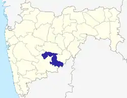 | |
| Cities and towns | ||
| Monuments | ||
| Lok Sabha constituencies | ||
| Vidhan Sabha constituencies | ||