Ungheni, Mureș
Ungheni (Hungarian: Nyárádtő [ˈɲaːraːttøː]; German: Nyaradfluß) is a town in Mureș County, in Transylvania, Romania. Until 1968 its Romanian name was Nirașteu.
Ungheni | |
|---|---|
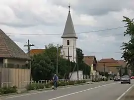 Reformed church | |
 Coat of arms | |
 Location in Mureș County | |
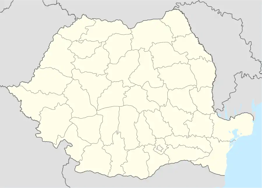 Ungheni Location in Romania | |
| Coordinates: 46°29′9″N 24°27′39″E | |
| Country | |
| County | Mureș |
| Government | |
| • Mayor | Victor Prodan[1] (PNL) |
| Area | 63.69 km2 (24.59 sq mi) |
| Population (2011)[2] | 6,945 |
| • Density | 110/km2 (280/sq mi) |
| Time zone | EET/EEST (UTC+2/+3) |
| Postal code | 547605 |
| Vehicle reg. | MS |
| Website | www |
Six villages are administered by the town:
- Cerghid (Nagycserged)
- Cerghizel (Kiscserged)
- Morești (Malomfalva)
- Recea (Recsa)
- Șăușa (Sóspatak)
- Vidrasău (Vidrátszeg)
Location
Ungheni is situated 10.6 kilometres (6.6 mi) from the county capital Târgu Mureș, 42.2 kilometres (26.2 mi) from Reghin, and 99.6 kilometres (61.9 mi) from Cluj-Napoca. The Târgu Mureș International Airport is located in Vidrasău, 14 kilometres (8.7 mi) southwest of the county capital.
The town is bordered by the following communes: to the north by Band and Pănet, to the south by Suplac and Mica, to the east by Cristești, and to the west by Sânpaul.
Demographics
| Year | Pop. | ±% |
|---|---|---|
| 2002 | 6,554 | — |
| 2011 | 6,945 | +6.0% |
| Source: Census data | ||
The town has a population of 6,945. The ethnic breakdown is as follows:
- Romanians: 5,053 (76.3%)
- Roma: 984 (14.85%)
- Hungarians: 576 (8.69%)
- Others: 4 (0.06%)
References
- "Results of the 2016 local elections". Central Electoral Bureau. Retrieved 5 April 2020.
- "Populaţia stabilă pe judeţe, municipii, oraşe şi localităti componenete la RPL_2011" (in Romanian). National Institute of Statistics. Retrieved 4 February 2014.

Wooden church in Cerghizel
Târgu Mureș Transilvania Airport in Vidrasău
| Wikimedia Commons has media related to Ungheni, Romania. |

This article is issued from Wikipedia. The text is licensed under Creative Commons - Attribution - Sharealike. Additional terms may apply for the media files.