Upala
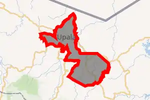
Upala is a district of the Upala canton, in the Alajuela province of Costa Rica.[1][2]
Upala | |
|---|---|

Upala district | |
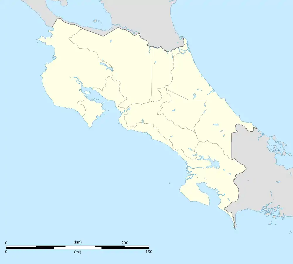
 Upala Upala district location in Costa Rica | |
| Coordinates: 10.8645353°N 84.9942032°W | |
| Country | |
| Province | Alajuela |
| Canton | Upala |
| Area | |
| • Total | 148.65 km2 (57.39 sq mi) |
| Elevation | 48 m (157 ft) |
| Population (2011) | |
| • Total | 16,139 |
| • Density | 110/km2 (280/sq mi) |
| Time zone | UTC−06:00 |
| Postal code | 21301 |
History
Upala was granted the title of "ciudad" (city) by a law of May 4, 1970.
Geography
Upala has an area of 148.65 km²[3] and an elevation of 48 metres.[1]
It is in the northwest corner of the San Carlos Plain (Llanura de San Carlos) in northern Costa Rica, 76 kilometers (47 mi) southeast of La Cruz, 124 kilometers (77 mi) northwest of Ciudad Quesada, 195 kilometers (121 mi) from the provincial capital city of Alajuela, and 214 kilometers (133 mi) from the national capital city of San José.
Demographics
| Historical population | |||
|---|---|---|---|
| Census | Pop. | %± | |
| 1963 | 10,001 | — | |
| 1973 | 5,492 | −45.1% | |
| 1984 | 7,008 | 27.6% | |
| 2000 | 12,372 | 76.5% | |
| 2011 | 16,139 | 30.4% | |
|
Instituto Nacional de Estadística y Censos[4] |
|||
For the 2011 census, Upala had a population of 16,139 inhabitants. [6]
Transportation
Road transportation
The district is covered by the following road routes:
Economy
Upala is a supply center for cattle ranchers and rice growers in the area. A hospital, bank, medical clinic, pharmacy and gas station are here. There is a busy commercial marketplace in the town center where vendors sell fruits, vegetables and a wide array of other home-grown products. Several small restaurants share the market area, and there are other restaurants and a few places to stay in the town.
Nearby places of interest
Caño Negro Wildlife Refuge: a watery lowland of lush sloughs and marshes, a seasonal lake, and abundant wildlife. The area is a birdwatcher's paradise. (37 kilometers (23 mi) east of Upala via Highway 4 to Colonia Puntarenas and Highway 138 to Caño Negro)
Climate
This area typically has a pronounced dry season. According to the Köppen Climate Classification system, Upala has a tropical savanna climate, abbreviated "Aw" on climate maps.[7]
| Climate data for Upala | |||||||||||||
|---|---|---|---|---|---|---|---|---|---|---|---|---|---|
| Month | Jan | Feb | Mar | Apr | May | Jun | Jul | Aug | Sep | Oct | Nov | Dec | Year |
| Average high °C (°F) | 30.6 (87.1) |
31.3 (88.3) |
33.1 (91.6) |
34.0 (93.2) |
34.0 (93.2) |
32.8 (91.0) |
31.8 (89.2) |
32.4 (90.3) |
32.5 (90.5) |
32.1 (89.8) |
31.1 (88.0) |
30.6 (87.1) |
32.2 (90.0) |
| Daily mean °C (°F) | 24.4 (75.9) |
24.6 (76.3) |
25.7 (78.3) |
26.4 (79.5) |
26.9 (80.4) |
26.8 (80.2) |
26.3 (79.3) |
26.5 (79.7) |
26.5 (79.7) |
26.2 (79.2) |
25.4 (77.7) |
24.7 (76.5) |
25.9 (78.6) |
| Average low °C (°F) | 18.2 (64.8) |
17.9 (64.2) |
18.2 (64.8) |
18.7 (65.7) |
19.8 (67.6) |
20.8 (69.4) |
20.7 (69.3) |
20.7 (69.3) |
20.5 (68.9) |
20.4 (68.7) |
19.7 (67.5) |
18.9 (66.0) |
19.5 (67.1) |
| Average precipitation mm (inches) | 111.1 (4.37) |
68.0 (2.68) |
38.2 (1.50) |
53.4 (2.10) |
185.1 (7.29) |
325.3 (12.81) |
322.0 (12.68) |
317.9 (12.52) |
281.0 (11.06) |
283.9 (11.18) |
227.9 (8.97) |
185.2 (7.29) |
2,399 (94.45) |
| Average precipitation days (≥ 1.0 mm) | 16 | 10 | 7 | 7 | 15 | 22 | 24 | 23 | 21 | 21 | 19 | 19 | 204 |
| Average relative humidity (%) | 86.8 | 82.6 | 78.0 | 76.2 | 82.0 | 87.9 | 88.8 | 88.7 | 87.2 | 87.5 | 88.2 | 88.1 | 85.2 |
| Mean monthly sunshine hours | 155.0 | 163.9 | 207.7 | 186.0 | 158.1 | 117.0 | 89.9 | 108.5 | 117.0 | 130.2 | 123.0 | 127.1 | 1,683.4 |
| Mean daily sunshine hours | 5.0 | 5.8 | 6.7 | 6.2 | 5.1 | 3.9 | 2.9 | 3.5 | 3.9 | 4.2 | 4.1 | 4.1 | 4.6 |
| Source: Instituto Meteorologico Nacional (precipitation 1963–2012, temperatures 1990–2013, sun 1984–1995, humidity 1989–2013)[8] | |||||||||||||
References
- "Declara oficial para efectos administrativos, la aprobación de la División Territorial Administrativa de la República N°41548-MGP". Sistema Costarricense de Información Jurídica (in Spanish). 19 March 2019. Retrieved 26 September 2020.
- División Territorial Administrativa de la República de Costa Rica (PDF) (in Spanish). Editorial Digital de la Imprenta Nacional. 8 March 2017. ISBN 978-9977-58-477-5.
- "Área en kilómetros cuadrados, según provincia, cantón y distrito administrativo". Instituto Nacional de Estadística y Censos (in Spanish). Retrieved 26 September 2020.
- "Instituto Nacional de Estadística y Censos" (in Spanish).
- "Sistema de Consulta de a Bases de Datos Estadísticas". Centro Centroamericano de Población (in Spanish).
- "Censo. 2011. Población total por zona y sexo, según provincia, cantón y distrito". Instituto Nacional de Estadística y Censos (in Spanish). Retrieved 26 September 2020.
- Climate Summary for Upala
- "Descripción del clima: Cantón de Upala" (in Spanish). Instituto Meteorologico Nacional. Archived from the original on 31 October 2016. Retrieved 30 October 2016.