Uricani
Uricani (Romanian pronunciation: [uriˈkanʲ]; Hungarian: Hobicaurikány) is a town in the Jiu Valley region of Hunedoara County, in southern Transylvania, Romania. As of 2011 it had a population of 8,618.
Uricani | |
|---|---|
.JPEG.webp) | |
 Coat of arms | |
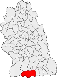 Location in Hunedoara County | |
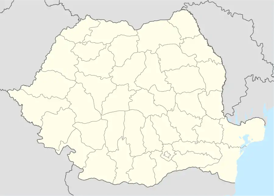 Uricani Location in Romania | |
| Coordinates: 45°20′11″N 23°9′9″E | |
| Country | |
| County | Hunedoara |
| Government | |
| • Mayor | Dănuț Buhăescu[1] (PSD) |
| Area | 251.41 km2 (97.07 sq mi) |
| Population (2011)[2] | 8,972 |
| • Density | 36/km2 (92/sq mi) |
| Time zone | EET/EEST (UTC+2/+3) |
| Vehicle reg. | HD |
| Website | http://www.uricani.ro/ |
History
| Year | Pop. | ±% |
|---|---|---|
| 1966 | 6,193 | — |
| 1977 | 7,353 | +18.7% |
| 1992 | 12,835 | +74.6% |
| 2002 | 12,177 | −5.1% |
| 2011 | 8,618 | −29.2% |
| Source: Census data | ||
Uricani is first mentioned in a certified document dated 1888, when the locality was referred to as Hobicza-Urikány (in Romanian both Hobiceni-Uricani and Uricani-Hobiceni versions were used). The name of Uricani is derived from the union of two villages, Hobița (Hobica, listed in documents from 1473 first as Ohabycza) and Uric (Urik, from 1473 first as Wryk) from Hațeg Land. After 1920 the locality's name was changed to Uricani. Over time, the village of Câmpu lui Neag functioned as either a separate commune or as a village belonging to Uricani. In 1965, Uricani was declared a city. It administers two villages, Câmpu lui Neag (Kimpulunyág) and Valea de Brazi.
Like the other Jiu Valley cities, Uricani's principal economic activities revolve around the region's coal mines, although the city, like the region, is in a period of transition as the mines have been gradually closed and many of the workers made redundant.
Location
The city location lies on the western side of Jiu Valley and at the foot of the Retezat Mountains, with the geographical coordinates of 23o10’ meridian, east longitude and 45o25’ parallel, north latitude. The city is located in Hunedoara County and adjacent to Mehedinti and Gorj counties. It lies at an altitude of 729 m altitude on the west side of the Petrosani Depression and along the West Jiu River. Its area also contains the smaller waterways of Lazarul, Valea de Pesti, Buta, and Bilugu, as well as the fresh water reservoir which contains the drinking water used throughout Jiu Valley.
Uricani is accessed via the DN 66A, the 27 kilometer long west branch of the DN 66 that connects the cities of Petrosani, Vulcan, Lupeni and Uricani.
The city covers 25,141 hectares, the largest geographical area of all the Jiu Valley cities. The city limits are bordered to the east by Cow’s Valley, to the west by Retezat National Park, to the north by peaks of the Retezat Mountains (Custura, Lazarul -2282m, and Tulisa-1782m),[3] and to the south by peaks of the Vâlcan Mountains (Coarnele-1789m and Siglaul Mare-1682m). The surrounding mountains are part of the Meridional Carpathians (in an area commonly referred to as the Transylvanian Alps).
See also
References
- "Results of the 2016 local elections". Central Electoral Bureau. Retrieved 3 April 2020.
- "Populaţia stabilă pe judeţe, municipii, oraşe şi localităti componenete la RPL_2011" (in Romanian). National Institute of Statistics. Retrieved 4 February 2014.
- Nature reserves in Romania - Page 18 Emil Pop, N. "ending with Mount Tulisa (1,795 m.) at the eastern end of the massif, overlooking the Romanian Jiu Valley and the Petrosani Basin."
External links
| Wikimedia Commons has media related to Uricani. |
- Jiu Valley Portal - the regional portal host of the official Jiu Valley websites