Ururi
Ururi (Arbërisht: Rùri) is an Arbëreshë comune in the Province of Campobasso, in the Italian region Molise, located about 40 kilometres (25 mi) northeast of Campobasso.
Ururi | |
|---|---|
| Comune di Ururi | |
 Panorama of Ururi | |
 Coat of arms | |
Location of Ururi 
| |
 Ururi Location of Ururi in Italy 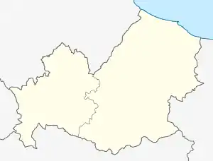 Ururi Ururi (Molise) | |
| Coordinates: 41°49′N 15°1′E | |
| Country | Italy |
| Region | Molise |
| Province | Campobasso (CB) |
| Government | |
| • Mayor | Raffaele Primiani |
| Area | |
| • Total | 31.5 km2 (12.2 sq mi) |
| Elevation | 262 m (860 ft) |
| Population | |
| • Total | 2,779 |
| • Density | 88/km2 (230/sq mi) |
| Demonym(s) | Ururesi |
| Time zone | UTC+1 (CET) |
| • Summer (DST) | UTC+2 (CEST) |
| Postal code | 86049 |
| Dialing code | 0874 |
| Website | Official website |
Ururi borders the following municipalities: Larino, Montorio nei Frentani, Rotello, San Martino in Pensilis.
Transportation
Ururi is served by a railway station, the Ururi-Rotello railway station, on the Termoli-Campobasso and Termoli–Venafro line.
The station, however, has been closed for a few years and does not have passenger service.
| Wikimedia Commons has media related to Ururi. |
References
- "Superficie di Comuni Province e Regioni italiane al 9 ottobre 2011". Istat. Retrieved 16 March 2019.
- All demographics and other statistics: Italian statistical institute Istat.
- "Popolazione Residente al 1° Gennaio 2018". Istat. Retrieved 16 March 2019.
| Authority control |
|
|---|
This article is issued from Wikipedia. The text is licensed under Creative Commons - Attribution - Sharealike. Additional terms may apply for the media files.
