Uunarteq
Uunarteq, formerly Kap Tobin, is an abandoned settlement in the Sermersooq municipality in eastern Greenland, located 7 km (4.3 mi) south of Ittoqqortoormiit.
Uunarteq | |
|---|---|
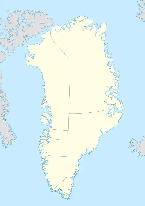 Uunarteq Location within Greenland | |
| Coordinates: 70°25′08″N 21°58′20″W | |
| State | |
| Constituent country | |
| Municipality | |
| Founded | 1926 |
| Abandoned | 1980s |
| Time zone | UTC-01 |
History
The settlement was founded by fishermen and their families in 1926. In 1947 a telegraph and weather station were erected; the station itself employed roughly 20 people. At its largest extent, the settlement was home for approximately 120 people, with its own grade school. The village housed a seismic station until 1960, when it was closed down.[1] Uunarteq was abandoned as a settlement in the mid-1980s, when the local weather station was closed. Today the remaining buildings serve as cottages for the inhabitants of nearby Ittoqqortoormiit. The last family left the settlement in 2004.
Climate
The place of the outlying village has a tundra climate (Köppen: ET), like most coastal places in Greenland, where temperatures above zero can remain on average in the summer months, although much of the year is like a long winter.[2]
| Climate data for Uunarteq (north), elevation: 41 m, 1961-1990 normals[lower-alpha 1] | |||||||||||||
|---|---|---|---|---|---|---|---|---|---|---|---|---|---|
| Month | Jan | Feb | Mar | Apr | May | Jun | Jul | Aug | Sep | Oct | Nov | Dec | Year |
| Average high °C (°F) | −12.0 (10.4) |
−12.7 (9.1) |
−12.2 (10.0) |
−7.1 (19.2) |
−0.4 (31.3) |
3.7 (38.7) |
6.5 (43.7) |
6.5 (43.7) |
2.0 (35.6) |
−3.9 (25.0) |
−9.2 (15.4) |
−11.0 (12.2) |
−4.1 (24.5) |
| Daily mean °C (°F) | −16.1 (3.0) |
−17.1 (1.2) |
−16.5 (2.3) |
−11.3 (11.7) |
−3.6 (25.5) |
1.1 (34.0) |
3.3 (37.9) |
3.5 (38.3) |
−0.3 (31.5) |
−6.3 (20.7) |
−12.2 (10.0) |
−14.6 (5.7) |
−7.5 (18.5) |
| Average low °C (°F) | −20.5 (−4.9) |
−21.7 (−7.1) |
−21.0 (−5.8) |
−15.6 (3.9) |
−6.7 (19.9) |
−1.1 (30.0) |
0.8 (33.4) |
1.0 (33.8) |
−2.4 (27.7) |
−8.6 (16.5) |
−15.3 (4.5) |
−18.5 (−1.3) |
−10.8 (12.5) |
| Average precipitation mm (inches) | 52.0 (2.05) |
39.0 (1.54) |
47.0 (1.85) |
27.0 (1.06) |
27.0 (1.06) |
27.0 (1.06) |
30.0 (1.18) |
48.0 (1.89) |
41.0 (1.61) |
67.0 (2.64) |
42.0 (1.65) |
48.0 (1.89) |
495 (19.48) |
| Average precipitation days (≥ 1.0 mm) | 9.0 | 7.0 | 9.0 | 6.0 | 6.0 | 5.0 | 4.0 | 6.0 | 6.0 | 8.0 | 7.0 | 8.0 | 81 |
| Average relative humidity (%) | 74.0 | 74.0 | 73.0 | 73.0 | 77.0 | 80.0 | 78.0 | 77.0 | 75.0 | 75.0 | 74.0 | 74.0 | 75.3 |
| Source: NOAA[3] | |||||||||||||
Places of interest
In the area ruins of an early Inuit village can be found. The ruins are located at the nearby hot springs, the average temperature of which is 140 °F (60.0 °C).
Notes
- Except for precipitation days and fall (snow and rain) that have the measurement period of 1961-1980 (20 years).
References
- denstoredanske.dk
- "Kap Tobin, Greenland Köppen Climate Classification (Weatherbase)". Weatherbase. Retrieved 2019-01-28.
- "Uunarteq (04340) - WMO Weather Station". NOAA. Retrieved January 28, 2019.
Abandoned sites in Greenland | ||||||||||||||
|---|---|---|---|---|---|---|---|---|---|---|---|---|---|---|
|
|  | ||||||||||||
|
| |||||||||||||
| ||||||||||||||
| ||||||||||||||
| Polar exploration | ||||||||||||||
| Paleo-Eskimo | ||||||||||||||