Van Buren Township, Brown County, Indiana
Van Buren Township is one of four townships in Brown County, Indiana. As of the 2010 census, its population was 2,008 and it contained 941 housing units.[3] The township includes the southern portion of Brown County State Park.
Van Buren Township | |
|---|---|
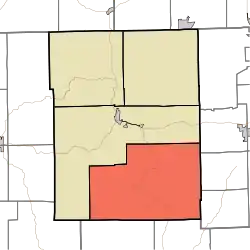 Location of Van Buren Township in Brown County | |
| Coordinates: 39°05′40″N 86°10′27″W | |
| Country | United States |
| State | Indiana |
| County | Brown |
| Government | |
| • Type | Indiana township |
| Area | |
| • Total | 87.33 sq mi (226.2 km2) |
| • Land | 87.2 sq mi (226 km2) |
| • Water | 0.13 sq mi (0.3 km2) |
| Elevation | 692 ft (211 m) |
| Population (2010) | |
| • Total | 2,008 |
| • Density | 23/sq mi (9/km2) |
| FIPS code | 18-78398[2] |
| GNIS feature ID | 453942 |
History
Van Buren Township was established in 1836. It is named for Martin Van Buren, eighth President of the United States.[4]
In 1892, a church later known as Grandview Apostolic Church was built along Grandview Ridge Road,[5] on the eastern edge of Van Buren Township.[6] It was added to the National Register of Historic Places in 1991,[5] but after it was arsoned on July 14, 2010,[7] it was removed from the Register.[8]
The Thomas A. Hendricks House and Stone Head Road Marker at Stone Head was listed on the National Register of Historic Places in 1984.[9]
Geography
According to the 2010 census, the township has a total area of 87.33 square miles (226.2 km2), of which 87.2 square miles (226 km2) (or 99.85%) is land and 0.13 square miles (0.34 km2) (or 0.15%) is water.[3] Black Oak Pond, Meyer Pond and Treaty Line Pond are in this township.
Unincorporated towns
- Becks Grove
- Christiansburg
- Elkinsville
- Lake on the Green
- Pikes Peak
- Spurgeons Corner
- Stone Head
- Story
(This list is based on USGS data and may include former settlements.)
Adjacent townships
- Washington (northwest)
- Harrison Township, Bartholomew County (northeast)
- Jackson Township, Bartholomew County (east)
- Ohio Township, Bartholomew County (east)
- Pershing Township, Jackson County (southeast)
- Salt Creek Township, Jackson County (southwest)
Major highways
Cemeteries
The township contains eleven cemeteries: Beck' Grove, Bellsville, Cain, Christiansburg, Elkinsville, McKinney, Moffitt, Mt. Zion, Phillips, Reeves and Spiker.
References
- "US Board on Geographic Names". United States Geological Survey. 2007-10-25. Retrieved 2008-01-31.
- "U.S. Census website". United States Census Bureau. Retrieved 2008-01-31.
- "Population, Housing Units, Area, and Density: 2010 - County -- County Subdivision and Place -- 2010 Census Summary File 1". United States Census. Archived from the original on 2020-02-12. Retrieved 2013-05-10.
- Blanchard, Charles (1884). Counties of Morgan, Monroe and Brown, Indiana: Historical and Biographical. F.A. Battey & Company. pp. 747.
- "National Register Information System". National Register of Historic Places. National Park Service. March 13, 2009.
- DeLorme. Indiana Atlas & Gazetteer. 3rd ed. Yarmouth: DeLorme, 2004, 51. ISBN 0-89933-319-2.
- Arson suspected in Grandview Church fire UPDATED Archived 2011-07-08 at the Wayback Machine, Brown County Democrat, 2010-07-14. Retrieved 2010-10-09.
- Weekly List of Actions Taken on Properties: 9/27/10 Through 10/01/10, National Park Service, 2010-10-08. Retrieved 2010-10-09.
- "National Register Information System". National Register of Historic Places. National Park Service. July 9, 2010.
External links
Municipalities and communities of Brown County, Indiana, United States | ||
|---|---|---|
| Town | Map of Indiana highlighting Brown County | |
| Townships | ||
| CDP | ||
| Other unincorporated communities |
| |
| Footnotes | ‡This populated place also has portions in an adjacent county or counties | |
| ||
| Authority control |
|
|---|