Victor, Montana
Victor is a census-designated place (CDP) in Ravalli County, Montana, United States. The population was 745 at the 2010 census.[1]
Victor, Montana | |
|---|---|
 Location of Victor, Montana | |
| Coordinates: 46°25′2″N 114°8′58″W | |
| Country | United States |
| State | Montana |
| County | Ravalli |
| Area | |
| • Total | 0.5 sq mi (1.2 km2) |
| • Land | 0.5 sq mi (1.2 km2) |
| • Water | 0.0 sq mi (0.0 km2) |
| Elevation | 3,415 ft (1,041 m) |
| Population (2010) | |
| • Total | 745 |
| • Density | 1,668/sq mi (643.9/km2) |
| Time zone | UTC-7 (Mountain (MST)) |
| • Summer (DST) | UTC-6 (MDT) |
| ZIP code | 59875 |
| Area code(s) | 406 |
| FIPS code | 30-76900 |
| GNIS feature ID | 0792701 |
History
Victor is named for Chief Victor of the Bitterroot Salish, whose proper name was Xweɫxƛ̣ ̓cín (Many Horses).[2] Chief Victor met Lewis and Clark when he was 15 years old in September 1805 at Ross' Hole and later he would refuse to cede the Bitterroot Valley to the United States' Washington Territory. After Chief Victor's death in 1870, the Salish were forced to move to the Flathead Reservation.
Geography
Victor is located at 46°25′2″N 114°8′58″W (46.417213, -114.149547).[3]
According to the United States Census Bureau, the CDP has a total area of 0.46 square miles (1.2 km2), all land.[1]
Demographics
As of the census[4] of 2000, there were 859 people, 351 households, and 230 families residing in the CDP. The population density was 537.6 people per square mile (207.3/km2). There were 375 housing units at an average density of 234.7 per square mile (90.5/km2). The racial makeup of the CDP was 96.16% White, 0.12% African American, 1.51% Native American, 0.12% Pacific Islander, 0.70% from other races, and 1.40% from two or more races. Hispanic or Latino of any race were 2.56% of the population.
There were 351 households, out of which 34.5% had children under the age of 18 living with them, 50.1% were married couples living together, 10.0% had a female householder with no husband present, and 34.2% were non-families. 27.1% of all households were made up of individuals, and 9.1% had someone living alone who was 65 years of age or older. The average household size was 2.45 and the average family size was 2.97.
In the CDP, the population was spread out, with 29.2% under the age of 18, 7.2% from 18 to 24, 27.5% from 25 to 44, 21.0% from 45 to 64, and 15.1% who were 65 years of age or older. The median age was 35 years. For every 100 females, there were 90.9 males. For every 100 females age 18 and over, there were 90.6 males.
The median income for a household in the CDP was $38,618, and the median income for a family was $42,986. Males had a median income of $29,917 versus $17,250 for females. The per capita income for the CDP was $17,599. About 6.6% of families and 7.7% of the population were below the poverty line, including 14.0% of those under age 18 and none of those age 65 or over.
Notable people
- Hoyt Axton, singer, songwriter, actor
- Marty Essen, ten-time award-winning author, photographer, professional speaker
- Tom Hewitt, actor
- David Baty, singer, songwriter
- Jared Gramza, humanitarian, community leader, regional harmonicist
References
- "Geographic Identifiers: 2010 Demographic Profile Data (DP-1): Victor CDP, Montana". U.S. Census Bureau, American Factfinder. Archived from the original on February 12, 2020. Retrieved March 22, 2013.
- "Montana Place Names". Retrieved December 5, 2020.
- "US Gazetteer files: 2010, 2000, and 1990". United States Census Bureau. 2011-02-12. Retrieved 2011-04-23.
- "U.S. Census website". United States Census Bureau. Retrieved 2008-01-31.
Municipalities and communities of Ravalli County, Montana, United States | ||
|---|---|---|
| City | 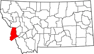 Ravalli County map | |
| Towns | ||
| CDPs | ||
| Other communities | ||
| ||
| Authority control |
|---|