Stevensville, Montana
Stevensville (Salish: ɫq̓éɫmlš[4]) is a town in Ravalli County, Montana, United States. The population was 1,809 at the 2010 census.
Stevensville, Montana | |
|---|---|
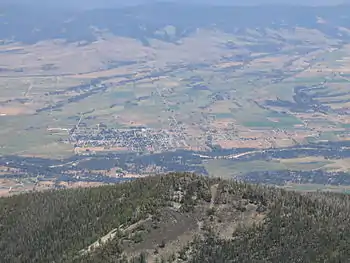 Stevensville and the Bitterroot River seen from Saint Mary's Peak (2005) | |
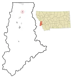 Location of Stevensville, Montana | |
| Coordinates: 46°30′28″N 114°5′36″W | |
| Country | United States |
| State | Montana |
| County | Ravalli |
| Government | |
| • Type | Mayor-Council |
| • Mayor | Brandon E. Dewey |
| • Body | Stevensville Town Council |
| Area | |
| • Total | 1.31 sq mi (3.40 km2) |
| • Land | 1.29 sq mi (3.35 km2) |
| • Water | 0.02 sq mi (0.05 km2) |
| Elevation | 3,323 ft (1,013 m) |
| Population | |
| • Total | 1,809 |
| • Estimate (2019)[3] | 2,072 |
| • Density | 1,600.00/sq mi (617.77/km2) |
| Time zone | UTC-7 (Mountain (MST)) |
| • Summer (DST) | UTC-6 (MDT) |
| ZIP code | 59870 |
| Area code(s) | 406 |
| FIPS code | 30-71200 |
| GNIS feature ID | 0791505 |
| Website | www |
Stevensville is officially recognized as the first permanent settlement of non-indigenous peoples in the state of Montana. Forty-eight years before Montana became the nation's 41st state, Stevensville was settled by Jesuit Missionaries at the request of the Bitterroot Salish tribe.
History
Through interactions with Iroquois working in the fur trade between 1812 and 1820, the Bitter Root Salish learned about Christianity and Jesuit missionaries (the Blackrobes as they were called) who worked with Native Americans teaching about agriculture, medicine, and religion. Interest in these "blackrobes" grew among the Salish and, in 1831, four young Salish men were dispatched to St. Louis, Missouri to request a priest to return with them to their homeland of present-day Stevensville. The four Salish men were directed to the home and office of William Clark (of Lewis and Clark fame) to make their request. At that time Clark was in charge of administering the territory they called home. Through the perils of their trip, two of the Salish died at the home of General Clark. The remaining two Salish men secured a visit with St. Louis Bishop Joseph Rosati, who assured them that missionaries would be sent to the Bitterroot Valley when funds and missionaries were available in the future.
Again in 1835 and 1837 the Bitterroot Salish dispatched men to St. Louis to request missionaries, but to no avail. Finally in 1839 a group of Iroquois and Salish met Father Pierre-Jean DeSmet in Council Bluffs. The meeting resulted in Fr. DeSmet promising to fulfill their request for a missionary the following year.
DeSmet arrived in present-day Stevensville on September 24, 1841, and called the settlement St. Mary's.[5] Construction of a chapel immediately began, followed by other permanent structures including log cabins and Montana's first pharmacy. Father Ravalli, Jesuit priest and physician, was the builder.
In 1850 Major John Owen arrived in the valley and set up camp north of St. Mary's.[6] In time, Major Owen established a trading post and military strong point named Fort Owen, which served the settlers, the indigenous peoples, and missionaries in the valley.
Both St. Mary's Mission and Fort Owen still have permanent structures that stand today in present-day Stevensville, denoting its historical past starting in 1841.[7]
The name of the settlement was changed from St. Mary's to Stevensville in 1864 to honor territorial governor Isaac Stevens. In the words of Luther E. Stanley, "When Isaac Ingle Stevens was ordered to Fort Owen in 1853, he came to what he supposed would be a military fort but much to his surprise, it was a trading post. General Stevens, for the past year, had been in charge of military operations and Indian affairs in the Northwest Territory... he moved his government and military material to Fort Owen. This fort became the territorial capital in 1853 and served that until 1858, when Stevens was called back to active duty with the Union Army. He was killed in action in 1862 at Chantilly, Virginia... Stevens laid out a new town near the ruins of St. Mary's Mission and Fort Owen... It was named Stevensville in his honor and authorized by President Lincoln on May 12, 1864."[8]
Geography
Stevensville is located at 46°30′28″N 114°5′36″W (46.507836, −114.093214), 25 miles south of Missoula.[9]
According to the United States Census Bureau, the town has a total area of 1.00 square mile (2.59 km2), of which 0.98 square miles (2.54 km2) is land and 0.02 square miles (0.05 km2) is water.[10]
"Flanked by the Bitterroot and Sapphire mountains, the small, historic town in the Bitterroot Valley offers beautiful views, outdoor recreation, and watchable wildlife."[11] The Bitterroot Mountain Range, just west of Stevensville, is the longest single mountain range in the Rocky Mountains.
Climate
This climatic region is typified by large seasonal temperature differences, with warm to hot (rarely humid) summers and cold (sometimes severely cold) winters. According to the Köppen Climate Classification system, Stevensville has a humid continental climate, abbreviated "Dfb" on climate maps.[12]
Demographics
| Historical population | |||
|---|---|---|---|
| Census | Pop. | %± | |
| 1880 | 47 | — | |
| 1900 | 346 | — | |
| 1910 | 796 | 130.1% | |
| 1920 | 744 | −6.5% | |
| 1930 | 692 | −7.0% | |
| 1940 | 703 | 1.6% | |
| 1950 | 772 | 9.8% | |
| 1960 | 784 | 1.6% | |
| 1970 | 829 | 5.7% | |
| 1980 | 1,207 | 45.6% | |
| 1990 | 1,221 | 1.2% | |
| 2000 | 1,553 | 27.2% | |
| 2010 | 1,809 | 16.5% | |
| 2019 (est.) | 2,072 | [3] | 14.5% |
| U.S. Decennial Census[13][14] 2015 Estimate[15] | |||

2010 census
As of the census[2] of 2010, there were 1,809 people, 836 households, and 455 families living in the town. The population density was 1,845.9 inhabitants per square mile (712.7/km2). There were 935 housing units at an average density of 954.1 per square mile (368.4/km2). The racial makeup of the town was 96.0% White, 0.1% African American, 1.0% Native American, 0.4% Asian, 0.6% from other races, and 2.0% from two or more races. Hispanic or Latino of any race were 3.4% of the population.
There were 836 households, of which 24.9% had children under the age of 18 living with them, 40.8% were married couples living together, 8.4% had a female householder with no husband present, 5.3% had a male householder with no wife present, and 45.6% were non-families. 40.2% of all households were made up of individuals, and 19.5% had someone living alone who was 65 years of age or older. The average household size was 2.11 and the average family size was 2.87.
The median age in the town was 42.3 years. 22.2% of residents were under the age of 18; 7.3% were between the ages of 18 and 24; 23.8% were from 25 to 44; 25.1% were from 45 to 64; and 21.7% were 65 years of age or older. The gender makeup of the town was 46.9% male and 53.1% female.
2000 census
As of the census[16] of 2000, there were 1,553 people, 652 households, and 385 families living in the town. The population density was 3,008.3 people per square mile (1,153.1/km2). There were 711 housing units at an average density of 1,377.3 per square mile (527.9/km2). The racial makeup of the town was 96.52% White, 0.26% African American, 1.03% Native American, 0.26% Asian, 0.32% from other races, and 1.61% from two or more races. Hispanic or Latino of any race were 2.00% of the population.
There were 652 households, out of which 29.4% had children under the age of 18 living with them, 46.0% were married couples living together, 10.7% had a female householder with no husband present, and 40.8% were non-families. 35.6% of all households were made up of individuals, and 16.0% had someone living alone who was 65 years of age or older. The average household size was 2.27 and the average family size was 2.93.
In the town, the population was spread out, with 25.3% under the age of 18, 9.0% from 18 to 24, 24.9% from 25 to 44, 20.1% from 45 to 64, and 20.8% who were 65 years of age or older. The median age was 39 years. For every 100 females there were 89.9 males. For every 100 females age 18 and over, there were 85.0 males.
The median income for a household in the town was $27,951, and the median income for a family was $34,583. Males had a median income of $29,327 versus $20,729 for females. The per capita income for the town was $14,700. About 10.4% of families and 12.8% of the population were below the poverty line, including 13.3% of those under age 18 and 9.7% of those age 65 or over.
Notable people
- Janine Benyus, author
- Tyler Bradt, whitewater kayaker, ran Palouse Falls in 2009
- Fr. Edward Catich, author, stone-cutter, calligrapher, photographer, musician, liturgical artist, historian, lecturer, and born in the town
- Huey Lewis, lead singer of Huey Lewis and the News
- Washington J. McCormick, United States Representative from Montana, retired to Stevensville
- George McGovern, United States senator and presidential candidate, owned a book store and a summer home in the area
- Lee Metcalf, United States congressman (1953-1961) and senator (1961-1978) from Montana
- Kathleen Meyer, author
- Anthony Ravalli, Jesuit pioneer and founder of western U.S. settlements
References
- "2019 U.S. Gazetteer Files". United States Census Bureau. Retrieved July 26, 2020.
- "U.S. Census website". United States Census Bureau. Retrieved 2012-12-18.
- "Population and Housing Unit Estimates". United States Census Bureau. May 24, 2020. Retrieved May 27, 2020.
- Tachini, Pete; Louie Adams, Sophie Mays, Mary Lucy Parker, Johnny Arlee, Frances Vanderburg, Lucy Vanderburg, Diana Christopher-Cote (1998). nyoʻnuntn q̓éymin, Flathead Nation Salish dictionary. Pablo, Montana: Bilingual Education Department, Salish Kootenai College. p. 137.CS1 maint: multiple names: authors list (link)
- "Historic St. Mary's Mission - Where Montana Began - National Historic Site". www.SaintMarysMission.org. Retrieved February 1, 2018.
- "Major John Owen". mt.gov. Archived from the original on September 25, 2009. Retrieved February 1, 2018.
- "Fort Owen". mt.gov. Archived from the original on September 25, 2009. Retrieved February 1, 2018.
- "Stevensville". VisitMt.com. Retrieved February 1, 2018.
- "US Gazetteer files: 2010, 2000, and 1990". United States Census Bureau. February 12, 2011. Retrieved 2011-04-23.
- "US Gazetteer files 2010". United States Census Bureau. Archived from the original on January 12, 2012. Retrieved December 18, 2012.
- "Official State of Montana Department of Tourism, "Towns and Cities: Stevensville"". VisitMt.com. Retrieved February 1, 2018.
- "Stevensville, Montana Köppen Climate Classification (Weatherbase)". Weatherbase. Retrieved February 1, 2018.
- "Census of Population and Housing". Census.gov. Retrieved June 4, 2015.
- "Census & Economic Information Center". Retrieved July 3, 2015.
- "Population Estimates". United States Census Bureau. Archived from the original on October 19, 2016. Retrieved July 19, 2016.
- "U.S. Census website". United States Census Bureau. Retrieved 2008-01-31.
External links
- Stevensville Montana Information
- Official Website
- Visit Stevensville
- US Forest Service Stevensville Ranger Station Real Time Camera
Municipalities and communities of Ravalli County, Montana, United States | ||
|---|---|---|
| City | 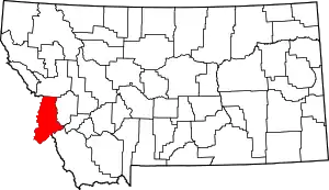 Ravalli County map | |
| Towns | ||
| CDPs | ||
| Other communities | ||
| ||