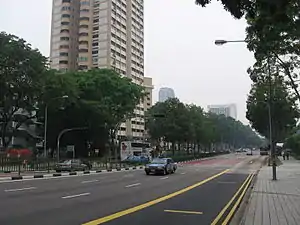
Victoria Street, Singapore
Victoria Street (Chinese: 维多利亚街) is a major two-way road in Singapore. It links Kallang Road in the northeast with Hill Street in the southwest. En route, Victoria Street passes through the planning areas of Kallang, Rochor, Downtown Core and Museum.
Etymology and history
Both Victoria Street and Victoria Bridge were named after Queen Victoria (1819-1901). Victoria Bridge over Rochor River was built in 1914 and took its name from Victoria Street.
The name of Victoria Street may have changed several times in the nineteenth century. On Lieutenant Philip Jackson's plan of the town of Singapore, drawn in 1822, the street appears as "Rochor Street". However, in an 1836 map of the town drawn from a survey by George Drumgoole Coleman, the street was marked out as "Marbro Street".
The Chinese called the street au bei chia lo, or "the back of horse carriage street", referring to the back of North Bridge Road.[1]
The Tamil name for the street was kammangala puthu kuthu madei sadakku, கம்மங்களாம் புது கூத்துமேடை சடக்கு which meant "Street of Kampong Glam and the new Hindu theatre", a reference to Kampong Glam and the Tamil cinema. The Indians also called it boyan kampam போயான் கம்பம் or pal kampam பால் கம்பம்.[1]
The Malays refer to the street as kampong boyan lama, a reference to the old Baweanese village that was located in the area towards Rochor Road.[1]
Landmarks
Victoria Street passes through the historic districts of Kampong Glam, Bugis and Bras Basah. Notable landmarks along the road include (from north to south):
- Hotel Boss
- Masjid Malabar
- Victoria Street Wholesale Centre near Ophir Road and Arab Street
- Bugis Street
- Bugis Junction
- National Library building
- Nanyang Academy of Fine Arts, Middle Road campus
- Saint Joseph's Church, a national monument
- Bras Basah Complex
- Singapore Management University, Administration building and Lee Kong Chian School of Business
- Cathedral of the Good Shepherd, a national monument
- Former CHIJ which has been turned into a popular entertainment venue called CHIJMES, now a national monument
- Bugis+, formerly known as Iluma
References
- Victor R Savage; Brenda Yeoh (15 June 2013). Singapore Street Names: A Study of Toponymics. Marshall Cavendish International Asia Pte Ltd. pp. 396–. ISBN 978-981-4484-74-9.