Włochy
Włochy (Polish pronunciation: [ˈvwɔxɨ]) is one of the districts of Warsaw, located in the south-western part of city. Włochy borders districts Bemowo and Wola from the north, Ochota and Mokotów from the east, and Ursus and Ursynów from the south.
Włochy | |
|---|---|
_COA.gif) Coat of arms | |
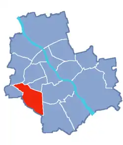 Location of Włochy within Warsaw | |
| Coordinates: 52°12′N 20°55′E | |
| Country | |
| Voivodeship | Masovian |
| County/City | Warsaw |
| Notable landmarks | Warsaw Chopin Airport |
| Government | |
| • Mayor | Jarosław Karcz |
| Area | |
| • Total | 28.63 km2 (11.05 sq mi) |
| Population (2019) | |
| • Total | 42,862[1] |
| Time zone | UTC+1 (CET) |
| • Summer (DST) | UTC+2 (CEST) |
| Area code(s) | +48 22 |
| Website | ud-wlochy.waw.pl |
History
It is not known from where the name Włochy derives. Grammatically it is plural, and literally means "Italy" in Polish (see Walhaz for etymology, its modern English cognate is Welsh). One theory is that the name comes from a foreign army, probably Italian, that could have stayed in nearby Wola (a place where the election of Polish kings took place). Another theory is that name derives from Jan Yokel, who was called "Włoch". Seemingly he was the founder of the village in the forest.
Between 1938 and 1951 Włochy had town privileges. On 2 May 1951 Włochy was annexed into Warsaw as part of the Ochota district. Since 1994 it has formed the Warszawa-Włochy municipality. In 2002 the municipality became an independent district of Warsaw.
Neighbourhoods within the district
- Nowe Włochy
- Okęcie
- Jadwisin
- Zbarż
- Opacz Wielka
- Paluch
- Gorzkiewki
- Raków
- Wiktoryn
- Salomea
- Stare Włochy
- Solipse
- Budki Szczęśliwickie
- Załuski
References
- "Powierzchnia i ludność w przekroju terytorialnym w 2019 roku. Tabl. 21 Powierzchnia, ludność oraz lokaty według gmi". stat.gov.pl. Główny Urząd Statystyczny. Retrieved 2 September 2020.
| Wikimedia Commons has media related to Włochy. |
