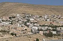
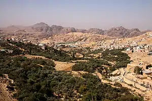
Wadi Musa
Wadi Musa (Arabic: وادي موسى, literally "Valley of Moses") is a town located in the Ma'an Governorate in southern Jordan. It is the administrative center of the Petra Department[1] and the nearest town to the archaeological site of Petra. It hosts many hotels and restaurants for tourists, and the important B'doul settlement of Umm Seyhoun, created after the community's forced displacement in 1985, is approximately 2 kilometres (1 mi) from the town.
Wadi Musa
وادي موسى | |
|---|---|
Town | |
 | |
 Wadi Musa | |
| Coordinates: 30°19′12″N 35°28′42″E | |
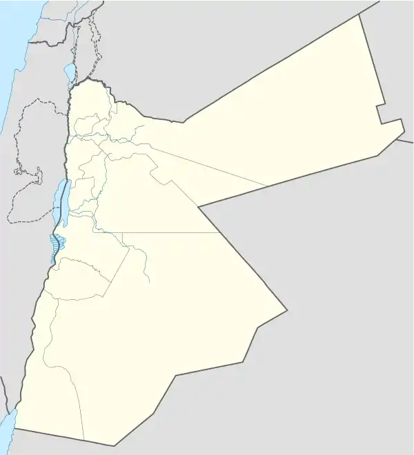
| Country | Jordan |
| Province | Ma'an Governorate |
| Area | |
| • Total | 7.36 km2 (2.84 sq mi) |
| (excludes Al Hayy, an undeveloped residential zone) | |
| Elevation | 1,050−1,450 m (−3,700 ft) |
| Population (2015)[2] | |
| • Total | 6,831 |
| • Density | 930/km2 (2,400/sq mi) |
| Time zone | GMT +2 |
| • Summer (DST) | +3 |
| Area code(s) | +(962)3 |
Etymology
Wadi Musa means "Valley of Moses" in Arabic (وادي موسى). It is said that the prophet Moses passed through the valley and struck water from the rock for his followers at the site of Ain Musa ("Moses's water spring" or "Moses's Well").[3] The Nabateans built channels that carried water from this spring to the city of Petra. Wadi Musa was also nicknamed the "Guardian of Petra". The Tomb of Aaron, supposed burial site of the Biblical Aaron, the brother of Moses, is on nearby Mount Hor.
History
During the Arab Revolt, Turkish forces under the command of Mehmed Djemal Pasha attacked Wadi Musa on 21 Oct. 1917. The Ottoman forces were defeated by forces under the command of Mawlud Mukhlis, Faisal's aide-de-camp.[4][5]
Climate
In Wadi Musa, there is a semi-arid climate. Most rain falls in the winter. The Köppen-Geiger climate classification is BSk. The average annual temperature in Wadi Musa is 15.5 °C (59.9 °F). About 193 mm (7.60 in) of precipitation falls annually.
| Climate data for Wadi Musa | |||||||||||||
|---|---|---|---|---|---|---|---|---|---|---|---|---|---|
| Month | Jan | Feb | Mar | Apr | May | Jun | Jul | Aug | Sep | Oct | Nov | Dec | Year |
| Average high °C (°F) | 11.0 (51.8) |
13.1 (55.6) |
16.6 (61.9) |
20.9 (69.6) |
25.1 (77.2) |
28.6 (83.5) |
29.8 (85.6) |
30.0 (86.0) |
28.1 (82.6) |
24.6 (76.3) |
18.2 (64.8) |
13.4 (56.1) |
21.6 (70.9) |
| Average low °C (°F) | 2.2 (36.0) |
2.8 (37.0) |
5.6 (42.1) |
8.7 (47.7) |
11.7 (53.1) |
14.1 (57.4) |
16.1 (61.0) |
16.5 (61.7) |
14.2 (57.6) |
11.2 (52.2) |
7.1 (44.8) |
3.4 (38.1) |
9.5 (49.1) |
| Average precipitation mm (inches) | 45 (1.8) |
38 (1.5) |
36 (1.4) |
12 (0.5) |
4 (0.2) |
0 (0) |
0 (0) |
0 (0) |
0 (0) |
2 (0.1) |
15 (0.6) |
41 (1.6) |
193 (7.6) |
| Source: Climate-Data.org,Climate data | |||||||||||||
Demographics
As of 2009, Wadi Musa's population was 17,085, with a male-to-female sex ratio of 52.1 to 47.9 (8,901 males and 8,184 females), making it the most populous settlement of the Petra Department.[1] As of the 2004 census, Petra Department, which includes Wadi Musa and 18 other villages, had a population of 23,840 inhabitants.[6] The population density of the town was 2.3 people per dunam, or 23 inhabitants per hectare (9.3/acre), and the population growth rate was 3.2%.[1]
Most of the town's population belongs to the Layathnah tribe, whose members play leading roles in the region's economy and politics and dominate the local tourism industry since the 20th century.[1]
Economy
The town is about 250 kilometres (160 mi) from Amman, Jordan's capital, and 100 kilometres (60 mi) north of the port city of Aqaba. With more than 50 hotels and many tourist restaurants, its economy is almost entirely tied to tourism.
The campus of the College of Archaeology, Tourism & Hotel Management of Al-Hussein Bin Talal University is located in Wadi Musa.
Gallery
 Wadi Musa Valley
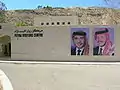 Petra Visitors Center
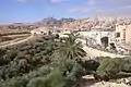 Townscape
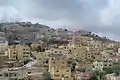 Houses in Wadi Musa
.jpg.webp) Wadi Musa at dusk
Wadi Musa at dusk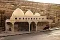 Moses source
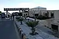 Hotel
Hotel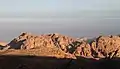 Mountains
References
- "The Strategic Master Plan for the Petra Region: Strategic Plan for WADI MUSA and surrounding areas" (PDF). Petra Development and Tourism Region Authority. June 2011. Archived (PDF) from the original on 12 June 2016. Retrieved 5 June 2016.
- "The General Census - 2015" (PDF). Department of Population Statistics.
- Visiting Moses' Well
- Faulkner, Neil (2016). Lawrence of Arabia's War: The Arabs, the British and the Remaking of the Middle East in WWI. New Haven: Yale University Press. p. 314-315. ISBN 9780300226393.
- Lawrence, T.E. (1935). Seven Pillars of Wisdom. Garden City: Doubleday, Doran & Company, Inc. p. 381.
- "Table 3.1 Distribution of Population by Category, Sex, Nationality, Administrative Statistical Divisions and Urban - Rural" (PDF). Population and Housing Census 2004. Department of Statistics. Archived from the original (PDF) on 22 July 2011. Retrieved 5 June 2016.
External links
 Media related to Wadi Musa at Wikimedia Commons
