Waimauku
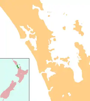
Waimauku is a small locality in the Auckland Region of New Zealand. It comes under the jurisdiction of Auckland Council, and is in the council's Rodney ward. Waimauku is approximately 4 kilometres west of Huapai on State Highway 16 at the junction with the road to Muriwai Beach. Helensville is 16 km to the north-west.[1][2] Waimauku is a Māori word which is literally translated as wai: stream and mauku: varieties of small ferns.[3]
Waimauku | |
|---|---|
 Waimauku School | |
 Waimauku | |
| Coordinates: 36°46′7″S 174°29′36″E | |
| Country | |
| Region | Auckland |
| Local board | Rodney |
| Ward | Rodney |
| Population (2018) | |
| • Total | 1,338 |
Formerly a farming and fruit-growing community, the area around Waimauku now features a number of wineries and an increasing suburban and lifestyle farming population.

The Auckland Regional Council announced in 2007 that Western Line rail services would be extended to Helensville for a one-year trial period commencing in July 2008.[4] This service would include a stop at Waimauku.[5] A new station platform was built at Waimauku and the service commenced on 14 July 2008.[6] The service ceased in 2009, and the platform is currently unused.[7]
Demographics
| Year | Pop. | ±% p.a. |
|---|---|---|
| 2006 | 1,014 | — |
| 2013 | 1,173 | +2.10% |
| 2018 | 1,338 | +2.67% |
| Source: [8] | ||
Waimauku had a population of 1,338 at the 2018 New Zealand census, an increase of 165 people (14.1%) since the 2013 census, and an increase of 324 people (32.0%) since the 2006 census. There were 426 households. There were 666 males and 669 females, giving a sex ratio of 1.0 males per female. The median age was 40.4 years, with 294 people (22.0%) aged under 15 years, 216 (16.1%) aged 15 to 29, 660 (49.3%) aged 30 to 64, and 165 (12.3%) aged 65 or older.
Ethnicities were 93.7% European/Pākehā, 11.0% Māori, 3.4% Pacific peoples, 4.5% Asian, and 1.8% other ethnicities (totals add to more than 100% since people could identify with multiple ethnicities).
The proportion of people born overseas was 22.0%, compared with 27.1% nationally.
Although some people objected to giving their religion, 61.0% had no religion, 30.5% were Christian, and 2.9% had other religions.
Of those at least 15 years old, 234 (22.4%) people had a bachelor or higher degree, and 135 (12.9%) people had no formal qualifications. The median income was $45,400. The employment status of those at least 15 was that 588 (56.3%) people were employed full-time, 174 (16.7%) were part-time, and 18 (1.7%) were unemployed.[8]
Marae
The local Reweti Marae is affiliated with the Ngāti Whātua o Kaipara and Ngāti Whātua hapū of Te Taoū.[9] It features Whiti te Rā meeting house.[10]
Governance
Waimauku is part of the Local Government Rodney Ward of Auckland Council and is part of the Kumeu Subdivision of the Rodney Local Board.
Waimauku is in the Helensville Electorate however proposed Boundary changes in late 2019 could change this.
Economy
The township is in the North West Country Inc business improvement district zone. The business association which represents businesses from Kaukapakapa to Riverhead.
Education
Waimauku School is a coeducational full primary (years 1-8) school with a roll of 728 students as at March 2020.[11][12]
The local secondary school is Kaipara College.
References
- Peter Dowling (editor) (2004). Reed New Zealand Atlas. Reed Books. map 11. ISBN 0-7900-0952-8.CS1 maint: extra text: authors list (link)
- Roger Smith, GeographX (2005). The Geographic Atlas of New Zealand. Robbie Burton. map 34. ISBN 1-877333-20-4.
- Wises New Zealand Guide, 7th Edition 1979. p.475
- Auckland Regional Council Summary Draft Plan 2008/2009
- "Commuter train services to resume to Helensville". New Zealand Herald. 27 June 2007.
- Dearnaley, Mathew (2008-07-14). "New commuter train services". New Zealand Herald. Retrieved 2008-07-14.
- "Calls for rail to ease congestion in Auckland's north-west". Stuff.co.nz. 27 September 2016. Retrieved 11 November 2018.
- "Statistical area 1 dataset for 2018 Census". Statistics New Zealand. March 2020. Waimauku (114200). 2018 Census place summary: Waimauku
- "Te Kāhui Māngai directory". tkm.govt.nz. Te Puni Kōkiri.
- "Māori Maps". maorimaps.com. Te Potiki National Trust.
- "New Zealand Schools Directory". New Zealand Ministry of Education. Retrieved 26 April 2020.
- Education Counts: Waimauku School