Waipatukahu
Waipatukahu is a locality west of Auckland, in New Zealand. It surrounds Waipatukahu Stream, which flows north-north-east from Lake Paekawau, draining the Waimauku Plateau and the Western Sand Country and joins the Kaipara River.[1][2]
Waipatukahu | |
|---|---|
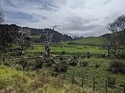 Waipatukahu Valley | |
 Waipatukahu | |
| Coordinates: 36.776°S 174.449°E | |
| Country | New Zealand |
| Region | Auckland Region |
| Ward | Rodney Ward |
| Population (2018) | |
| • Total | 1,461 |
Demographics
| Year | Pop. | ±% p.a. |
|---|---|---|
| 2006 | 1,188 | — |
| 2013 | 1,239 | +0.60% |
| 2018 | 1,461 | +3.35% |
| Source: [3] | ||
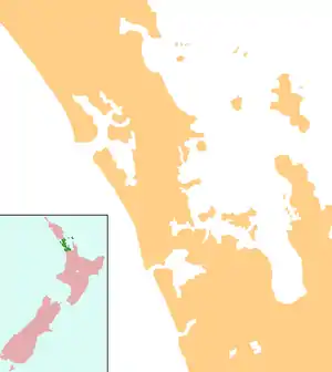
The statistical area of Waipatukahu, which is 52 square kilometres, extends west to the Tasman Sea, and slightly further east than Waimauku, but doesn't include Waimauku or Muriwai. It had a population of 1,461 at the 2018 New Zealand census, an increase of 222 people (17.9%) since the 2013 census, and an increase of 273 people (23.0%) since the 2006 census. There were 471 households. There were 732 males and 732 females, giving a sex ratio of 1.0 males per female. The median age was 40.1 years, with 327 people (22.4%) aged under 15 years, 261 (17.9%) aged 15 to 29, 723 (49.5%) aged 30 to 64, and 150 (10.3%) aged 65 or older.
Ethnicities were 90.1% European/Pākehā, 16.6% Māori, 3.5% Pacific peoples, 2.1% Asian, and 1.8% other ethnicities (totals add to more than 100% since people could identify with multiple ethnicities).
The proportion of people born overseas was 19.3%, compared with 27.1% nationally.
Although some people objected to giving their religion, 57.9% had no religion, 29.0% were Christian, and 5.1% had other religions.
Of those at least 15 years old, 231 (20.4%) people had a bachelor or higher degree, and 165 (14.6%) people had no formal qualifications. The median income was $40,500. The employment status of those at least 15 was that 612 (54.0%) people were employed full-time, 210 (18.5%) were part-time, and 36 (3.2%) were unemployed.[3]
Notes
- Topo50 map BA30 - Helensville (Map). 1:50,000. Land Information New Zealand. 2019.
- "TP146 Kaipara River Catchment Water Allocation Strategy 2001 Part B" (PDF). Auckland City Council. 2001. p. 42.
- "Statistical area 1 dataset for 2018 Census". Statistics New Zealand. March 2020. Waipatukahu (113200). 2018 Census place summary: Waipatukahu