Waitoa
Waitoa is a settlement in the Matamata-Piako District of New Zealand. State Highway 26 runs through the town, and connects to Te Aroha 10 km to the north-east.
Waitoa | |
|---|---|
| |
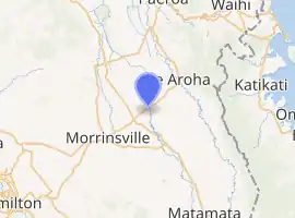
| Coordinates: 37.601°S 175.628°E | |
| Country | New Zealand |
| Region | Waikato Region |
| District | Matamata-Piako District |
| Ward | Te Aroha Ward |
| Population (2018) | |
| • Total | 195 |
A Fonterra dairy factory is a prominent blue building in the middle of the town.[1]
The Waitoa River runs through the village and is prone to flooding.
A railway line runs to the dairy factory, and used to go to Te Aroha, however this section was closed and the line only runs to service the dairy factory.
Two freezing works and a rendering plant also operate in the Waitoa area. Workers commute from nearby towns of Te Aroha, Morrinsville and Matamata.
Demographics
| Year | Pop. | ±% p.a. |
|---|---|---|
| 2006 | 1,296 | — |
| 2013 | 1,152 | −1.67% |
| 2018 | 1,170 | +0.31% |
| Source: [2] | ||
The statistical area of Waitoa-Ngarua, which at 107 square kilometres is much larger than this settlement, had a population of 1,170 at the 2018 New Zealand census, an increase of 18 people (1.6%) since the 2013 census, and a decrease of 126 people (-9.7%) since the 2006 census. There were 432 households. There were 615 males and 555 females, giving a sex ratio of 1.11 males per female. The median age was 35.9 years, with 255 people (21.8%) aged under 15 years, 231 (19.7%) aged 15 to 29, 552 (47.2%) aged 30 to 64, and 135 (11.5%) aged 65 or older.
Ethnicities were 79.2% European/Pākehā, 13.3% Māori, 3.1% Pacific peoples, 9.7% Asian, and 3.3% other ethnicities (totals add to more than 100% since people could identify with multiple ethnicities).
The proportion of people born overseas was 16.9%, compared with 27.1% nationally.
Although some people objected to giving their religion, 52.3% had no religion, 33.6% were Christian, 2.6% were Hindu, 0.3% were Muslim, 0.5% were Buddhist and 3.1% had other religions.
Of those at least 15 years old, 96 (10.5%) people had a bachelor or higher degree, and 240 (26.2%) people had no formal qualifications. The median income was $37,500. The employment status of those at least 15 was that 498 (54.4%) people were employed full-time, 135 (14.8%) were part-time, and 36 (3.9%) were unemployed.[2]
The settlement of Waitoa is covered by two meshblocks, which had a combined total of 195 people in 2018.[3]
Education
Waitoa had a primary school between 1904 and 2015. It opened as Waitoa Valley School and reached a roll of 222 students in 1959. The roll fell subsequently, and there were 18 students in the final year.[4]
References
- Kissun, Sudesh. "Fonterra cuts cheese plant". Rural News. Retrieved 31 July 2010.
- "Statistical area 1 dataset for 2018 Census". Statistics New Zealand. March 2020. Waitoa-Ngarua (174400). 2018 Census place summary: Waitoa-Ngarua
- "Meshblock Electoral Populations 2020 for proposed boundaries data". Statistics New Zealand. April 2020. Meshblocks 1096800 and 1096900.
- Ramsey, Teresa (29 October 2015). "Waitoa School to close after 111 years". Waikato Times.