Wapella Township, DeWitt County, Illinois
Wapella Township is one of thirteen townships in DeWitt County, Illinois, USA. As of the 2010 census, its population was 944 and it contained 415 housing units.[1]
Wapella Township | |
|---|---|
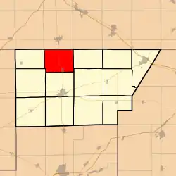 Location in DeWitt County | |
 DeWitt County's location in Illinois | |
| Coordinates: 40°15′01″N 88°58′36″W | |
| Country | |
| State | |
| County | DeWitt |
| Established | November 2, 1858 |
| Area | |
| • Total | 29.07 sq mi (75.3 km2) |
| • Land | 29.07 sq mi (75.3 km2) |
| • Water | 0 sq mi (0 km2) 0% |
| Elevation | 722 ft (220 m) |
| Population (2010) | |
| • Total | 944 |
| • Density | 32.5/sq mi (12.5/km2) |
| Time zone | UTC-6 (CST) |
| • Summer (DST) | UTC-5 (CDT) |
| ZIP codes | 61727, 61745, 61777 |
| GNIS feature ID | 0429892 |
Geography
According to the 2010 census, the township has a total area of 29.07 square miles (75.3 km2), all land.[1]
Cities, towns, villages
Unincorporated towns
(This list is based on USGS data and may include former settlements.)
Cemeteries
The township contains four cemeteries: Crum, Long Point, Saint Particks and Sugar Grove.
School districts
- Clinton Community Unit School District 15
Political districts
- Illinois's 15th congressional district
- State House District 87
- State Senate District 44
References
- "Wapella Township, DeWitt County, Illinois". Geographic Names Information System. United States Geological Survey. Retrieved 2010-07-06.
- United States Census Bureau 2009 TIGER/Line Shapefiles
- United States National Atlas
- "Population, Housing Units, Area, and Density: 2010 - County -- County Subdivision and Place -- 2010 Census Summary File 1". United States Census. Archived from the original on 2020-02-12. Retrieved 2013-05-28.
External links
Places adjacent to Wapella Township, DeWitt County, Illinois | |
|---|---|
Municipalities and communities of DeWitt County, Illinois, United States | ||
|---|---|---|
| Cities | Map of Illinois highlighting DeWitt County | |
| Villages | ||
| Townships | ||
| Unincorporated communities | ||
| Footnotes | ‡This populated place also has portions in an adjacent county or counties | |
| ||
This article is issued from Wikipedia. The text is licensed under Creative Commons - Attribution - Sharealike. Additional terms may apply for the media files.