Well, North Yorkshire
Well is a small village and civil parish in the Hambleton District of North Yorkshire, England. It is about 4 miles south of Bedale, near Snape. The population taken at the 2011 Census was 230.[1]
| Well | |
|---|---|
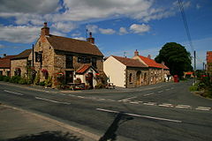 Crossroads in Well with the Milbank Arms on the left | |
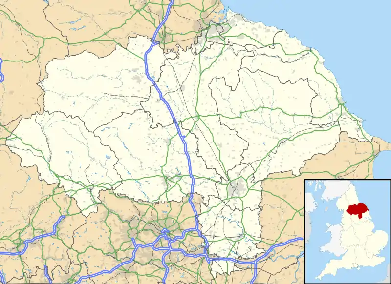 Well Location within North Yorkshire | |
| Population | 230 (2011 census)[1] |
| OS grid reference | SE266819 |
| District | |
| Shire county | |
| Region | |
| Country | England |
| Sovereign state | United Kingdom |
| Post town | Bedale |
| Postcode district | DL8 |
| Dialling code | 01677 |
| Police | North Yorkshire |
| Fire | North Yorkshire |
| Ambulance | Yorkshire |
History
The 'well' of Well is a spring which, along with several other springs, feeds the beck running through the village. The well lends its name to the village, described as Wella in the Domesday Book.[2] The name Wella is Old English, lieterally meaning well or stream.[3] The village used to be in the wapentake of Hang East.[4]
The village has an old school with a school house. Although the school has been out of use for a long time, the school house has only just been vacated. They are both owned by "The Neville Trust", a charity named after an influential family from the Tudor period. With this is also a small playing field comprising two swings and a small football pitch and, as this is rarely used by the children in the village, the trust is now planning to sell all assets.
The village still has four almshouses called St Michael's Cottages with their own chapel.[5] There is a family-run pub called The Milbank Arms which serves food and drink.[6]
There is also a Methodist Chapel, which holds regular services, and a village institute, which is used for children's parties, coffee mornings and other events. Every August the village hosts a scarecrow trail in which many of the houses in the village create a scarecrow and give it a name; each house then has a number, and members of the community have to work out which name belongs to which scarecrow. The winner receives a cash prize. The competition usually runs from mid-August to early September.[7]
The village also has a number of walks with views across the area; on a clear day, Roseberry Topping is visible.
The church
The Church of St Michael the Archangel is a Grade I listed 12th century structure.[8] A place of worship was noted in the Domesday Book, but the present structure dates from the 12th and 14th centuries, being built by Sir Ralph Neville.[9]
References
- UK Census (2011). "Local Area Report – Well Parish (1170216955)". Nomis. Office for National Statistics. Retrieved 4 July 2018.
- "Well | Domesday Book". opendomesday.org. Retrieved 14 December 2020.
- Ekwall, Eilert (1960). The concise Oxford dictionary of English place-names (4 ed.). Oxford: Oxford University Press. p. 504. ISBN 0-19-869103-3.
- "Genuki: Well, Yorkshire (North Riding)". www.genuki.org.uk. Retrieved 14 December 2020.
- "Saint Michaels Hospital Almshouses, Well, North Yorkshire | Educational Images". Historic England. Retrieved 14 December 2020.
- Warne, Malcom (10 March 2019). "Eating Out: Funerals, wakes, black pudding and the Milbank Arms". The Northern Echo. Retrieved 14 December 2020.
- "Well Scarecrow Trail | Well Village". wellvillage.org.uk. Retrieved 14 December 2020.
- Historic England. "Church of St Michael (Grade I) (1315190)". National Heritage List for England. Retrieved 14 December 2020.
- "Genuki: St. Michael's Church, Well, Yorkshire (North Riding)". www.genuki.org.uk. Retrieved 14 December 2020.
External links
![]() Media related to Well, North Yorkshire at Wikimedia Commons
Media related to Well, North Yorkshire at Wikimedia Commons
- Well Village Website Contains information on the village and history.
- Masham Parishes website
| Authority control |
|
|---|