West Point, Nebraska
West Point is a city in and the county seat of Cuming County, Nebraska, United States.[5] The population was 3,364 at the 2010 census.
West Point, Nebraska | |
|---|---|
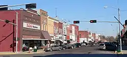 Main Street | |
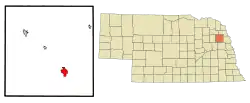 Location of West Point, Nebraska | |
| Coordinates: 41°50′23″N 96°42′41″W | |
| Country | United States |
| State | Nebraska |
| County | Cuming |
| Area | |
| • Total | 2.78 sq mi (7.19 km2) |
| • Land | 2.77 sq mi (7.17 km2) |
| • Water | 0.01 sq mi (0.02 km2) |
| Elevation | 1,348 ft (411 m) |
| Population | |
| • Total | 3,364 |
| • Estimate (2019)[3] | 3,283 |
| • Density | 1,186.48/sq mi (458.12/km2) |
| Time zone | UTC-6 (Central (CST)) |
| • Summer (DST) | UTC-5 (CDT) |
| ZIP code | 68788 |
| Area code(s) | 402 |
| FIPS code | 31-52575 |
| GNIS feature ID | 0834614[4] |
| Website | http://www.ci.west-point.ne.us/ |
History
West Point was first founded in the spring of 1857, when Omaha businessmen formed the Nebraska Settlement Association in order to find suitable townsites in the Elkhorn Valley. Uriah, John, and Andrew Bruner (three brothers originally from Pennsylvania), and William Sexauer chose the present location on a bend along a river, which they called New Philadelphia.[6] The name was soon changed to West Point because it was the westernmost outpost along the valley.[7]
West Point became the county seat of Cuming County on October 12, 1858 after winning the election over the community of DeWitt. A total of 19 votes were split between the two towns with West Point obtaining 12 votes. By the spring of 1859, over 4,000 Pawnee natives flooded the Elkhorn Valley during a hunting excursion and, displeased to find white settlers in the valley, burned several homesteads and killed livestock. The so-called Pawnee War ended near Battle Creek without a fight.
West Point grew slowly at first, but with the coming of the railroad in 1870, it boomed to a population of over 700.
The Chicago & North Western ended railroad service in 1982 after flood damage and declining freight traffic levels resulted in the track being abandoned. Plans were made to revive railroad service from the newly formed Fremont & Elkhorn Valley Railroad, who purchased the abandoned C&NW track. However, the costs were too high to revive railroad service, and the tracks were removed in 1988.
On August 26, 2019, the DHHS announced that the city's water was unsafe to drink after a year of complaints from citizens of the town. The maximum safe level of manganese for infants had been exceeded by over 700 micrograms per mL.[8]
Geography
West Point is located at 41°50′23″N 96°42′41″W (41.839635, -96.711406).[9]
According to the United States Census Bureau, the city has a total area of 2.73 square miles (7.07 km2), of which 2.72 square miles (7.04 km2) is land and 0.01 square miles (0.03 km2) is water.[10] West Point lies on the eastern bank of the Elkhorn River.
Demographics
| Historical population | |||
|---|---|---|---|
| Census | Pop. | %± | |
| 1860 | 14 | — | |
| 1870 | 520 | 3,614.3% | |
| 1880 | 1,009 | 94.0% | |
| 1890 | 1,842 | 82.6% | |
| 1900 | 1,890 | 2.6% | |
| 1910 | 1,776 | −6.0% | |
| 1920 | 2,002 | 12.7% | |
| 1930 | 2,225 | 11.1% | |
| 1940 | 2,510 | 12.8% | |
| 1950 | 2,658 | 5.9% | |
| 1960 | 2,921 | 9.9% | |
| 1970 | 3,385 | 15.9% | |
| 1980 | 3,609 | 6.6% | |
| 1990 | 3,250 | −9.9% | |
| 2000 | 3,660 | 12.6% | |
| 2010 | 3,364 | −8.1% | |
| 2019 (est.) | 3,283 | [3] | −2.4% |
| U.S. Decennial Census[11] 2012 Estimate[12] | |||
2010 census
As of the census[2] of 2010, there were 3,364 people, 1,432 households, and 899 families living in the city. The population density was 1,236.8 inhabitants per square mile (477.5/km2). There were 1,580 housing units at an average density of 580.9 per square mile (224.3/km2). The racial makeup of the city was 87.7% White, 0.3% African American, 0.4% Native American, 0.3% Asian, 0.1% Pacific Islander, 10.3% from other races, and 1.0% from two or more races. Hispanic or Latino of any race were 16.8% of the population.
There were 1,432 households, of which 27.4% had children under the age of 18 living with them, 52.0% were married couples living together, 7.3% had a female householder with no husband present, 3.5% had a male householder with no wife present, and 37.2% were non-families. 34.1% of all households were made up of individuals, and 19.4% had someone living alone who was 65 years of age or older. The average household size was 2.31 and the average family size was 2.97.
The median age in the city was 43.2 years. 25.5% of residents were under the age of 18; 5.4% were between the ages of 18 and 24; 20.9% were from 25 to 44; 25.6% were from 45 to 64; and 22.6% were 65 years of age or older. The gender makeup of the city was 48.1% male and 51.9% female.
2000 census
As of the census of 2000, there were 3,660 people, 1,432 households, and 946 families living in the city. The population density was 1,479.2 people per square mile (572.1/km2). There were 1,552 housing units at an average density of 627.3 per square mile (242.6/km2). The racial makeup of the city was 92.02% White, 0.22% African American, 0.41% Native American, 0.16% Asian, 5.74% from other races, and 1.45% from two or more races. Hispanic or Latino of any race were 12.02% of the population.
There were 1,432 households, out of which 30.7% had children under the age of 18 living with them, 56.7% were married couples living together, 6.7% had a female householder with no husband present, and 33.9% were non-families. 30.2% of all households were made up of individuals, and 18.1% had someone living alone who was 65 years of age or older. The average household size was 2.45 and the average family size was 3.04.
In the city, the population was spread out, with 25.1% under the age of 18, 7.0% from 18 to 24, 25.0% from 25 to 44, 19.6% from 45 to 64, and 23.2% who were 65 years of age or older. The median age was 40 years. For every 100 females, there were 96.8 males. For every 100 females age 18 and over, there were 92.3 males.
As of 2000 the median income for a household in the city was $32,616, and the median income for a family was $38,702. Males had a median income of $27,981 versus $20,774 for females. The per capita income for the city was $19,053. About 5.4% of families and 9.0% of the population were below the poverty line, including 8.9% of those under age 18 and 6.8% of those age 65 or over.
Notable people
- Eldon Johnson, Oregon state legislator.
- Gris Grimly, illustrator and amateur filmmaker.
- Karl H. Timmermann, who led the initial assault on the Ludendorff Bridge at Remagen, and was the first American officer to cross the River Rhine into Germany during WWII.
- Tim Walz, current Governor of Minnesota (January 2019 – present) and former U.S. Representative for Minnesota's 1st congressional district, served from 2007 to 2019.
- Nick Krajicek, Air Force Thunderbirds pilot[13]
- Lawrence Bruner, internationally recognized entomologist from the University of Nebraska.
References
- "2019 U.S. Gazetteer Files". United States Census Bureau. Retrieved July 26, 2020.
- "U.S. Census website". United States Census Bureau. Retrieved 2012-06-24.
- "Population and Housing Unit Estimates". United States Census Bureau. May 24, 2020. Retrieved May 27, 2020.
- "US Board on Geographic Names". United States Geological Survey. 2007-10-25. Retrieved 2008-01-31.
- "Find a County". National Association of Counties. Retrieved 2011-06-07.
- "West Point, Cuming County". Center for Advanced Land Management Information Technologies. University of Nebraska. Retrieved 4 August 2014.
- Chicago and North Western Railway Company (1908). A History of the Origin of the Place Names Connected with the Chicago & North Western and Chicago, St. Paul, Minneapolis & Omaha Railways. p. 138.
- Omaha.com. "Bottled or filtered water recommended after high manganese levels found in West Point water". Retrieved 29 August 2019.
- "US Gazetteer files: 2010, 2000, and 1990". United States Census Bureau. 2011-02-12. Retrieved 2011-04-23.
- "US Gazetteer files 2010". United States Census Bureau. Archived from the original on 2012-01-25. Retrieved 2012-06-24.
- United States Census Bureau. "Census of Population and Housing". Retrieved October 18, 2013.
- "Annual Estimates of the Resident Population: April 1, 2010 to July 1, 2012". Archived from the original on October 19, 2013. Retrieved October 18, 2013.
- Liewer, Steve (April 30, 2018). "Nebraska native will return to Air Force Thunderbirds after pilot's death". Omaha World-Herald.
External links
Municipalities and communities of Cuming County, Nebraska, United States | ||
|---|---|---|
| Cities | Map of Nebraska highlighting Cuming County | |
| Villages | ||
| Townships | ||
| Indian reservations | ||
| Unincorporated communities | ||
| Ghost town | ||
| Footnotes | ‡This populated place also has portions in an adjacent county or counties | |
| ||