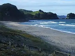
Whiritoa
Whiritoa is a small beach town on the Coromandel Peninsula between Whangamata and Waihi Beach. It has a permanent population in the low hundreds, which swells to over a thousand during the New Year holiday period.
Whiritoa | |
|---|---|
 Whiritoa Beach | |
 Whiritoa | |
| Coordinates: 37°16′58″S 175°54′03″E | |
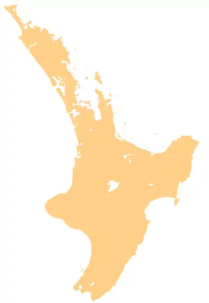
| Country | New Zealand |
| Region | Waikato |
| District | Hauraki District |
| Population | |
| • Total | 117 |
It has a convenience store, a library and a volunteer fire department. The local Surf lifesaving club has a close relationship with the community of regularly holidaying families.
At the north end of the 1.5 km beach is a small lagoon and past this is a short walk to Waimama bay. The lagoon has a cycle of being blocked by sand then being dug out by the council digger or enthusiastic members of the public. At the south end a short bush walk crosses through privately owned land to a blowhole.
The beach itself is popular for surfers as it often features a roaming sandbar or two. The shore is often quite steep meaning the waves are sometimes breaking directly on the sand making it difficult for casual swimmers.
History
Whiritoa beach is typical of many beaches along the eastern Coromandel Peninsula, starting its formation around 6,000 to 7,000 years ago.
Early Māori communities removed most of the original coastal forest and dune plants. Farmers then introduced stock to the dune area, disturbing the native sand-binding grasses and causing severe wind erosion. Most of the sand reserves eroded, reducing the height of the dunes and caused sheets of sand to move more than 200 m inland. The sand at Whiritoa Beach was mined for over 50 years; in total more than 180,000 m³ of sand has been removed. Since the 1960s coastal subdivision has covered most of what remains of the sand dune reserves.[1]
References
- Sand mining and management at Whiritoa Beach – Environment Waikato
External links
| Wikimedia Commons has media related to Whiritoa Beach. |
