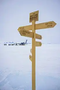
Wolfs Fang Runway
Wolf's Fang Runway is a private runway established by White Desert Ltd, a luxury travel company, in Queen Maud Land, Antarctica to provide access for tourists to the company's Whichaway Oasis eco-camp. It was established on the site of a previous blue ice runway that was known as Blue One.
Wolf's Fang Runway | |||||||||||
|---|---|---|---|---|---|---|---|---|---|---|---|
| Summary | |||||||||||
| Airport type | Private | ||||||||||
| Operator | White Desert Antarctica | ||||||||||
| Location | Queen Maud Land, Antarctica | ||||||||||
| Elevation AMSL | 3,707 ft / 1,130 m | ||||||||||
| Coordinates | 71°31′S 08°48′E | ||||||||||
| Website | https://white-desert.com/our-story/wolfsfang-runway-logistics/ | ||||||||||
| Map | |||||||||||
 Wolf's Fang Runway Location of airfield in Antarctica | |||||||||||
| Runways | |||||||||||
| |||||||||||
Source:[1] | |||||||||||
Wolf’s Fang Runway is operated by the logistics arm of White Desert Ltd. and it was built to support large business jets operating from Cape Town.
There are six blue ice runways in Antarctica, made of snow compressed over millennia into glacial ice that has a distinctive blue colour and a compressive strength similar to concrete, so passenger jets can land on them.
During construction a ground penetrating radar was used to ensure the area was free of subsurface voids or crevassing. The site was also surveyed to determine the best positioning in conformity with the ICAO requirements for runways.
Being part of a glacier, a blue ice runway moves and changes over time. Operating systems need to ensure changes to the runway are measured, corrected and any non-conformances reported to aircrews using the facility. This includes the surface smoothness and friction coefficient which can vary considerably.
To prepare the runway for flight operations, grooming equipment works the ice to achieve surface frictions that are similar to those of a damp bitumen runway.
Flights operate into/out of the runway during austral summer. Aircraft types which typically operate into and out of Wolf’s Fang include Gulfstream G550, G650, Basler BT-67 and helicopters, although the runway is able to accommodate aircraft of all sizes.
Technical details
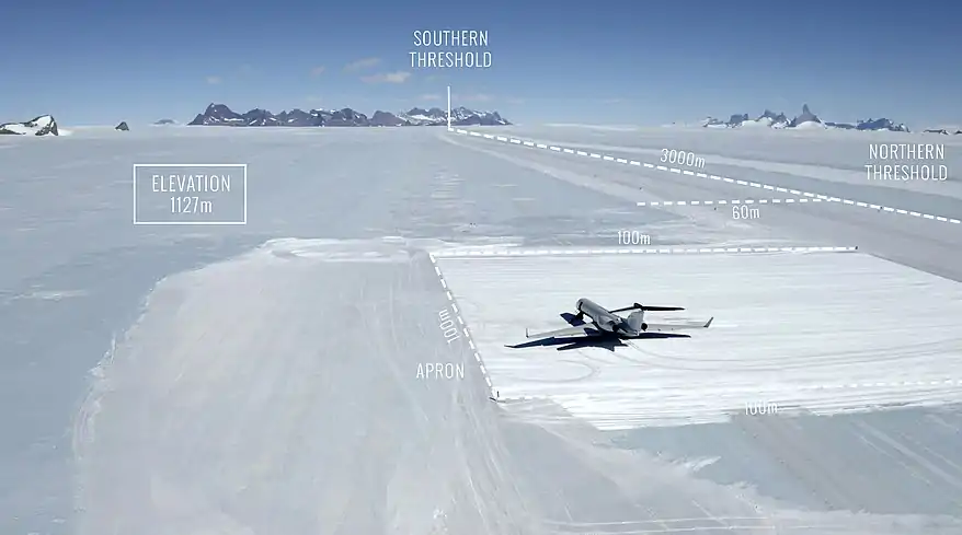
Northern Threshold, (ITRF 2014)
S 71° 31’ 34.2”
E 008° 47’ 56.4”
Elevation 1109 m (3639’) AMSL
Azimuth 175° True
Gradient Average 0.86%, rising to South.
End of Runway (South),
S 71° 33’ 10.8”
E 8° 48’ 20.9”
Elevation 1135 m (3724’) AMSL
Declared Distances for Runway 17T
TORA & LDA: 3000 m (9840’)
TODA & ASDA: 3000 m (9840’)
