Woodbridge, Virginia
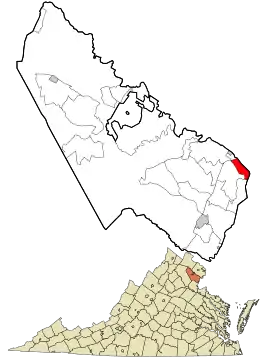
Woodbridge is a census-designated place (CDP) in Prince William County, Virginia, United States, located 20 miles (32 km) south of Washington, D.C.[3] Bounded by the Occoquan and Potomac rivers, Woodbridge Magisterial District had 54,275 residents at the 2010 census.[4] The Woodbridge census-designated place comprises just one portion of the magisterial district and had a population of 4,055 in the 2010 census.[5] The census-designated place consists solely of the section north of Occoquan Road and Dawson Beach Road, and east of Interstate 95.
Woodbridge, Virginia | |
|---|---|
 Woodbridge Railway Station | |
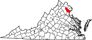
 Location in Prince William County and the U.S. state of Virginia | |
 Woodbridge, Virginia Location in Prince William County and the U.S. state of Virginia  Woodbridge, Virginia Woodbridge, Virginia (the United States) | |
| Coordinates: 38°38′37″N 77°15′39″W | |
| Country | |
| State | |
| County | |
| Area | |
| • Total | 10.8 sq mi (28.0 km2) |
| • Land | 10.5 sq mi (27.1 km2) |
| • Water | 0.3 sq mi (0.8 km2) |
| Elevation | 75 ft (23 m) |
| Population (2010) | |
| • Total | 54,275 |
| • Density | 5,000/sq mi (1,900/km2) |
| Time zone | UTC−5 (Eastern (EST)) |
| • Summer (DST) | UTC−4 (EDT) |
| ZIP codes | 22191–22193 |
| Area code(s) | 571, 703 |
| FIPS code | 51-87312[1] |
| GNIS feature ID | 1497222[2] |
Woodbridge offers a variety of amenities for residents and visitors, including the Potomac Mills shopping mall and the Stonebridge at Potomac Town Centre Shopping Centers. Woodbridge is served by the Prince William County Public Schools, and the Woodbridge campus of Northern Virginia Community College borders the district. Sentara Northern Virginia Medical Centera non-profit hospital, formerly Potomac Hospital, recently expanded and now has the capacity to serve 183 patients.[6] Transportation includes access to Interstate 95, two VRE commuter train stations, bus service, and a local "slugging" system, offering residents a variety of transit options.
Woodbridge offers a wide range of recreational opportunities for resident and visitors. The Occoquan Bay National Wildlife Refuge is a natural habitat for a variety of plant and animal life including the bald eagles and ospreys. Veteran's Park and Leesylvania State Park are located on the Potomac River and provide swimming, boating, picnic and hiking services. Close by is Rippon Lodge, the oldest house in Prince William County, which is open for tours throughout the summer. Trails at Leesylvania Park lead to the ancestral home of the Lee family.
History
Woodbridge was a village composed largely of either farms or industrial complexes. Later, the Woodbridge postal delivery area became the hub that included Dale City and Lake Ridge, which had previously been forged as a planned community in the 1960s and 1970s. The area takes its name from Thomas Mason's 1795 wooden toll bridge built to supplant the existing ferry, carrying the King's Highway traffic across the Occoquan River. Mason's Woodbridge Plantation was located in the area of the present day Belmont Bay golf course community.
The Freestone Point Confederate Battery and Rippon Lodge are listed on the National Register of Historic Places.[7]
- Tent city
Since ca. 2003 there exists a 10-acre (4.0 ha) tent city adjacent to the Potomac Mills mall. It is tolerated by the private landlord. In 2018, part of the residents were directed to leave.[8]
Geography
Woodbridge is at 38°38′37″N 77°15′39″W (38.643517, −77.260843).[9] According to the United States Census Bureau, in 2000, the CDP has a total area of 10.8 square miles (28 km2), of which 10.5 square miles (27 km2) is land and 0.3 square miles (0.78 km2), or 2.87%, is water. Woodbridge is about 20 miles (32 km) from Washington, D.C.
The 2010 census reconfigured Woodbridge so that the majority of its land area was redesignated Marumsco and Neabsco, Virginia. The southern border of Woodbridge is now Occoquan Road. The area between Occoquan Road and Opitz Boulevard–Rippon Boulevard is now Marumsco. All of the former Woodbridge CDP south of those streets has been designated as Neabsco. However, these areas continue to have postal addresses in "Woodbridge," which is served by a post office in Marumsco.[3]
Climate
Woodbridge has a humid subtropical climate.
| Climate data for Woodbridge | |||||||||||||
|---|---|---|---|---|---|---|---|---|---|---|---|---|---|
| Month | Jan | Feb | Mar | Apr | May | Jun | Jul | Aug | Sep | Oct | Nov | Dec | Year |
| Average high °F (°C) | 43 (6) |
47 (8) |
56 (13) |
67 (19) |
75 (24) |
84 (29) |
88 (31) |
86 (30) |
79 (26) |
68 (20) |
58 (14) |
48 (9) |
67 (19) |
| Average low °F (°C) | 26 (−3) |
29 (−2) |
36 (2) |
45 (7) |
54 (12) |
64 (18) |
69 (21) |
67 (19) |
61 (16) |
48 (9) |
38 (3) |
31 (−1) |
47 (8) |
| Average precipitation inches (mm) | 3.33 (85) |
2.75 (70) |
3.69 (94) |
2.97 (75) |
3.78 (96) |
3.06 (78) |
3.72 (94) |
3.43 (87) |
3.96 (101) |
3.34 (85) |
3.51 (89) |
3.17 (81) |
40.71 (1,034) |
| Source: [10] | |||||||||||||
Demographics
| Historical population | |||
|---|---|---|---|
| Census | Pop. | %± | |
| 1970 | 25,412 | — | |
| 1980 | 24,004 | −5.5% | |
| 1990 | 26,401 | 10.0% | |
| 2000 | 31,941 | 21.0% | |
| 2010 | 52,754 | 65.2% | |
| This is for the Magisterial District, not the CDP.source:[11][12][13] | |||
As of the 2010 Census, the Woodbridge Magisterial District had 54,275 residents with 17,796 households. The racial demographics were as follows:
- 55% White
- 23% Black
- 10% Asian
- 0.55% Native American
- 0.17% Pacific Islander
- 13% Hispanic
As of the census of 2000, there were 31,941 people, 10,687 households, and 7,769 families residing in the CDP. The population density was 3,047.8 people per square mile (1,176.8/km2). There were 11,026 housing units at an average density of 1,052.1/sq mi (406.2/km2). The racial makeup of the CDP was 56.34% White, 23.45% African American, 0.55% Native American, 4.90% Asian, 0.17% Pacific Islander, 9.62% from other races, and 4.96% from two or more races. Hispanic or Latino people of any race were 19.07% of the population.
There were 10,687 households, out of which 41.5% had children under the age of 18 living with them, 52.3% were married couples living together, 14.2% had a female householder with no husband present, and 27.3% were non-families. Of all households 20.4% were made up of individuals, and 3.9% had someone living alone who was 65 years of age or older. The average household size was 2.96 and the average family size was 3.40.
In the CDP, the population was spread out, with 30.0% under the age of 18, 10.7% from 18 to 24, 35.7% from 25 to 44, 17.0% from 45 to 64, and 6.7% who were 65 years of age or older. The median age was 30 years. For every 100 females, there were 102.5 males. For every 100 females age 18 and over, there were 100.2 males.
The median income for a household in the CDP was $75,525, and the median income for a family was $52,362. Males had a median income of $35,538 versus $28,587 for females. The per capita income for the CDP was $19,810. About 4.6% of families and 5.5% of the population were below the poverty line, including 7.7% of those under age 18 and 5.9% of those age 65 or over.
The estimate median house or condo value was $294,156 as of 2008.[14] As of 2013, the average home sale price was $222,940.[15]
Education
Public schools
Woodbridge has 11 public high schools and over 20 elementary and middle schools.[14][16]
The public high schools include:[14]
- Battlefield High School
- Brentsville District High School
- C. D. Hylton High School
- Charles J. Colgan Sr. High School
- Forest Park High School
- Freedom High School
- Gar-Field Senior High School
- Patriot High School
- Potomac Senior High School
- Stonewall Jackson High School
- Woodbridge High School
The middle schools include:[14]
- Fred Lynn Middle School
- George M. Hampton Middle School
- Herbert J Saunders Middle School
- Lake Ridge Middle School
- Potomac Middle School
- Rippon Middle School
- Stuart M. Beville Middle School
- Woodbridge Middle School
- Louise A. Benton Middle School
The elementary schools include:[14]
- Antietam Elementary School
- Bel Air Elementary School
- Belmont Elementary School
- Dale City Elementary School
- Elizabeth Vaughan Elementary School
- Enterprise Elementary School
- Fannie W. Fitzgerald Elementary School
- Featherstone Elementary School
- Ferlazzo Site Elementary School* (early-mid 2016)
- Kerrydale Elementary School
- Lake Ridge Elementary School
- Minieville Elementary School
- Marumsco Hills Elementary School
- Mullen Elementary School
- Neabsco Elementary School
- Occoquan Elementary School
- Old Bridge Elementary School
- Potomac View Elementary School
- R. Dean Kilby Elementary School* (late 2016)
- River Oaks Elementary School
- Rockledge Elementary School
- Sharon C. Mcauliffe Elementary School
- Sonnie Penn Elementary School
- Springwoods Elementary School
- Sudley Elementary School
- Westridge Elementary School
- Wilson Elementary School
* Currently being constructed or expanded
Private education
Colleges:
- Northern Virginia Community College, Woodbridge Campus
- Stratford University
- University of Valley Forge-Virginia Campus[17]
Private high schools:[14]
- Christ Chapel Academy[18] (Pre–12)
- Heritage Christian School (K–12)
- Saint John Paul the Great Catholic High School
Private middle schools, elementary schools, and preschools:[14]
- Academy Day Care (Pre-1)
- Cardinal Montessori School (Pre-4)
- Christ Chapel Academy[18] (Pre-12)
- Cloverdale School (Pre-2)
- Manassas Christian School
- Manassas Christian School Academy
- Minnieland Private Day School (Pre-K)
- Prince William Academy (Pre-8)
- Riverview Baptist Day School (Pre-K)
- Thomas Aquinas Regional School[19] (Pre-8)
- Young World Development Center (Pre-4)
Attractions and culture
Woodbridge experienced its current development boom in the mid-1980s, after being a municipality composed largely of either farms or industrial complexes, as an annex of sorts of Dale City, which had been forged as a planned community in the 1960s and 1970s.
Woodbridge is home to Potomac Mills Mall (managed by Simon Property Group), one of the largest shopping centers in northern Virginia. Woodbridge is a suburban city because many of its residents are employed in nearby Washington, D.C.
Due in part to the I-95 and I-66 HOV waiver given to hybrid vehicles, many D.C. government workers have relocated to the area to take advantage of the lower-priced housing. However, in July 2006, the hybrid/HOV privilege was revoked. Vehicles registered prior to July 2006 were exempted from occupancy requirements in all (HOV) facilities in Virginia until July 1, 2009.
Other cultural resources include Rippon Lodge, the oldest house in Prince William County, which was opened as a park and museum in October 2007.
Recreation
Woodbridge is the home of the Northern Virginia Royals soccer club and the Potomac Nationals minor league baseball club.[20] The stadium is located within the city limits.
Transportation
Prince William Parkway serves as the cross-county connector. It links the community to I-95 and runs from Woodbridge westward to near Gainesville. Virginia Route 123 connects the I-95 corridor and U.S. 1 (Jefferson Davis Highway) to points west and north and ultimately terminates in McLean, Virginia. Marumsco has the Prince William Parkway (Virginia Route 294) as an east-west highway, and Neabsco is served by Rippon Boulevard and Cardinal Drive.[3] The area is also served by the Virginia Railway Express Fredericksburg Line.
U.S. 1 (Jefferson Davis Highway) is currently under major construction to widen the road to six lanes. It will also see a new interchange to redirect traffic from Virginia Route 123 to Belmont Bay Drive. There will also be a 10' shared use path, a 6' side walk, and a 28' median for future WMATA Metro expansion or Bus Rapid Transit. The Project is estimated to cost $259 Million, with completion by the end of 2018.
The Woodbridge Amtrak station, at 1040 Express Way, is owned by Virginia Railway Express. Its 29,418 passengers (2014)[21] are served by numerous VRE trains and Amtrak Virginia Regionals, as well as OmniRide Commuter buses. The station has free (taxpayer-subsidized) parking spaces for 738 vehicles, as well as bike racks. It is ADA compliant.
Notable people
- Jeff Baker, 10-year Major League Baseball player
- Brandon Brown, NASCAR driver
- Russell Davis, former NFL running back
- Christine Fox, former Acting US Deputy Secretary of Defense
- Da'Shawn Hand, defensive tackle for the Detroit Lions
- Emmylou Harris, (singer, songwriter, musician); Member, Country Music Hall of Fame
- Meyers Leonard, NBA basketball player
- Nelson Martinez, soccer player
- David Robinson, Basketball Hall of Fame player
See also
- List of people from the Washington, D.C. metropolitan area
References
- "U.S. Census website". United States Census Bureau. Retrieved 2008-01-31.
- "US Board on Geographic Names". United States Geological Survey. 2007-10-25. Retrieved 2008-01-31.
- Morello, Carol (February 11, 2011). "Welcome to Woodbridge. Er, make that... Marumsco?". Washington Post. p. B1.
- "Race, Hispanic or Latino, Age, and Housing Occupancy: 2010 Census Redistricting Data (Public Law 94-171) Summary File (QT-PL), Woodbridge district, Prince William County, Virginia". United States Census Bureau. Retrieved September 27, 2011.
- "Profile of General Population and Housing Characteristics: 2010". United States Census Bureau. Retrieved 6 September 2016.
- "Sentara Northern Virginia Medical Center". Sentara Healthcare. 2014. Retrieved 2014-01-23.
- "National Register Information System". National Register of Historic Places. National Park Service. July 9, 2010.
- "wusa9.com". wusa9.com. Retrieved 2018-03-01.
- "US Gazetteer files: 2010, 2000, and 1990". United States Census Bureau. 2011-02-12. Retrieved 2011-04-23.
- "Average weather for Woodbridge". Weather.com. Retrieved October 23, 2019.
- "CENSUS OF POPULATION AND HOUSING (1790–2000)". U.S. Census Bureau. Retrieved 2010-07-17.
- Area reported as Woodbridge-Marumsco during the 1970 census.
- Most of Woodbridge's census area was lost to newly created Marumsco CDP, which recorded a population of 35,036 in 2010.
- "Woodbridge, Virginia (VA) profile". City-data.com. 2010. Retrieved 2010-07-12.
- "Neighborhoods: Woodbridge (Prince William County, VA)". The Washington Post. Retrieved February 9, 2013.
- "Woodbridge, VA Elementary Schools". Retrieved 14 April 2017.
- University of Valley Forge-Virginia Campus
- Christ Chapel Academy
- St. Thomas Aquinas Regional School
- "Potomac Nationals' Official site". minorleaguebaseball.com. May 7, 2009. Retrieved 2010-07-12.
- http://www.amtrak.com/pdf/factsheets/VIRGINIA14.pdf
External links
| Wikimedia Commons has media related to Woodbridge, Virginia. |
| Wikivoyage has a travel guide for Woodbridge (Virginia). |

