Woodburn, Iowa
Woodburn is a city in Clarke County, Iowa, United States. The population was 202 at the 2010 census.
Woodburn, Iowa | |
|---|---|
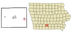 Location of Woodburn, Iowa | |
| Coordinates: 41°0′42″N 93°35′55″W | |
| Country | |
| State | |
| County | Clarke |
| Area | |
| • Total | 0.64 sq mi (1.65 km2) |
| • Land | 0.64 sq mi (1.65 km2) |
| • Water | 0.00 sq mi (0.00 km2) |
| Elevation | 978 ft (298 m) |
| Population | |
| • Total | 202 |
| • Estimate (2019)[3] | 194 |
| • Density | 305.03/sq mi (117.73/km2) |
| Time zone | UTC-6 (Central (CST)) |
| • Summer (DST) | UTC-5 (CDT) |
| ZIP code | 50275 |
| Area code(s) | 641 |
| FIPS code | 19-86880 |
| GNIS feature ID | 0463181 |
Geography
Woodburn is located at 41°0′42″N 93°35′55″W (41.011646, -93.598546).[4]
According to the United States Census Bureau, the city has a total area of 0.64 square miles (1.66 km2), all land.[5]
Demographics
| Year | Pop. | ±% |
|---|---|---|
| 1880 | 371 | — |
| 1890 | 336 | −9.4% |
| 1900 | 467 | +39.0% |
| 1910 | 420 | −10.1% |
| 1920 | 375 | −10.7% |
| 1930 | 305 | −18.7% |
| 1940 | 324 | +6.2% |
| 1950 | 255 | −21.3% |
| 1960 | 202 | −20.8% |
| 1970 | 186 | −7.9% |
| 1980 | 207 | +11.3% |
| 1990 | 240 | +15.9% |
| 2000 | 244 | +1.7% |
| 2010 | 202 | −17.2% |
| 2019 | 194 | −4.0% |
| Source:"U.S. Census website". United States Census Bureau. Retrieved 2020-03-29. and Iowa Data Center Source: | ||
2010 census
As of the census[2] of 2010, there were 202 people, 83 households, and 59 families living in the city. The population density was 315.6 inhabitants per square mile (121.9/km2). There were 89 housing units at an average density of 139.1 per square mile (53.7/km2). The racial makeup of the city was 99.0% White and 1.0% Asian.
There were 83 households, of which 21.7% had children under the age of 18 living with them, 60.2% were married couples living together, 4.8% had a female householder with no husband present, 6.0% had a male householder with no wife present, and 28.9% were non-families. 21.7% of all households were made up of individuals, and 9.6% had someone living alone who was 65 years of age or older. The average household size was 2.39 and the average family size was 2.76.
The median age in the city was 45.3 years. 17.8% of residents were under the age of 18; 6.4% were between the ages of 18 and 24; 25.2% were from 25 to 44; 33.7% were from 45 to 64; and 16.8% were 65 years of age or older. The gender makeup of the city was 54.0% male and 46.0% female.
2000 census
As of the census[7] of 2000, there were 244 people, 89 households, and 63 families living in the city. The population density was 387.9 people per square mile (149.5/km2). There were 99 housing units at an average density of 157.4 per square mile (60.7/km2). The racial makeup of the city was 98.36% White, 0.41% Native American, 0.41% Asian, and 0.82% from two or more races.
There were 89 households, out of which 46.1% had children under the age of 18 living with them, 55.1% were married couples living together, 6.7% had a female householder with no husband present, and 29.2% were non-families. 22.5% of all households were made up of individuals, and 11.2% had someone living alone who was 65 years of age or older. The average household size was 2.74 and the average family size was 3.27.
In the city, the population was spread out, with 32.4% under the age of 18, 9.8% from 18 to 24, 31.1% from 25 to 44, 17.2% from 45 to 64, and 9.4% who were 65 years of age or older. The median age was 32 years. For every 100 females, there were 105.0 males. For every 100 females age 18 and over, there were 106.3 males.
The median income for a household in the city was $22,500, and the median income for a family was $30,938. Males had a median income of $24,375 versus $18,750 for females. The per capita income for the city was $11,139. About 21.5% of families and 26.8% of the population were below the poverty line, including 38.5% of those under the age of eighteen and 14.3% of those 65 or over.
References
- "2019 U.S. Gazetteer Files". United States Census Bureau. Retrieved July 17, 2020.
- "U.S. Census website". United States Census Bureau. Retrieved 2012-05-11.
- "Population and Housing Unit Estimates". United States Census Bureau. May 24, 2020. Retrieved May 27, 2020.
- "US Gazetteer files: 2010, 2000, and 1990". United States Census Bureau. 2011-02-12. Retrieved 2011-04-23.
- "US Gazetteer files 2010". United States Census Bureau. Retrieved 2012-05-11.
- "Census of Population and Housing". Census.gov. Retrieved June 4, 2015.
- "U.S. Census website". United States Census Bureau. Retrieved 2008-01-31.
Municipalities and communities of Clarke County, Iowa, United States | ||
|---|---|---|
| Cities | Map of Iowa highlighting Clarke County | |
| Townships | ||
| Unincorporated communities | ||
| ||
