Woodland Caribou Provincial Park
Woodland Caribou Provincial Park is a provincial park in Northwestern Ontario, Canada, west of the municipality of Red Lake.[1][4][5] It borders Atikaki Provincial Park and Nopiming Provincial Park in eastern Manitoba,[4][5] and is made up of Canadian Shield and boreal forest. Woodland Caribou Provincial Park is a wilderness park of 450,000 hectares (1,100,000 acres), and it became part of the Pimachiowin Aki UNESCO World Heritage site in 2018.[3]
| Woodland Caribou Provincial Park | |
|---|---|
IUCN category Ib (wilderness area) | |
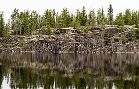 Rock wall | |
 Location in Ontario | |
| Location | Kenora District, Ontario, Canada |
| Nearest city | Red Lake |
| Coordinates | 50°59′55″N 94°45′01″W[1] |
| Area | 4,500 km2 (1,700 sq mi) |
| Established | 1983[2] |
| Governing body | Ontario Parks |
| World Heritage site | 2018[3] |
Access to the park is via float plane or canoe. The park is noted as a wilderness canoe destination, with over 2,000 kilometres (1,200 mi) of waterways that weave a pattern between large interconnected lakes and rivers, including the Bloodvein River and the Gammon River. Portages connect many of the common canoe routes. The park has many archaeological sites containing many Ojibway pictographs.
See also
References
- "Woodland Caribou Provincial Park". Geographical Names Data Base. Natural Resources Canada. Retrieved 2018-08-24.
- "Woodland Caribou Provincial Park - Wilderness". Protected Planet. Archived from the original on 28 August 2014.
- Johnson, Rhiannon (2018-07-01). "Newest UNESCO World Heritage Site is boreal forest important to First Nations cultures". CBC News. Retrieved 2018-07-03.
- "Toporama (on-line map and search)". Atlas of Canada. Natural Resources Canada. Retrieved 2018-08-24.
- "Ontario Geonames GIS (on-line map and search)". Ontario Ministry of Natural Resources and Forestry. 2014. Retrieved 2018-08-24.
External links
| Western | |
|---|---|
| Eastern | |
| Northern | |
| Tentative List | |
| Former |
|
| |