Woree, Queensland
Woree is a suburb of Cairns in the Cairns Region, Queensland, Australia.[2] In the 2016 census Woree had a population of 4,821 people.[1]
| Woree Queensland | |||||||||||||||
|---|---|---|---|---|---|---|---|---|---|---|---|---|---|---|---|
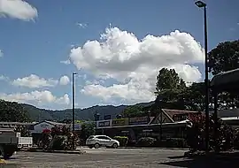 Southside Shopping Village | |||||||||||||||
 Woree | |||||||||||||||
| Coordinates | 16.9627°S 145.7430°E | ||||||||||||||
| Population | 4,821 (2016 census)[1] | ||||||||||||||
| • Density | 831/km2 (2,153/sq mi) | ||||||||||||||
| Postcode(s) | 4868 | ||||||||||||||
| Area | 5.8 km2 (2.2 sq mi) | ||||||||||||||
| Time zone | AEST (UTC+10:00) | ||||||||||||||
| Location | 6.7 km (4 mi) S of Cairns CBD | ||||||||||||||
| LGA(s) | Cairns Region | ||||||||||||||
| State electorate(s) | |||||||||||||||
| Federal Division(s) | Leichhardt | ||||||||||||||
| |||||||||||||||
Geography
The Bruce Highway goes between Bald Hills in Brisbane to Woree and is 1,656 kilometres (1,029 mi) long. The highway goes through Woree both southbound, and northbound from (Mount Sheridan / White Rock) and continues north through the suburb, splitting at 16.9564°S 145.7474°E into Mulgrave Road and Ray Jones Drive. Mulgrave Road/Bruce Highway (Alternative Route)[3][4] continues north-west and exits to Earlville, while Ray Jones Drive/Bruce Highway continues north-east to Portsmith.[5][6]
History
The name Woree is from the Yidinji Aboriginal traditional group of the predominantly inner-north, inner-north west and south Cairns region areas from the Yidiny language, referring to the young persons near or at the waterways.[7]
The Cairns Jockey Club commenced in Cairns in July 1884 with 50 members. Its first race meeting was proclaimed a holiday. Their current race track is Cannon Park in Woree, which was donated by the Cannon family and the first race was held there in 1911. A grandstand was officially opened on 15 July 1972 by Gordon Chalk, then Minister for Racing.[8]
Woree railway station was named by Queensland Rail in 1914 and the suburb takes is name from the railway station.[2] Prior to this, the area was known as Four Mile and Pryns Station.[7] Woree railway station was (16.9521°S 145.7461°E) on the North Coast railway line, but it has been dismantled following the realignment of the railway line.[9]
Woree State School was opened on 5 May 1925 and closed circa 1953.[10] In October 1954, it was decided to relocate its buildings which were relocated to Holloways Beach to establish a school there (which opened in 1955).[11] The present Woree State School opened in January 1980.[10][12]
Saint Mary's College opened 1 January 1986.[12]
Woree State High School opened on 29 January 1985.[10][12][13]
St Gerard Majella Catholic Primary School opened on 27 January 1988.[10]
In the 2006 census Woree had a population of 4,372 people.[14]
In the 2016 census Woree had a population of 4,821 people.[1]
Cairns State Special School opened in 2017.[15]
There was a popular drive-in movie theatre but it is no longer operational.
Education
Woree State School is a government primary (Prep-6) school for boys and girls at Cnr Rigg & Windarra Streets (16.9597°S 145.7413°E).[16][17] In 2018, the school had an enrolment of 687 students with 56 teachers (51 full-time equivalent) and 37 non-teaching staff (27 full-time equivalent).[18] It includes a special education program.[16][19]
St Gerard Majella Primary School is a Catholic primary (Prep-6) school for boys and girls at 63 Anderson Road (16.9675°S 145.7403°E).[16][20] In 2018, the school had an enrolment of 389 students with 28 teachers (21 full-time equivalent) and 20 non-teaching staff (14 full-time equivalent).[18]
Cairns State Special School is a primary and secondary (Prep-12) school for boys and girls at Windarra Street (16.9631°S 145.7402°E).[16][21] It provides individualised education to students with special needs. In 2018, the school had an enrolment of 63 students with 23 teachers (20 full-time equivalent) and 27 non-teaching staff (19 full-time equivalent).[18]
Woree State High School is a government secondary (7-12) school for boys and girls at Rigg Street (16.9602°S 145.7418°E).[16][22] In 2018, the school had an enrolment of 923 students with 88 teachers (82 full-time equivalent) and 54 non-teaching staff (44 full-time equivalent).[18] It includes a special education program.[16]
St Mary's Catholic College is a Catholic secondary (7-12) school for boys and girls at 53 Anderson Road (16.9680°S 145.7410°E).[16][23] In 2018, the school had an enrolment of 874 students with 70 teachers (67 full-time equivalent) and 53 non-teaching staff (40 full-time equivalent).[18]
Amenities
Southside Shopping Village is on Charlotte Close (16.9624°S 145.7449°E).[24]
Cairns Golf Club has an 18-hole golf course and club hose on Links Drive in the east of the locality (16.9637°S 145.7477°E).[25][26]
The Woree Sports and Aquatic Centre is on Pool Close (16.9630°S 145.7442°E). It has learn-to-swim classes and club with competitions for younger and masters swimmers.[27][28][29]
Cannon Park is a horse racing track (16.9486°S 145.7461°E). It is home to the Cairns Jockey Club. It is a 1,800-metre (1.1 mi) track. [30][8]
Cairns Coconut Caravan Park is at 23 Anderson Street (16.9686°S 145.7420°E).[31][32]
References
- Australian Bureau of Statistics (27 June 2017). "Woree (SSC)". 2016 Census QuickStats. Retrieved 20 October 2018.

- "Woree – suburb in Cairns Region (entry 48945)". Queensland Place Names. Queensland Government. Retrieved 3 December 2020.
- "Roads and paths". Cairns Regional Council. Retrieved 5 December 2020.
- "Division 3 Divisional Boundaries" (PDF). Electoral Commission of Queensland. Retrieved 5 December 2020.
- "Queensland Globe". State of Queensland. Retrieved 3 December 2020.
- "Bruce Highway—Cairns Southern Access Corridor—Stage 4: Kate Street to Aumuller Street". Department of Main Roads and Transport. Retrieved 3 December 2020.
- "W Suburbs" (PDF). Cairns Heritage Page. Cairns Regional Council. Archived (PDF) from the original on 13 April 2020. Retrieved 14 April 2020.
- "About Us". Cairns Jockey Club. Retrieved 3 December 2020.
- "Railway stations and sidings - Queensland". Queensland Open Data. Queensland Government. 2 October 2020. Archived from the original on 5 October 2020. Retrieved 5 October 2020.
- Queensland Family History Society (2010), Queensland schools past and present (Version 1.01 ed.), Queensland Family History Society, ISBN 978-1-921171-26-0
- "NORTHERN LOANS AND WORKS". Cairns Post (16, 410). Queensland, Australia. 15 October 1954. p. 7. Retrieved 6 May 2018 – via National Library of Australia.
- "Opening and closing dates of Queensland Schools". Queensland Government. Retrieved 18 April 2019.
- "Woree State High School". Archived from the original on 21 January 2018. Retrieved 21 January 2018.
- Australian Bureau of Statistics (25 October 2007). "Woree (SSC)". 2006 Census QuickStats. Retrieved 3 December 2020.
- "Annual Report 2017" (PDF). Cairns State Special School. Archived (PDF) from the original on 21 October 2018. Retrieved 21 October 2018.
- "State and non-state school details". Queensland Government. 9 July 2018. Archived from the original on 21 November 2018. Retrieved 21 November 2018.
- "Woree State School". Retrieved 21 November 2018.
- "ACARA School Profile 2018". Australian Curriculum, Assessment and Reporting Authority. Retrieved 28 January 2020.
- "Woree SS - Special Education Program". Retrieved 21 November 2018.
- "St Gerard Majella Primary School". Retrieved 21 November 2018.
- "Cairns State Special School". Retrieved 21 November 2018.
- "Woree State High School". Retrieved 21 November 2018.
- "St Mary's Catholic College". Retrieved 21 November 2018.
- "Building areas - Queensland". Queensland Open Data. Queensland Government. 17 November 2020. Archived from the original on 17 November 2020. Retrieved 17 November 2020.
- "Building areas - Queensland". Queensland Open Data. Queensland Government. 17 November 2020. Archived from the original on 17 November 2020. Retrieved 17 November 2020.
- "Home". Cairns Golf Club. Retrieved 3 December 2020.
- "Building points - Queensland". Queensland Open Data. Queensland Government. 17 November 2020. Archived from the original on 25 November 2020. Retrieved 25 November 2020.
- "About". Woree Sports and Aquatic Centre. Retrieved 3 December 2020.
- "Woree Sports and Aquatics Centre". Retrieved 3 December 2020.
- "Building points - Queensland". Queensland Open Data. Queensland Government. 17 November 2020. Archived from the original on 25 November 2020. Retrieved 25 November 2020.
- "Building points - Queensland". Queensland Open Data. Queensland Government. 17 November 2020. Archived from the original on 25 November 2020. Retrieved 25 November 2020.
- "BIG4 Ingenia Holidays Cairns Coconut". Cairns Coconut. 16 November 2020. Retrieved 3 December 2020.
Further reading
- "Woree". 2006 Census. Australian Bureau of Statistics. 10 February 2007.