Wunjunga, Queensland
Wunjunga is a coastal locality in the Shire of Burdekin in Queensland, Australia.[2] In the 2016 census, Wunjunga had a population of 9 people.[1]
| Wunjunga Queensland | |||||||||||||||
|---|---|---|---|---|---|---|---|---|---|---|---|---|---|---|---|
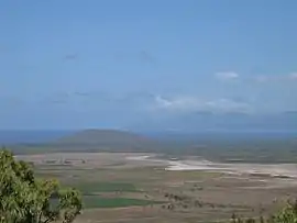 Wunjunga viewed from Mount Inkerman, Nov 2005 | |||||||||||||||
 Wunjunga | |||||||||||||||
| Coordinates | 19.7745°S 147.5772°E | ||||||||||||||
| Population | 9 (2016 census)[1] | ||||||||||||||
| • Density | 0.127/km2 (0.328/sq mi) | ||||||||||||||
| Postcode(s) | 4806 | ||||||||||||||
| Area | 71.1 km2 (27.5 sq mi) | ||||||||||||||
| Location |
| ||||||||||||||
| LGA(s) | Shire of Burdekin | ||||||||||||||
| State electorate(s) | Burdekin | ||||||||||||||
| Federal Division(s) | Dawson | ||||||||||||||
| |||||||||||||||
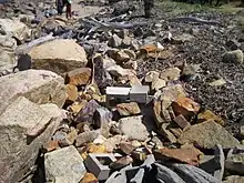
Rubble still litters the beach some 17 years after Cyclone Aivu hit
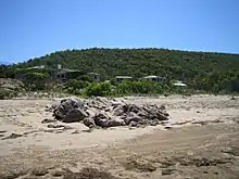
Township of Wunjunga viewed from the Beach in Upstart Bay, 19 Feb 2006
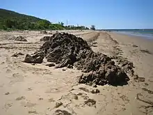
Rocky Outcrops on Beach at Wunjunga, 19 Feb 2006
Geography
It is located south of Home Hill in North Queensland.
References
- Australian Bureau of Statistics (27 June 2017). "Wunjunga (SSC)". 2016 Census QuickStats. Retrieved 20 October 2018.

- "Wunjunga (entry 42305)". Queensland Place Names. Queensland Government. Retrieved 14 January 2016.
This article is issued from Wikipedia. The text is licensed under Creative Commons - Attribution - Sharealike. Additional terms may apply for the media files.
