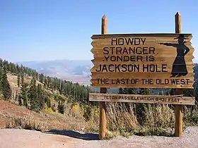
Wyoming Highway 22
Wyoming Highway 22 (WYO 22) is a 17.53-mile-long (28.21 km) state highway in the U.S. State of Wyoming known as the Teton Pass Highway in Teton County Wyoming. WYO 22 spans 17.53 miles (28.21 km) from Idaho State Highway 33 at the Idaho-Wyoming state line to the concurrency of U.S. Routes 26, 89, 189, and 191 in Jackson.
| ||||
|---|---|---|---|---|
| Teton Pass Highway | ||||
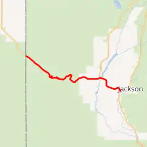
WYO 22 highlighted in red | ||||
| Route information | ||||
| Maintained by WYDOT | ||||
| Length | 17.53 mi[1] (28.21 km) | |||
| Major junctions | ||||
| West end | ||||
| East end | ||||
| Location | ||||
| Counties | Teton | |||
| Highway system | ||||
State highways in Wyoming
| ||||

Route description
After the Idaho-Wyoming state line, WYO 22 becomes Teton Pass,[1] later passing through the community of Wilson, a census-designated place (CDP) west of Jackson. On the eastern border of Wilson, at 13.51 miles (21.74 km), WYO 22 intersects the southern terminus of Wyoming Highway 390 (Moose-Wilson Road) before crossing the Snake River.[2] WYO 22 then continues east to Jackson where it ends at U.S. Highway 26/89/189/191 (Broadway).
History
WYO 22 used to connect to former Alternate US 20, which began at U.S. Highway 20 in Sugar City, Idaho, following Idaho State Highway 33 until the state line, then connected with WYO 22. Alternate US 20 used to end at the state line, where it was redesignated as WYO 22, as Wyoming didn't extend the route into the state. If that route had been extended, it would have taken over the entire route of WYO 22, to then overlap U.S. Highway 26 until it reached U.S. Highway 20 in Shoshoni.
Major intersections
The entire route is in Teton County. [3]
| Location[3] | mi[2] | km | Destinations | Notes | |
|---|---|---|---|---|---|
| | 0.00 | 0.00 | Continuation beyond Idaho state line | ||
| Wilson | 6.40 | 10.30 | Teton Pass | ||
| Wilson–Moose Wilson Road line | 13.51 | 21.74 | Southern terminus of WYO 390 | ||
| 13.80 | 22.21 | Bridge over the Snake River | |||
| Jackson | 17.53 | 28.21 | Eastern terminus | ||
| 1.000 mi = 1.609 km; 1.000 km = 0.621 mi | |||||
References
- Wyoming @ AARoads.com - Wyoming Routes 000-099
- Google (February 15, 2014). "WYO 22" (Map). Google Maps. Google. Retrieved February 15, 2014.
- Geography Division (2016). "Wyoming Governmental Unit Reference Map". United States Census Bureau. Retrieved January 23, 2017.
External links
| Wikimedia Commons has media related to Wyoming Highway 22. |