Wyoming Highway 222
Wyoming Highway 222 (WYO 222) is a 1.81-mile-long (2.91 km) Wyoming State Road known as Fort Access Road located in Laramie County, on the western edge of Cheyenne.
| ||||
|---|---|---|---|---|
| Fort Access Road | ||||
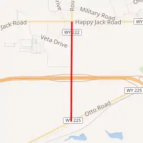
WYO 222 highlighted in red | ||||
| Route information | ||||
| Maintained by WYDOT | ||||
| Length | 1.81 mi[1] (2.91 km) | |||
| Major junctions | ||||
| South end | ||||
| North end | ||||
| Location | ||||
| Counties | Laramie | |||
| Highway system | ||||
State highways in Wyoming
| ||||

Route description
Wyoming Highway 222 travels from its south end at Wyoming Highway 225 (Otto Road) and travels north intersecting Interstate 80 and US 30 (exit 357) at 0.79 miles (1.27 km).[2] At 1.81 miles (2.91 km) WYO 222 intersects Wyoming Highway 210 (Happy Jack Road), its northern terminus at the southwest corner of F.E. Warren Air Force Base.[2][3]
History
Highway 222 was originally 8.29 miles long and traveled from WYO 225 north to WYO 211.[4] The segment of WYO 222 north of Highway 210 to Highway 211 has since been decommissioned.[3]
Major intersections
The entire route is in Laramie County.
| Location | mi | km | Destinations | Notes | ||
|---|---|---|---|---|---|---|
| | 0.00 | 0.00 | Southern terminus | |||
| | 0.79 | 1.27 | I-80 exit 357; | |||
| | 1.81 | 2.91 | Northern terminus; road continues as Roundtop Road | |||
1.000 mi = 1.609 km; 1.000 km = 0.621 mi
| ||||||
References
- Wyoming Department of Transportation Reference Marker Book - November 2004 (PDF) (Map). WYDOT. Archived from the original (PDF) on July 17, 2011. Retrieved 2011-03-31.
- Google (21 December 2016). "Wyoming Highway 222" (Map). Google Maps. Google. Retrieved 21 December 2016.
- Overview Map of Wyoming Highway 222 original routing (Map). Google Maps. Retrieved 2013-07-07.
External links
| Wikimedia Commons has media related to Wyoming Highway 222. |
This article is issued from Wikipedia. The text is licensed under Creative Commons - Attribution - Sharealike. Additional terms may apply for the media files.