Wyoming Highway 412
Wyoming Highway 412 (WYO 412) is a 22.02-mile-long (35.44 km) Wyoming state road in northern Uinta County and extreme southern Lincoln County.
| ||||
|---|---|---|---|---|
| Carter-Lyman Road | ||||
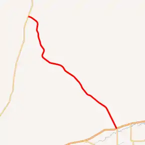
WYO 412 highlighted in red | ||||
| Route information | ||||
| Maintained by WYDOT | ||||
| Length | 22.03 mi[1] (35.45 km) | |||
| Existed | June 1971[2]–present | |||
| Major junctions | ||||
| South end | ||||
| North end | ||||
| Location | ||||
| Counties | Uinta, Lincoln | |||
| Highway system | ||||
State highways in Wyoming
| ||||

Route description
Wyoming Highway 412 begins its southern end at Interstate 80 (exit 39), northwest of Lyman. The roadway continues south of the interstate as Wyoming Highway 414 to Mountain View and the Utah state line. Highway 412 travels northwest, passing east of Fort Bridger Airport, before reaching the small community (CDP) of Carter nearing 8 miles into the route. Past Carter, WYO 412 continues northwest in direction, crossing into Lincoln County nearing its end. At just over 22 miles, Highway 412 reaches its northern terminus at U.S. Route 189.[3][4]
Major intersections
| County | Location | mi | km | Destinations | Notes |
|---|---|---|---|---|---|
| Uinta | | 0.00 | 0.00 | Southern terminus of WYO 412; northern terminus of WYO 414 Exit 39 (I-80) | |
| Lincoln | | 22.03 | 35.45 | Northern terminus of WYO 412 | |
| 1.000 mi = 1.609 km; 1.000 km = 0.621 mi | |||||
References
- Wyoming Department of Transportation Reference Marker Book - November 2004 (PDF) (Map). WYDOT. Archived from the original (PDF) on July 17, 2011. Retrieved 2011-10-19.
- "New Highway Signs Appear". Casper Star-Tribune. June 25, 1971. p. 9. Retrieved December 18, 2019 – via Newspapers.com.

- Google (4 December 2011). "Overview Map of Wyoming Highway 412" (Map). Google Maps. Google. Retrieved 4 December 2011.
- Wyoming @ AARoads.com - Wyoming Routes 400-499
External links
This article is issued from Wikipedia. The text is licensed under Creative Commons - Attribution - Sharealike. Additional terms may apply for the media files.
