Wyoming Highway 93
Wyoming Highway 93 (WYO 93) is a 26.10-mile-long (42.00 km) north–south (northwest-southeast) Wyoming State Road located in central Converse County northwest of Douglas.
| ||||
|---|---|---|---|---|
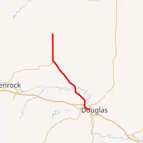
WYO 93 highlighted in red | ||||
| Route information | ||||
| Maintained by WYDOT | ||||
| Length | 26.02 mi.[1] (41.88 km) | |||
| Major junctions | ||||
| South end | ||||
| North end | ||||
| Location | ||||
| Counties | Converse | |||
| Highway system | ||||
State highways in Wyoming
| ||||

Route description
Wyoming Highway 94 begins at Wyoming Highway 59 on the western edge of Douglas,[2] just north of exit 140 of Interstate 25.[3] Highway 93 heads west, and then turns northwest as briefly parallels I-25/US 20/US 26/US 87 before turning north.[3] Highway 93 turns back northwest again as it now parallels railroad track through the community of Morton, and heads to head to the community of Orpha. WYO 93 continues traveling northwest, it reaches the northern terminus of Wyoming Highway 95 near the community of Carey at 18.09 miles (29.11 km).[3] WYO 93 then turns due north, named Highland Loop Road, as Converse CR 31 (Ross Road) runs northwest. Approximately 8 miles later WYO 93 ends at an intersection with Converse CR 32 (Highland Loop Road) which continues the roadway[2] and Converse CR 33 (Willow Creek Road).[3]
Major intersections
The entire route is in Converse County.
| Location | mi | km | Destinations | Notes | |
|---|---|---|---|---|---|
| Douglas | 0.00 | 0.00 | Southern terminus | ||
| | 18.09 | 29.11 | Eastern terminus of WYO 95 | ||
| | 26.02 | 41.88 | Northern terminus | ||
| 1.000 mi = 1.609 km; 1.000 km = 0.621 mi | |||||
References
- Wyoming Department of Transportation Reference Marker Book - November 2004 (PDF) (Map). WYDOT. Archived from the original (PDF) on July 17, 2011. Retrieved 2010-03-03.
- Wyoming @ AARoads.com - Wyoming Routes 000-099
- Google (14 August 2016). "Wyoming Highway 93" (Map). Google Maps. Google. Retrieved 14 August 2016.
- Official 2003 State Highway Map of Wyoming
